


The Cabot Trail rewards travelers who slow down. This rugged loop around northern Cape Breton Island is often marketed as a one-day scenic drive, but the reality on the ground is very different. Once you add hikes, photo stops, coastal villages, and the time it takes to reach the trail from Halifax or Sydney, it becomes a rich four to five day road trip. This itinerary is designed to be genuinely usable, with realistic daily distances, clear hiking choices, and up to date details on Skyline Trail timed parking and autumn travel pressures in 2026.
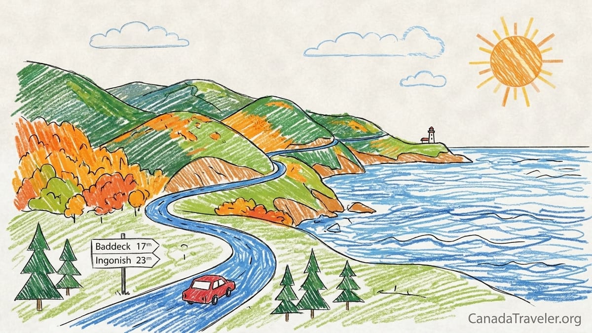
Understanding the Cabot Trail and How Far You Will Really Drive
The Cabot Trail itself is roughly a 298 kilometre loop around the northern tip of Cape Breton Island, but the principal scenic portion through and around Cape Breton Highlands National Park that most visitors focus on is closer to about 208 kilometres. That shorter figure reflects the highland and coastal section from just west of Baddeck through Ingonish, Cape North and Chéticamp, where the mountains plunge into the Gulf of St. Lawrence and the Atlantic. In practice, however, road trippers almost always drive much farther once they factor in travel to and from the island and side excursions away from the main loop.
If you are starting from Halifax, it is about 350 kilometres to Baddeck by road, with a non stop drive time of four and a half to five hours in good conditions. Add the Cabot Trail loop itself and you are already looking at a trip well over 650 kilometres even before you consider side trips to places such as Meat Cove or White Point. Travelers flying into Sydney airport still face about 85 kilometres each way between Sydney and Baddeck, so a realistic multi day plan must account for these approach drives as separate travel days or half days.
The Cabot Trail also drives differently depending on whether you travel counterclockwise or clockwise. This itinerary assumes a counterclockwise loop, leaving from Baddeck and reaching the coastal highlands near Ingonish first, then the more remote north around Cape North and Dingwall, before returning along the western side through Pleasant Bay and Chéticamp. A shorter clockwise alternative is included later for those with only two days to spare, but first it is worth understanding what you actually want to see.
Most visitors are drawn to the classic highland hikes and viewpoints in Cape Breton Highlands National Park, especially Skyline Trail above the Gulf of St. Lawrence, Franey Mountain above Ingonish, and the coastal Middle Head peninsula. Several easier forest and lake trails, such as Freshwater Lake and Jack Pine, provide gentler options. The route descriptions that follow distinguish short stop viewpoints, quick walks, and multi hour hikes so you can make informed choices based on your fitness, weather and daylight.
Day 1: Baddeck, Bras d’Or Lake and Arrival Logistics
Baddeck is the most practical starting point for a Cabot Trail road trip and works well as an overnight base before and after your loop. The village sits on the shore of the Bras d’Or Lake, an inland sea that cuts across Cape Breton Island. Arriving from Halifax, many travelers check into an inn or motel in Baddeck, stretch their legs along the waterfront boardwalk and then visit the Alexander Graham Bell National Historic Site, which overlooks the water. The museum displays Bell’s experimental hydrofoils and aviation work and typically requires one and a half to two hours to appreciate without rushing.
Spending your first night in Baddeck reduces the fatigue of a long drive and lets you start the Cabot Trail section rested. Accommodation in the village ranges from simple motels on the highway to historic inns near the harbour. On peak autumn weekends, and especially during the Celtic Colours International Festival in 2026, many popular properties book out months in advance. In October 2026 the festival runs from October 9 to October 17, overlapping exactly with typical fall colour season and placing heavy pressure on all types of rooms across the island.
Food options in Baddeck are concentrated along the waterfront and main street. Typical example prices in 2026 for a sit down dinner are in the range of 20 to 35 Canadian dollars for main courses at casual restaurants, plus tax and tip. Travelers on a budget can lower costs by picking up groceries at the local supermarket and making use of motel kitchenettes or campground facilities. Fuel is easy to find around Baddeck, with gas stations on the Trans Canada Highway, but once you leave town and head into the highlands, fuel stops become more widely spaced and closing times can be earlier than urban travelers expect.
Mobile coverage in and around Baddeck is relatively reliable, but that changes quickly as you drive north. Throughout the highlands, pockets of the Cabot Trail still have weak or intermittent cellular service. Downloading offline maps before you leave, carrying printed maps from Nova Scotia Tourism or Parks Canada, and keeping accommodation details written down are sensible precautions, especially if you plan to hike longer trails where you may not have a signal at the trailhead or on the ridge tops.
Day 2: Baddeck to Ingonish, Beaches and First Hikes
The second day of this itinerary runs counterclockwise from Baddeck to Ingonish, roughly 120 to 140 kilometres depending on your precise route. Plan a leisurely morning departure so you can enjoy viewpoints on the eastern shore of Cape Breton as you enter Cape Breton Highlands National Park. Once inside the park, you must have a valid Parks Canada entry pass, which can be bought online or at staffed entry points and visitor centres. In 2026 personal vehicles pay a daily rate for the park, while the Skyline parking reservation described later is a separate cost.
Ingonish is actually a string of small communities spread along the Cabot Trail: Ingonish Ferry, Ingonish Centre, Ingonish Beach and Ingonish. Your first stop should be Ingonish Beach, one of the most accessible places in the park to combine sea and lake scenery. Here a short walk leads to the wide cobble beach facing open Atlantic swells, while the Freshwater Lake trail, an easy, mostly level loop of roughly 2 kilometres, circles the adjacent lake behind the beach. Freshwater Lake works well as a leg stretch for almost any traveler, taking about 30 to 45 minutes at a relaxed pace.
For a more dramatic but still manageable coastal walk, Middle Head begins near the Keltic Lodge area above Ingonish Beach. Middle Head is a roughly 5 kilometre return trail along a narrow peninsula that separates two ocean bays and ends on cliffs overlooking the Atlantic and Cape Smokey. Parks Canada currently rates it as an easier route, but the path is often rooted and rocky, so sturdy footwear is helpful. Many visitors allow one and a half to two hours for Middle Head, more if they linger for photos or whale watching when conditions are calm.
Franey Mountain provides the first major summit experience of the trip and should be treated as a half day outing, not a quick stop. Trail descriptions from Parks Canada and Nova Scotia tourism sources describe a substantial climb to viewpoints overlooking the Clyburn River canyon and the Atlantic, with total distance varying between a shorter lower loop and a longer full loop of over 10 kilometres. Even experienced hikers usually budget two and a half to five hours, depending on which loop they choose. There are many steps and steep sections, so it is best to start this hike earlier in the day in settled weather and to carry water, a light jacket and basic safety gear.
Day 3: Northern Highlands via Cape North, Dingwall and Meat Cove Option
Day three focuses on the more remote feeling northern part of the Cabot Trail. From Ingonish to Cape North, including detours, you will likely drive between 80 and 120 kilometres. Here the road leaves the more settled Ingonish cluster and passes several short stop highlights, including Black Brook Beach and Lakies Head. Black Brook Beach is known for its small waterfall dropping onto a sandy cove and a sheltered picnic area just off the highway, making it ideal for a coffee stop or picnic lunch. Lakies Head, a rocky headland with photogenic boulders and surf views, sits close to the road and can be enjoyed in 10 or 15 minutes of walking on flat ground.
Cape North and the nearby community of Dingwall form a useful midpoint on this northern day. Fuel and food services are limited but important here. A typical pattern is to top up fuel in Ingonish or Neils Harbour in the morning, then treat Dingwall or Cape North as a backup. Dining options tend to be small local cafés and seasonal seafood restaurants, with lunch plates of fish and chips or chowder often in the 18 to 25 Canadian dollar range by 2026. Call ahead or check recent opening hours if you are outside the July to early October peak, as some kitchens close earlier or operate only on certain days.
Several rewarding hikes sit slightly off the main Cabot Trail in this region. Trails such as Wilkie Sugar Loaf near Dingwall offer big views over Aspy Harbour and the northern highlands for a moderate investment of time. Although this article focuses in more detail on Skyline, Franey and Middle Head, it is worth remembering that even short detours to view points like Cabots Landing Provincial Park provide a different perspective from the main highway pullouts. These side trips add distance and time, so leaving your schedule flexible is more realistic than planning to tick off every named trail in a single day.
Meat Cove, often promoted in travel photos for its cliff top campground and remote character, should be considered an optional extension rather than an essential stop on a tight four day itinerary. The final stretch of the access road historically includes unpaved or rough sections, and although local authorities periodically grade and improve the surface, conditions can change after heavy rain. In 2026 travelers should expect a narrow road with gravel segments, no mobile coverage for stretches, and slow passing if they meet oncoming traffic. If you add Meat Cove, allow at least two extra hours including the drive in, time to enjoy the views, and the return to the main Cabot Trail.
Day 4: Western Cabot Trail, Skyline Trail and Chéticamp
The western side of the Cabot Trail contains some of the most iconic scenery on Cape Breton Island, including the sweeping curves of French Mountain and MacKenzie Mountain above the Gulf of St. Lawrence and the world famous Skyline Trail. Driving from the Cape North area through Pleasant Bay and on to Chéticamp is roughly 110 to 130 kilometres, but progress is slowed by steep grades, lookouts, and the time you will spend at Skyline. It is realistic to treat this as a full day of driving, short walks and one major hike rather than trying to stack multiple long trails.
Skyline Trail is a roughly 7 kilometre loop in Cape Breton Highlands National Park that follows a headland above the Gulf of St. Lawrence before descending to a series of boardwalk lookouts. The views take in the coastline and the winding line of the Cabot Trail over French Mountain. The trail is mostly gentle, with some rooty and muddy stretches, and is often recommended for visitors seeking a high reward to effort ratio. Wildlife such as moose can sometimes be seen from the path or viewpoints. For many road trippers, Skyline is the single must do hike of the trip, and in recent years its popularity has led to serious parking congestion at the trailhead.
In response to crowding, a timed parking reservation system is in place for 2026. From June 26 to October 25, travelers who want to access Skyline by private vehicle must hold a parking permit for a specific time slot at the trailhead. Without this reservation, you cannot park at Skyline during those dates, except as part of a guided Parks Canada sunset hike, which uses a different access arrangement. Evening slots that line up with golden hour and sunset tend to book out first. Travelers planning key dates, such as Thanksgiving weekend or the middle of Celtic Colours in October, should secure Skyline parking as soon as the system opens reservations for their travel period.
Timed parking does not change the trail itself, but it does affect how you schedule your day. For example, if you secure a 5 p.m. to 9 p.m. evening parking window, you might spend the earlier afternoon exploring Pleasant Bay, photo stopping at the MacKenzie Mountain and French Mountain viewpoints, and checking into your accommodation in or near Chéticamp before driving back to Skyline. If you have a mid morning slot instead, reverse the pattern: hike Skyline first, then continue slowly west, stopping at the lookouts and beaches as your energy allows. A typical visit to Skyline, including hiking, photos and rest time, runs between two and a half and four hours for most visitors.
Pleasant Bay is a small community best known for boat based whale watching tours operating in season, while Chéticamp functions as the main service village on the park’s western edge. In Chéticamp you will find restaurants, grocery stores, gas stations and a wide range of accommodations, from simple motels along the highway to inns and cottages facing the water. Seafood remains central to many menus, and in 2026 visitors can expect main courses at mid range restaurants to be broadly similar in price to Baddeck and Ingonish. Chéticamp is a natural overnight base for this fourth day, with the option to add a short forest or river walk such as the easier park trails near town if you still have daylight.
Comparing the Signature Hikes: Skyline, Franey, Middle Head and Easy Trails
While Cape Breton Highlands National Park has more than two dozen marked trails, most short Cabot Trail road trips revolve around a handful that combine accessibility and outstanding scenery. Skyline, Franey and Middle Head form a useful trio to compare, with easier forest and lake trails filling gaps for days when weather, fatigue or time make bigger climbs less appealing.
Skyline Trail is roughly 7 kilometres for the typical loop and is generally rated as easy to moderate. The path undulates gently across heath and forest before reaching a long boardwalk on the headland, with steps down to lower viewing platforms. Elevation gain is modest compared with summit hikes like Franey, and many families with school age children complete the loop comfortably in two and a half to three hours with rest stops. The scenery emphasises huge sea and coastal highway views rather than dramatic cliffs immediately underfoot, and the sense of space at sunset or on clear evenings can be exceptional.
Franey Mountain, by contrast, is a much steeper undertaking. Descriptions from Parks Canada and recent trail guides describe a significant climb on rougher trail, with elevation gain of several hundred metres and an overall distance that can reach well over 7 kilometres depending on the loop you choose. Fit day hikers often complete the ascent and descent in around three hours, but allowing up to five hours keeps the pace relaxed and leaves space for photos and breaks. The payoff is a set of viewpoints that look inland over the Clyburn River canyon and out to the Atlantic, with Middle Head and Cape Smokey visible on clear days. Franey suits those who enjoy a workout and want a summit experience with a mix of forest and cliff edge views.
Middle Head offers something in between. Its roughly 5 kilometre return distance and lower elevation change make it less strenuous than Franey, but the terrain still feels like real coastal hiking, with roots, rocks and narrow sections leading to cliff top views. Hikers commonly spend one and a half to two hours here, more if they stop for a picnic on the headland. Because the trail starts near road accessible resort facilities, it is one of the easiest big view walks to slot into a travel day without needing elaborate logistics. For many visitors, Middle Head plus either Skyline or Franey makes a satisfying combination over a two day stretch.
Easier forest and lakeside trails round out the hiking mix. Freshwater Lake near Ingonish Beach, the Jack Pine and Coastal trails on the western side, and short waterfall walks such as MacIntosh Brook or Beulach Ban give access to forest, rivers and shoreline without long climbs. These routes often run in the 1 to 3 kilometre range and can be completed in 30 to 90 minutes. For travelers sharing the Cabot Trail with young children, older relatives or mixed fitness groups, combining one of the signature hikes with one of these gentler walks each day helps everyone see headline scenery without exhaustion.
Seasonal Weather, Fall Colours and Celtic Colours Crowds
Weather on the Cabot Trail is variable even in midsummer and can change quickly over short distances. In late June and July, daytime highs along the coast frequently reach the high teens or low twenties Celsius, but fog banks can roll in off the Atlantic and drop temperatures rapidly. By late September and early October, when many visitors arrive for fall colours, highs often sit in the low teens, with chilly mornings and evenings and a noticeable wind at higher viewpoints such as Skyline and Franey. Carrying layers, including a windproof shell and light fleece, is more practical than travelling with only a single heavy coat.
Autumn colour in northern Cape Breton typically peaks between late September and mid October, but exact timing varies year by year based on temperature, rainfall and wind events. Many recent travelers have reported strong colour on the highlands and along the western Cabot Trail in the first week of October, with some late pockets of red and gold persisting into the second week if storms have been mild. For 2026, the Celtic Colours International Festival runs from October 9 to 17, overlapping with what has historically been a prime window for foliage. This makes planning ahead particularly important if you hope to combine hiking and music events.
Celtic Colours is not limited to one venue. Concerts, workshops and community events take place in dozens of communities around the island, including Baddeck, Chéticamp and smaller villages along or near the Cabot Trail. That means that accommodation pressure is not confined to a single town. Visitors have noted that inns, cottages and campgrounds that are easy to book in June may sell out or adopt multi night minimums during the festival period. Many repeat guests now aim to secure October bookings several months in advance, especially for waterfront rooms or properties within walking distance of evening venues.
Travelers who prefer quieter roads sometimes choose to visit in the week immediately before Celtic Colours, when colours are often already strong and accommodation availability is a little wider. Others embrace the festival atmosphere and combine a daytime Skyline hike with an evening fiddle concert in a nearby community hall. Both styles of travel are valid, but either way, aligning your Cabot Trail plan with fixed dates such as the Skyline parking season and the festival period prevents disappointment on arrival.
Daily Mileage, Overnight Bases, Typical Costs and a Two Day Shortcut
Putting the pieces together, a realistic four day counterclockwise Cabot Trail itinerary, not counting approach travel from Halifax or Sydney, might look like this. Day one involves arrival in Baddeck and local exploring, with roughly 0 to 50 kilometres of local driving once you reach the village. Day two runs from Baddeck to Ingonish with stops at Ingonish Beach, Freshwater Lake and Middle Head, for a daily total in the 120 to 140 kilometre range. Day three continues through Cape North and Dingwall with short stops at Black Brook Beach and Lakies Head and optional side trails or the Meat Cove extension, adding roughly 80 to 120 kilometres. Day four completes the western loop through Pleasant Bay and Skyline to Chéticamp and back to Baddeck or Sydney, often totaling 200 to 230 kilometres depending on where you sleep.
Overnight bases on this pattern are Baddeck on the first night, Ingonish on the second, and Chéticamp or a nearby community on the third, with the fourth night either back in Baddeck or in Sydney if you have an early flight. Many travelers spread the trip to five days by adding an extra night either in Ingonish to allow time for both Franey and Cape Smokey hikes, or in Chéticamp to include additional forest trails and a whale watching tour. Campsites inside the national park and in private campgrounds around the trail provide a lower cost option, but even these can book solid in peak October weeks.
Costs vary by exact property and season, but in 2026 mid range motels on the Cabot Trail commonly charge in the low to mid 200 Canadian dollar range per night for a standard double room during fall weekends, with higher prices at popular waterfront inns and resort style properties. Park entry fees and the Skyline parking reservation add another modest but notable line to the budget, especially for families. Restaurant meals for two adults, including main courses and shared appetizers but excluding alcohol, often fall somewhere between 60 and 100 Canadian dollars including tax and tip, depending on the establishment and menu choices.
For travelers who only have two days available, a deliberately selective version of the Cabot Trail experience is still possible. The most practical approach is to choose either the eastern and northern side, focusing on Ingonish and Cape North with Franey or Middle Head as your flagship hike, or the western side, focusing on Skyline, Pleasant Bay and Chéticamp. Trying to drive the entire loop in two days while also tackling multiple major hikes leads to rushed stops and tired drivers. For example, a two day western focused plan from Baddeck might allocate day one to driving directly to Chéticamp with a late afternoon Skyline hike, then day two to returning slowly via the coastal viewpoints and a short forest trail before overnighting again in Baddeck.
FAQ
Q1. How many days do I really need for the Cabot Trail if I want to hike?
Four days on the Cabot Trail itself, plus your travel days to and from Cape Breton, is a realistic minimum if you want to include several hikes such as Skyline, Middle Head and either Franey or another summit trail. Adding a fifth day gives you more flexibility for weather, longer walks and unhurried village stops.
Q2. Is it better to drive the Cabot Trail clockwise or counterclockwise?
Both directions work, but this itinerary uses a counterclockwise route starting from Baddeck through Ingonish, Cape North and Chéticamp. Many drivers prefer this direction because it places the dramatic western coastal drop offs and viewpoints on the ocean side of the road later in the trip, when they are more familiar with local driving conditions.
Q3. How does the 2026 Skyline Trail timed parking system work?
From June 26 to October 25, 2026, you must reserve a timed parking slot to use the Skyline Trail parking lot if you arrive by private vehicle. Without a reservation, you cannot park at the trailhead during those dates, except if you have booked a guided Parks Canada Skyline sunset hike, which uses its own arrangements. Reservations are for specific time windows, often several hours long, and popular evening slots can sell out well in advance.
Q4. Which hike should I choose if I only have time for one big trail?
If you want the most famous view with the least climbing, Skyline is usually the best choice. If you prefer a challenging climb to a summit style lookout, Franey offers a more strenuous and rewarding workout. Middle Head is a strong option if you want dramatic coastal cliffs in a shorter, moderate package.
Q5. Is Meat Cove worth the detour from the main Cabot Trail?
Meat Cove has striking cliff top views and a memorable remote feel, but it should be treated as an optional extension rather than an essential stop. The final road section often includes unpaved or rough parts, there is limited mobile coverage, and the detour can easily add two hours or more to your day once driving and photo stops are included.
Q6. When is the best time to see autumn colours on the Cabot Trail?
Fall colours in northern Cape Breton typically peak between late September and mid October, though this varies with weather each year. In 2026, the Celtic Colours International Festival from October 9 to 17 coincides with what has historically been a prime period for foliage, so expect both vivid colours and higher demand for accommodation.
Q7. How expensive is it to stay along the Cabot Trail in October 2026?
By October 2026, many mid range motels and inns on the Cabot Trail charge somewhere in the low to mid 200 Canadian dollar range per night for a standard double room during busy fall weekends. More upscale waterfront properties can be higher. Booking several months ahead improves your chances of finding better rates and locations.
Q8. Will I have mobile phone coverage on the Cabot Trail?
Mobile coverage is generally good around larger communities such as Baddeck, Ingonish and Chéticamp, but there are long stretches of the highlands where the signal is weak or absent. It is wise to download offline maps before you leave, carry paper maps from visitor centres, and avoid relying on constant data access for navigation or communication.
Q9. Do I need a car, or can I visit the Cabot Trail without driving?
Public transport along the Cabot Trail is very limited, and most visitors explore by private car or rental vehicle. Guided bus tours from Halifax and Sydney exist, but they typically compress the trail into a long single day or focus on only a few viewpoints. For flexible hiking and village stops over several days, having your own vehicle is by far the most practical option.
Q10. How should I pack for weather along the trail in summer and fall?
Even in summer, temperatures can swing quickly due to coastal fog and wind, so packing layers is essential. A light fleece, windproof or waterproof shell, hat and gloves, along with sturdy footwear for trails, will keep you comfortable from June through October. In autumn, especially from late September onward, expect cooler mornings and evenings and dress accordingly for exposed viewpoints like Skyline and Franey.