


Akshayuk Pass in Auyuittuq National Park is one of the most committing backpacking routes in Canada: roughly 97 kilometres of glacial valley between Pangnirtung Fjord and North Pangnirtung Fjord on Baffin Island. There is no built trail, no food drops, no road access and only a handful of basic emergency shelters for the entire pass. Parks Canada is clear that this is an unmarked, unguided Arctic wilderness route suitable only for experienced backcountry travelers. This guide focuses on the full 8 to 12 day traverse, with options for shorter 2 to 6 day sections, and explains the real-world logistics, risks and preparations required to tackle Akshayuk Pass safely.
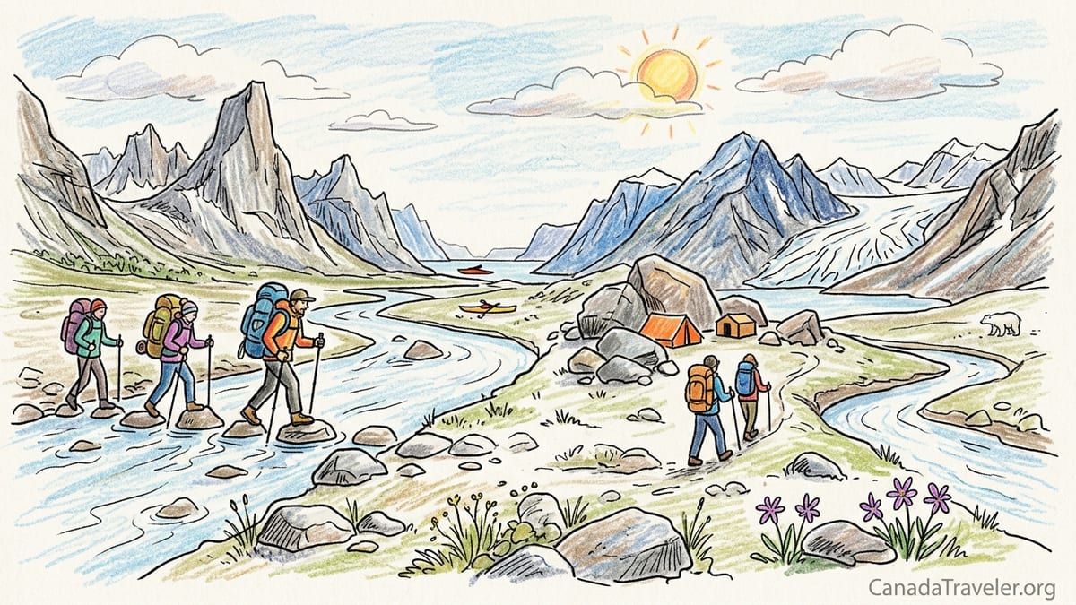
Understanding Akshayuk Pass and Choosing Your Direction
Akshayuk Pass is a natural corridor carved between the mountains and the Penny Ice Cap, following the Weasel River in the south and the Owl River in the north. Parks Canada currently describes it as a 97 kilometre backcountry route, usually taking 8 to 12 days on foot for a full traverse between the Pangnirtung side and the Qikiqtarjuaq side. Most hikers travel in summer, typically July and August, when the route is snow free but river levels can be high and conditions can change quickly with rain or snowmelt.
The most common direction for backpackers is from North Pangnirtung Fjord near Qikiqtarjuaq southwards to Pangnirtung Fjord. Starting in the north gives you a boat drop-off from Qikiqtarjuaq to the head of the Owl River, then a gradual climb towards Summit Lake and a long descent through Weasel Valley to Pangnirtung. Many hikers find it psychologically easier to be walking toward the community of Pangnirtung, where flights out are more frequent and delays less likely than on the more remote Qikiqtarjuaq side.
Some experienced parties choose to hike northbound from Pangnirtung into Weasel Valley and on to North Pangnirtung Fjord. This direction means you face the rougher moraine and river crossing section of the Weasel River early in your trip, and finish with a sustained descent along the Owl River. Because boat logistics and flight schedules sometimes line up better one way than the other, many independent hikers simply choose the direction that matches the easier combination of charter boat and commercial flights for their preferred dates.
Regardless of direction, Akshayuk Pass should be treated as an expedition rather than a simple backpacking trip. You must be completely self-sufficient with food, shelter, navigation, communication devices and clothing for freezing temperatures and strong winds, even in mid-summer. Planned itineraries should be flexible enough to absorb delays from high rivers or poor visibility around Summit Lake, where navigation on glacial moraine can become confusing in cloud or fresh snow.
Why the Route Is Unmarked and Why Experience Matters
Parks Canada is explicit that Akshayuk Pass is not a marked hiking trail. On current maps the route appears only as a suggested dotted line through the valley, not as a built or signed path. On the ground there are no blazes, posts or signboards leading you through the pass. In many places you are simply walking on open tundra, boulder fields or braided river bars, choosing your own path based on conditions and judgment.
There are several reasons for this unmarked status. First, this is an Arctic wilderness co-managed with Inuit partners, and Akshayuk Pass follows a traditional travel corridor that predates the park itself. Rather than impose a single engineered trail, management has opted to preserve the character of the landscape and respect existing travel patterns. Second, the terrain shifts constantly. Glacial outwash fans, river channels and moraines move from year to year, especially around Glacier Lake and Summit Lake. A fixed set of markers could easily be destroyed by ice or become dangerously misleading if a river cuts a new channel.
Because there is no clearly defined tread, hikers must use map and compass, GPS and on-the-ground judgment to progress. For example, the Chrismar or Gem Trek topographic maps of Auyuittuq show broad zones for travel but cannot tell you which braided channel of the Weasel River is safest to cross on a particular afternoon. You must read the water, detour upstream or downstream, and sometimes retreat and camp if levels continue to rise. This type of decision making demands genuine backcountry experience in remote, non-technical but serious terrain, not just comfort on waymarked long-distance trails.
Parks Canada staff regularly encounter visitors who underestimate the commitment involved because the valley floor looks gentle in photos. In practice, that valley includes kilometers of unstable glacial moraine, steep side streams emerging straight from ice, and sections of soft tundra that become boot-sucking mud in heavy rain. With no huts serving food or selling supplies, any mistake in planning or navigation can escalate quickly. Hikers are expected to arrive with a realistic itinerary, proven camping skills in foul weather, and a clear understanding that rescue, if needed, may take many hours or longer in poor flying conditions.
River Crossings, Terrain and Seasonal Hazards
River crossings are the single most serious objective hazard on the Akshayuk Pass route. The Weasel River, Owl River and their tributaries are glacier-fed, meaning levels rise throughout the day as ice melts and can surge after rain or rapid warming. Parks Canada warns that late July and early August often see the highest water, which coincides with the most popular hiking window. Hikers should expect multiple crossings of the Weasel River, sometimes six to fifteen depending on route choice, and several significant tributaries including the Norman River, Turner Creek and the outflows from Highway and Quvney glaciers.
Safe crossing strategies are essential. Many groups plan their camps so that major fords happen early in the morning when water levels are typically lowest. For instance, parties camping near Glacier Lake often wake before 5 am to tackle the Norman River and Turner Creek while the previous night’s cooling has slowed melt. Hikers commonly carry dedicated river shoes such as sturdy sandals or mesh trainers, plus trekking poles for stability. Waist-deep crossings are not unusual in a high-water year, and turning back is sometimes the only safe choice. This is not a place to learn basic river-crossing skills for the first time.
Beyond rivers, expect a mix of tundra walking, cobbles and extensive moraine. Approaches to Summit Lake and the Highway Glacier area involve weaving through massive boulder fields where progress can slow to one kilometre per hour. Fresh snow can fall any day of the summer, and whiteouts around Summit Lake can make it hard to distinguish snow patches, lake edges and crevasses on nearby glaciers. Wind is another constant factor; gusts funneled through the pass can flatten poorly anchored tents, especially near the open flats of the Weasel River.
Temperature swings are significant. Even in late July daytime temperatures can climb to around 10 to 15 degrees Celsius in sunlight, only to drop to freezing or below at night. Real-world gear lists from recent independent hikers usually include a four-season or robust three-season tent, a sleeping bag rated to at least minus 7 degrees Celsius, and full waterproof layers. It is sensible to pack extra camp insulation such as a down jacket and booties, since once you are committed to the pass there is no heated shelter and no possibility to dry soaked boots except in your tent.
Emergency Shelters, Camping and Food Strategy
Akshayuk Pass is equipped with a series of basic emergency shelters spaced roughly one long day apart along the valley. These small wooden huts are designed for short-term refuge in severe weather or emergencies, not as bookable accommodation. Inside you will typically find a simple platform or benches, limited space for a few people to sleep in a pinch, and sometimes emergency supplies or a visitor log. They do not have stoves, fuel or food for hikers, and cannot be relied upon for regular overnight use in busy periods.
Most nights, parties camp on the tundra or gravel bars near the shelters, using the huts only as a backup in high winds or sudden storms. There are outhouses close to shelters, but no running water; you collect water from nearby streams or the main river. A common example itinerary will link camps near the Overlord shelter, Summit Lake, Glacier Lake and the Outpost Lake shelter as you work through the pass. Ground conditions vary, so freestanding tents with strong poles and plenty of guylines are preferred over ultralight designs that depend on perfect pegs and soft soil.
Because there are no food drops or stores in the park, you must carry the entire supply for your traverse from the moment you step off the boat. For an 8 to 12 day crossing, that typically means about 18 to 24 kilograms of total pack weight at the start for most hikers, depending on gear choices and calorie needs. Many parties pre-pack commercial freeze-dried meals from well-known brands, combined with high-calorie snacks such as nuts, chocolate and energy bars. Stove fuel, typically white gas or isobutane canisters, must be purchased ahead of time in Iqaluit or arranged through a local outfitter in Pangnirtung or Qikiqtarjuaq, because availability in small Arctic communities can vary.
Food storage is linked directly to bear safety. Parks Canada generally recommends storing food and scented items inside hard-sided drums or robust dry barrels, sometimes rented from local outfitters, and placing them well away from your sleeping area. Traditional tree hangs are not possible above treeline, and gusty winds can make lightweight odor-proof bags inadequate as a sole measure. Many hikers follow a practical system of cooking and eating at least 100 metres from camp, sealing all smelly items in barrels, and choosing open campsites with clear sight lines so approaching wildlife is easier to spot.
Navigation, Communication and Polar Bear Precautions
Effective navigation on Akshayuk Pass involves layering modern tools with traditional map skills. Most hikers carry a detailed topographic map such as the Parks Canada recommended edition specific to Auyuittuq, plus a dedicated GPS device or mapping app on a waterproofed smartphone. Satellite imagery from services that can be saved offline helps visualize braided rivers and glacial outwash areas ahead of time. In poor visibility you should be able to follow bearings across featureless snow patches and use altimeter readings to confirm your position around Summit Lake and low passes.
Because there is no cellular service in the park, satellite communication is strongly advised. Many independent parties carry both a satellite messaging device, such as a Garmin inReach or Zoleo unit, and a full satellite phone rented in Iqaluit or from an outfitter. The messenger allows you to send daily check-ins and weather requests, while a phone is useful for more complex discussions with Parks Canada or a charter boat operator if your exit schedule needs to change. Parks staff at registration will ask for your device details and emergency contacts and will emphasize that self-rescue, such as retreating to a shelter, is often faster than waiting for an aircraft in poor flying conditions.
Polar bears are a real but manageable risk. While negative encounters on the main Akshayuk corridor have historically been rare, the park lies within polar bear range and recent climate shifts can alter patterns of sea ice and wildlife movement. Hikers are expected to be bear aware: this includes traveling in groups when possible, keeping an organized camp with no food scraps left around, and maintaining a consistent watch in low-visibility conditions such as fog or blowing snow. Many groups establish a simple protocol where everyone scans the surroundings whenever stepping out of the tent or before starting to cook.
Parks Canada typically recommends deterrents such as bear spray and, in some cases, bear-banger style pyrotechnics, which may be loaned at orientations in the communities and returned at the opposite end of the pass. Regulations around firearms are strict and require advance permits and experience. In practice, most independent hikers rely on a combination of vigilance, clean camp habits, deterrent devices and campsite choices that avoid narrow animal travel corridors or spots close to rotting marine carcasses along the fjords.
Transport, Permits and Shorter 2 to 6 Day Options
Reaching either end of Akshayuk Pass requires multiple legs of travel. From southern Canada, most hikers fly to Ottawa or Montreal, then on to Iqaluit with a northern airline, and from there connect to Pangnirtung or Qikiqtarjuaq. Return fares from major Canadian cities to either community can easily reach several thousand Canadian dollars in high season, so it is important to factor flights into your overall budget. Weather delays are common. Real-world accounts often mention missed connections because fog or crosswinds prevented aircraft from landing at Pangnirtung’s short gravel runway.
From the communities, you will need boat transfers to the actual park entrances on Pangnirtung Fjord or North Pangnirtung Fjord. These rides are usually arranged with local outfitters or individual boat operators and are highly dependent on sea ice and tide conditions. In midsummer, hikers commonly pay several hundred Canadian dollars per group, per ride, with prices varying by year, fuel costs and whether you share the charter with another party. It is good practice to book both your inbound and outbound boat legs in advance and then reconfirm after your in-person safety orientation with Parks Canada, as departure points and timings can shift with ice conditions.
Before entering the park you must register with Parks Canada at the visitor centre in either Pangnirtung or Qikiqtarjuaq and attend a mandatory safety briefing. During this session staff review your route plan, equipment, bear-safety knowledge and communication devices, and provide updates on current river and glacier conditions. On exit you are required to de-register so that rangers know you have left the park safely. Commercial groups must also hold appropriate business licenses, but independent hikers simply pay the current park usage fees and comply with registration rules.
Not every traveler wants or needs to complete the full 8 to 12 day crossing. Parks Canada and local operators promote shorter 2 to 6 day options that sample sections of Akshayuk Pass. Popular examples include a 2 or 3 day out-and-back hike from Pangnirtung Fjord up Weasel Valley toward Mount Thor, or a 4 to 6 day trip starting at Qikiqtarjuaq with a boat drop at North Pangnirtung Fjord and a turnaround point near Glacier Lake. These shorter itineraries still require solid backcountry skills and full expedition clothing, but they reduce the food burden and allow you to retreat to the same community if rivers become impassable.
For some visitors, booking a guided expedition with a specialist Arctic outfitter is the most realistic way to experience Akshayuk Pass. Guided trips often bundle flights from Iqaluit, boat charters, group gear such as stoves and satellite phones, and bilingual guides familiar with local conditions and Inuit culture. Prices vary widely, but multi-week guided expeditions in Auyuittuq commonly cost several thousand Canadian dollars per person. Independent hikers can study these commercial itineraries as reference examples when designing their own day-by-day plans.
The Takeaway
Akshayuk Pass is a rare combination of accessibility and remoteness: reachable in a couple of flights from southern Canada, yet utterly self-sufficient once you step off the boat at the fjord. The 97 kilometre corridor between Pangnirtung and Qikiqtarjuaq is not a trail but a dynamic Arctic landscape of glaciers, rivers and tundra shaped by ice and weather. Parks Canada’s insistence that the route is unmarked and suitable only for experienced backcountry travelers is not a formality. It reflects real hazards such as volatile river crossings, fast-changing weather and the presence of polar bears.
For hikers with the right skills, preparation and respect for local knowledge, Akshayuk Pass can be one of the defining treks of a lifetime. Whether you attempt the standard 8 to 12 day full traverse or opt for a shorter 2 to 6 day section, the key is conservative planning and a flexible mindset. Build extra days into your schedule, over-prepare for cold and wet conditions, and treat the emergency shelters as contingency rather than comfort. Rely on current guidance from Parks Canada staff, not older online trip reports, and remember that retreating to a shelter and waiting out high water is always preferable to forcing a dangerous crossing.
Ultimately, success on Akshayuk Pass is measured less by speed or distance and more by judgment. Parties that move patiently, communicate clearly, and adapt plans to the realities of Arctic weather usually come away with powerful memories of granite walls, hanging glaciers and the quiet of the tundra under midnight sun. Those who treat the pass as just another long-distance trail may find themselves overwhelmed. Approach this route as a serious expedition, and it will reward you with one of the most compelling wilderness journeys in the Canadian North.
FAQ
Q1. How long does it typically take to hike the full Akshayuk Pass?
The standard full traverse between the Pangnirtung and Qikiqtarjuaq sides is usually planned for 8 to 12 days on foot, depending on fitness, weather and river levels.
Q2. Do I need a guide to trek Akshayuk Pass?
A guide is not mandatory, but Parks Canada recommends that only experienced backcountry hikers with Arctic and river-crossing skills attempt the route without one. Many visitors choose guided trips for logistics and safety.
Q3. When is the best time of year to hike Akshayuk Pass?
Most hikers aim for July and August, when snow cover is minimal. However, river levels can peak in late July and early August, so an early or late summer window with cooler temperatures but lower water is often safer.
Q4. Are there marked trails or signs along the route?
No. Akshayuk Pass is an unmarked backcountry route. There are no waymarks or built trails, only a suggested line on maps. Navigation relies on your own skills and tools.
Q5. How serious are the river crossings on Akshayuk Pass?
River crossings are one of the main objective dangers. Expect multiple glacier-fed fords, some potentially waist deep in high water. You must be prepared to delay travel or turn back if conditions are unsafe.
Q6. What kind of accommodation exists inside the park?
There are simple emergency shelters spaced roughly a day apart, plus nearby outhouses, but no staffed huts, lodges or campgrounds. You sleep in your own tent and should treat shelters as emergency backup only.
Q7. How do I get to the start and end points of Akshayuk Pass?
Most travelers fly via Iqaluit to either Pangnirtung or Qikiqtarjuaq, then arrange boat charters to Pangnirtung Fjord or North Pangnirtung Fjord. All access is by air and boat, with no road connections.
Q8. What permits or registrations are required?
You must register with Parks Canada at the Auyuittuq visitor centre in Pangnirtung or Qikiqtarjuaq, attend a safety orientation, pay park fees and de-register when you exit the park.
Q9. How big is the risk of polar bears along the route?
Polar bears are present in the region, and while serious incidents in the main corridor have been rare, you must treat the risk as real, follow bear-safe camping practices and carry recommended deterrents.
Q10. Can I hike only part of Akshayuk Pass instead of the full 97 kilometres?
Yes. Shorter 2 to 6 day options include out-and-back trips from Pangnirtung toward Mount Thor or partial traverses from North Pangnirtung Fjord to features like Glacier Lake before turning around.