

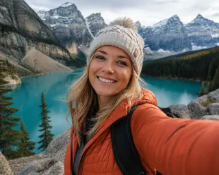
The Canadian Rockies are often reduced to a handful of famous Instagram viewpoints, yet hikers quickly discover that Banff, Lake Louise and Moraine Lake are only the start of a much larger mountain system. When you zoom out to include Jasper, Yoho, Kootenay and Kananaskis, an entire network of valleys, passes and ridgelines opens up, each with its own character, access rules and hiking season. This guide is designed to help you choose trails across regions rather than simply adding another Banff bucket list, with concrete details on distance, elevation, difficulty, shuttles and when the snow usually lets you through.
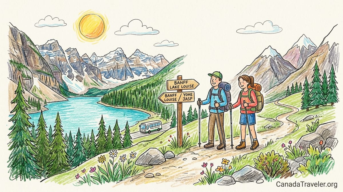
How to Think About Hiking the Canadian Rockies
For trip planning, it helps to think of the Canadian Rockies as a series of hiking “systems” rather than a single park: Banff around the townsite and Lake Louise, the Icefields Parkway corridor and Jasper to the north, Yoho and Kootenay across the British Columbia border, and Kananaskis just south of Banff in Alberta’s provincial parks. Each system has different rules, access points and crowd patterns. For example, a short walk at Lake Louise in July can feel like downtown at rush hour, while a similar-length stroll in Kootenay’s Marble Canyon might be almost empty on the same day.
The core hiking season for most front-country and mid-elevation trails runs from roughly mid June to late September, with July and August offering the most reliable snow-free conditions. Higher alpine passes such as Sentinel Pass above Moraine Lake or Wilcox Pass near Jasper often hold snow well into late June and can see fresh snowfalls again by mid September. Shoulder-season hikes are possible at lower elevations near Banff townsite, along the Bow Valley and in parts of Kananaskis, but you should expect lingering snow, mud and the need for traction devices in May and early June and again from late September onward.
Trail infrastructure and regulation have tightened in recent years, especially in busy spots. Moraine Lake Road is closed to personal vehicles, Lake Louise parking now requires high daily fees or shuttle reservations, and Kananaskis has a mandatory Conservation Pass for most roadside trailheads. In practice, that means you will spend almost as much time booking shuttle seats, park entry and passes as choosing which hike you want to do. The sections below compare specific trails across regions and difficulty levels so you can build a balanced itinerary: perhaps one easy lakeshore walk, one moderate day hike to a viewpoint, and one demanding alpine route if conditions and fitness allow.
Easy Scenic Walks: Big Views, Small Effort
Many travelers want iconic mountain views without a full-day climb. Around Lake Louise, the classic easy option is the Lake Louise Lakeshore trail, a nearly flat path of about 4 kilometers round-trip with negligible elevation gain that follows the north shore from the Chateau toward the Plain of Six Glaciers valley. In midsummer it can feel like a promenade, but the emerald water and hanging glaciers still deliver a dramatic introduction to the Rockies. Parking at the main lakeshore is limited and expensive, and most visitors now reach it via the Parks Canada shuttle from the Lake Louise Park and Ride, which operates from roughly late May to mid October with reservations releasing months ahead and a smaller batch two days before travel dates.
In Yoho National Park, the Emerald Lake loop offers a calmer alternative. The full circumnavigation is about 5 kilometers with minimal elevation change on a good gravel path, suitable for families and casual walkers. You can usually park directly at the lakeshore if you arrive early, and there are no shuttle or special permit requirements for day visitors at the time of writing. In busy July weekends the main lot can still fill by late morning, so arriving before 9 am is wise. Bears and moose occasionally pass through the surrounding forest; carry bear spray, keep children close and give wildlife generous space.
Closer to Banff townsite, the Fenland Trail and the Bow River trail system offer short forest and riverside loops under 3 kilometers with almost no elevation gain. These are often snow free earlier in the season, making them good options in late May or early June when higher passes are still buried. In Kootenay National Park, Marble Canyon’s out-and-back walk of roughly 1.5 kilometers through a narrow, water-sculpted gorge packs a surprising punch. It is right beside Highway 93, accessible from a paved lot, and is often combined with a stop at nearby Paint Pots, another easy walk of about 3.5 kilometers through ochre-colored mineral pools.
Kananaskis also has high-reward low-effort walks, though access comes with the added requirement of a Kananaskis Conservation Pass for all vehicles parked at most day-use areas. Grassi Lakes near Canmore is the best-known example: roughly 4 kilometers round-trip and about 150 meters of elevation gain on either an easier forest road or a slightly rougher scenic trail beside small cliffs and waterfalls. The turquoise pools at the top rival those at Banff’s more famous lakes. Because trailheads along Smith-Dorrien Trail and nearby valleys have patchy cell reception, it is smart to purchase your Conservation Pass online before driving out.
Moderate Day Hikes: Classic Viewpoints Across the Regions
If you are comfortable with 10 to 15 kilometers and 400 to 800 meters of climbing, the Canadian Rockies open up into a network of classic day hikes. Around Lake Louise, the Plain of Six Glaciers trail extends from the lakeshore promenade into a hanging valley directly facing the receding Victoria Glacier. Expect about 13 kilometers round-trip and 400 meters of elevation gain if you go to the teahouse and viewpoint. Grade is steady rather than steep, but early-season snow and avalanche debris can linger into late June. Access is via the same shuttle or paid parking system as the lakeshore, and hikers should factor in shuttle departure and last-return times when planning their day.
In Banff proper, the Sulphur Mountain trail offers a sustained but non-technical climb of about 10 kilometers round-trip and roughly 650 meters of gain from the lower gondola parking lot to the summit boardwalk. Many visitors ride the gondola both ways, but hiking up and taking the gondola down is a popular compromise that allows you to avoid burning your knees on the descent. There is no separate trail permit, though you will need to pay for the gondola if you choose not to hike both directions. Given frequent bear activity on the lower slopes, solo hikers should make noise and consider joining small ad-hoc groups at the trailhead.
Jasper’s moderate options feel more open and wild even at similar distances. The Valley of the Five Lakes loop near Jasper town is a relatively gentle 4.5 to 6 kilometer outing with rolling terrain and short hills, threading past a series of intensely colored ponds. For a larger day, Wilcox Pass off the Icefields Parkway is about 8 to 10 kilometers round-trip with around 400 meters of elevation gain, traversing open meadows with sweeping views of the Athabasca Glacier. Snow often lingers here into late June, and cold winds off the icefield can make July afternoons feel more like October on a damp coastline. There are no shuttle systems on these particular Jasper trails, but parking lots can fill by late morning in peak season.
Across the border in Yoho, the Iceline Trail is the standout moderate-to-challenging day hike. The standard loop from Takakkaw Falls campground runs roughly 17 to 20 kilometers with up to 800 meters of elevation gain depending on the variation chosen. Much of the route travels along a high bench opposite retreating glaciers, with constant views of Takakkaw Falls and the Yoho Valley. The road to Takakkaw Falls is typically open from late June to early October, with narrow switchbacks that are unsuitable for long trailers. There is no shuttle, but the small parking lots fill quickly in larch season. Because this route spends extended time above treeline, thunderstorms, snow and high winds are real concerns even in mid summer.
Demanding Alpine Routes: When You Want a Big Mountain Day
For strong hikers accustomed to long days and steep switchbacks, the Rockies offer numerous demanding but rewarding alpine routes. In the Lake Louise and Moraine Lake zones, two of the most sought-after are the Larch Valley and Sentinel Pass trail and the Mount Fairview / Saddleback area. Larch Valley and Sentinel Pass from Moraine Lake is roughly 11.5 kilometers round-trip with about 750 meters of elevation gain; the trail is well defined but steep in sections and can be snowbound or icy into late June. Because Moraine Lake Road is closed to personal vehicles, access is by Parks Canada shuttle or licensed commercial operator only, with reservations required and sunrise spots selling out particularly fast in peak season.
Mount Fairview and Saddleback Pass above Lake Louise is a similar challenge, often totaling 10 to 11 kilometers and about 1,000 meters of elevation gain if you summit Fairview. This is a solid introduction to steep Rocky Mountain switchbacks, with a mix of forest, larch groves and wide-open alpine slopes. As with other Lake Louise trails, you reach the trailhead either via limited paid parking or the Park and Ride shuttle system. Both Larch Valley and Fairview are in prime grizzly habitat, and group-size or mandatory group-hiking restrictions have occasionally been implemented in past years. Even when not formally required, many hikers choose to travel in groups of four or more and carry bear spray.
Jasper’s Skyline Trail is a multi-day classic rather than a single-day outing, but ambitious hikers sometimes sample a demanding section as a long day hike from Maligne Lake or Maligne Canyon trailheads. More realistic single-day alpine routes include the Sulphur Skyline trail near Miette Hot Springs, which climbs approximately 700 meters over about 8 kilometers round-trip to a bald summit with far-reaching views. The trail is sustained and can be extremely windy and exposed; an extra insulating layer and gloves are sensible even in August. Weather in Jasper’s alpine passes is volatile, and hikers should be prepared for fast-moving thunderstorms, sudden temperature drops and poor visibility.
Kananaskis is where Calgary-based hikers often go for serious day objectives. Popular demanding routes include Mount Yamnuska’s scrambling circuit near the Bow Valley, and the Northover Ridge and Aster Lake area in Peter Lougheed Provincial Park for experienced backpackers. Yamnuska’s standard scrambling loop is only around 11 kilometers but includes close to 900 meters of gain, loose rock, exposed sections and some fixed chains. It is unsuitable for inexperienced hikers and should be avoided in wet, icy or smoky conditions. All these trailheads require a Kananaskis Conservation Pass for parking, and some, such as popular routes off Highway 40, face periodic closures for wildlife or avalanche control, especially at the start and end of the hiking season.
Access, Shuttles, Passes and Reservations
Access logistics are now one of the defining features of hiking in the Canadian Rockies. In Banff, visiting both Lake Louise and Moraine Lake typically means booking seats on the Parks Canada shuttle system. Reservations usually open in spring for the main summer period, with a second wave of last-minute seats released 48 hours before departure. The shuttle runs from the Lake Louise Park and Ride just off the Trans-Canada Highway, and a separate connecting shuttle links Lake Louise and Moraine Lake. Private shuttles and tour companies also operate to these lakes at higher prices, offering early or late departures that target sunrise or quieter time slots.
Beyond the lake corridors, many Banff and Yoho trailheads still work on a first-come, first-served parking basis, including Johnston Canyon, Sunshine Meadows access at Sunshine Village, and most Yoho valley trails. However, parking lots can fill as early as 8 or 9 am on sunny July weekends. Travelers staying in Banff townsite often combine Roam public transit with trail choices to avoid parking stress, for example taking a bus to the Bow Falls or Tunnel Mountain area. In Jasper, there is currently no shuttle network comparable to Lake Louise, but popular lots at places like Maligne Canyon, Valley of the Five Lakes and Wilcox Pass can still overflow; starting early or hiking in the late afternoon can make the experience markedly calmer.
On the provincial side, Kananaskis requires a paid Conservation Pass per vehicle for most access roads and day-use areas. You can buy the pass online or at select physical outlets before arriving, and enforcement officers often patrol busy lots like those at Grassi Lakes, Spray Lakes and Peter Lougheed Provincial Park. Unlike the national parks, there is no entrance gate, so visitors sometimes forget the pass and risk fines. Kananaskis has limited or nonexistent mobile reception in many valleys, which makes it doubly important to complete the purchase and save confirmation details in advance rather than relying on a last-minute online payment.
National park entry fees apply in Banff, Jasper, Yoho and Kootenay except during special free-admission initiatives that may run for part of some seasons. Many international visitors purchase a Parks Canada Discovery Pass for unlimited visits over a year, which can be cost effective for itineraries longer than six or seven days that include multiple parks. When budgeting, factor in not only park entry and any shuttle reservations but also potential parking fees at premium lots near Lake Louise, as well as the higher cost of private shuttle operators if Parks Canada seats are sold out for your dates. Price structures and details change annually, so always confirm specifics directly with Parks Canada and the relevant provincial authorities before you travel.
Wildlife, Safety and Seasonal Timing
Wildlife is one of the greatest draws of the Canadian Rockies and one of the main reasons trail regulations change. Black bears and grizzly bears roam every region discussed here, from the Banff townsite outskirts to Jasper’s Maligne Valley and Kananaskis’s remote drainages. In practical terms, that means you should always hike with bear spray readily accessible, know how to use it, and make noise on blind corners and in dense brush. Trails like Larch Valley, Moraine Lake shoreline and some Kananaskis valleys have occasionally seen temporary group-size requirements or closures when bears are feeding heavily on seasonal berries or when there are cubs nearby.
The prime hiking season is short because snow lingers at elevation and returns early. In a typical year, low-elevation trails near Banff, Canmore and Jasper town can be snow-free by late May, while high passes on iconic routes may not fully open until late June or even early July in heavy snow seasons. The larch-viewing period, when needles on the subalpine larch trees turn gold, usually falls from mid to late September depending on elevation and exposure. This is one of the busiest times at Lake Louise, Moraine Lake, Skoki, Sunshine Meadows and select Kananaskis routes, leading to intense shuttle demand and crowded parking lots even as nights dip below freezing and daytime snow showers become more frequent.
Storms roll through quickly in these mountains. Even on a forecasted clear day, you should carry a waterproof shell, insulating mid-layer, hat and gloves, as well as extra food, water-treatment method and a basic first-aid kit. Temperatures at higher passes like Sentinel Pass, Wilcox Pass or the Iceline bench can be 10 to 15 degrees Celsius colder than in the valleys, and wind chill intensifies the effect. Early-season travel may involve traversing snow patches where microspikes and trekking poles make a significant difference. Late in the year, ice on shaded switchbacks is common, especially on north-facing descents such as those from Sulphur Mountain or Yamnuska.
Wildfire smoke has become another frequent seasonal wildcard. Depending on conditions in British Columbia, Alberta and the northwestern United States, smoke can significantly reduce visibility and air quality for days or weeks at a time, especially in late July and August. Hikers with respiratory issues should monitor forecasts and consider scheduling their hardest, highest-elevation days early in trips when lungs are fresh and weather windows are more flexible. Having backup lower-elevation options in Yoho, Kootenay or along river valleys like the Bow and Kootenay Rivers gives you flexibility if air quality temporarily worsens at higher or more interior locations.
Beyond Day Hikes: O’Hara, Assiniboine and Backcountry Systems
Some of the most celebrated hiking areas in the Canadian Rockies sit within controlled-access or remote backcountry systems, which deserve more planning than this overview can provide. Lake O’Hara in Yoho National Park is the classic example: access is limited by a reservation-only bus and a tightly regulated backcountry campground system. Once there, a network of superb day routes like the Alpine Circuit, Opabin Plateau and Lake Oesa loops reward experienced hikers with dramatic cirques and airy ledges. Because demand vastly exceeds supply, most travelers need to treat O’Hara as the focus of a trip rather than an add-on.
Mount Assiniboine Provincial Park, straddling the border between British Columbia and Alberta and often accessed from Kananaskis or Sunshine Village, is another destination that functions as its own multi-day system. Reaching the core area around Lake Magog typically involves a backpacking approach of 20 to 30 kilometers over one or two days on trails such as the Sunshine to Assiniboine route or the Mount Shark trailhead approach. Once at the core campgrounds or huts, hikers can explore demanding day routes like Nub Peak, Wonder Pass and the Rummel or Assiniboine Pass areas. Helicopter access and lodge stays introduce additional cost and reservation layers, which are better explained in specialist guides.
For trekkers interested in extended backcountry travel, the Great Divide Trail and its component segments weave through many of the regions mentioned in this article, linking Waterton in the south with remote parks in the north. Sections through Banff, Kootenay, Yoho and Jasper involve multiple nights of camping, water crossings, route-finding challenges and frequent travel above treeline. Permits, bear canister requirements, group-size regulations and booking windows vary by park and by year. Because of this complexity, it is wise to consult dedicated long-distance hiking resources and official park planning materials once you have decided which segment you hope to tackle.
For most visitors, the best way to engage with these advanced systems is to sample them via guided trips or by focusing on one area such as O’Hara or Assiniboine for a full trip. Many reputable guiding companies based in Canmore, Banff and Jasper offer multi-day hut-based treks, introductory backpacking courses and custom itineraries that bundle logistics, permits and food. If your trip is shorter than a week, it is usually more realistic to combine several high-quality day hikes in the main park systems with one carefully chosen multi-day objective rather than trying to fit in O’Hara, Assiniboine and long Great Divide Trail sections all at once.
The Takeaway
Planning hikes in the Canadian Rockies is less about finding that one “best” trail and more about assembling a set of experiences that match your time, fitness and appetite for logistics. Lake Louise and Moraine Lake deliver justifiably famous scenery, but so do Jasper’s glacier-view meadows, Yoho’s high benches and Kootenay’s deep river canyons, often with fewer people and lighter reservation requirements. If you structure your trip to include one or two easy scenic walks, several moderate day hikes and, conditions permitting, a demanding alpine route, you will gain a richer sense of how diverse these mountains really are.
Start your planning by locking in the hardest-to-get pieces first: any necessary shuttle seats for Lake Louise and Moraine Lake, Kananaskis Conservation Passes and, if applicable, coveted reservations for Lake O’Hara, Mount Assiniboine or popular backcountry campgrounds. Then fill in your schedule with flexible options in Jasper, Yoho and Kootenay that you can adjust based on weather, wildfire smoke and energy levels. With realistic expectations about distances, elevation and access, the Canadian Rockies reward hikers with some of the most memorable days you can spend on a trail anywhere in the world.
FAQ
Q1. When is the best time of year to hike in the Canadian Rockies?
The most reliable hiking window for snow-free mid-elevation trails is generally from mid June to late September, with July and August offering the warmest and most stable conditions. High alpine routes and passes may open later and can see fresh snow as early as mid September.
Q2. Do I need shuttle reservations for Lake Louise and Moraine Lake?
In practice, yes. Visiting either lake in peak season usually requires advance reservations on the Parks Canada shuttle system or a booking with a licensed private shuttle operator, as Moraine Lake Road is closed to private vehicles and parking at Lake Louise is limited and expensive.
Q3. What is the Kananaskis Conservation Pass and who needs it?
The Kananaskis Conservation Pass is a mandatory vehicle permit required to park at most day-use areas and trailheads in Kananaskis Country and the Bow Valley. One pass covers a vehicle and its occupants; it can be purchased online in advance or at select in-person outlets.
Q4. How difficult are classic trails like Plain of Six Glaciers and Larch Valley?
Plain of Six Glaciers is a moderate day hike of roughly 13 kilometers round-trip with a steady climb, suitable for reasonably fit hikers. Larch Valley and Sentinel Pass is shorter but steeper, with around 750 meters of elevation gain and some exposure to snow and loose rock early and late in the season.
Q5. Are there easy hikes with good views that avoid the biggest crowds?
Yes. Options like Emerald Lake loop in Yoho, Marble Canyon and Paint Pots in Kootenay, and Fenland or Bow River trails near Banff offer strong scenery with light effort. Starting early in the morning or hiking later in the afternoon helps avoid peak crowds even on popular routes.
Q6. What wildlife precautions should hikers take?
Hikers should carry bear spray, know how to use it and keep it readily accessible. Travel in groups when possible, make noise in dense vegetation, keep dogs leashed, never approach or feed wildlife, and respect any temporary trail closures or group-size requirements.
Q7. Can I hike in the Canadian Rockies without renting a car?
It is possible but requires more planning. Roam public transit connects Banff, some nearby attractions and Lake Louise, and Parks Canada shuttles serve Lake Louise and Moraine Lake. However, many Jasper, Yoho, Kootenay and Kananaskis trailheads are not reachable by public transport, so guided tours or private shuttles may be necessary.
Q8. How should I prepare for rapidly changing mountain weather?
Always pack layers, including a waterproof shell, insulating mid-layer, hat and gloves, even on sunny days. Check forecasts for your specific region, start early to avoid afternoon storms, and be willing to turn around if thunder, heavy rain, snow or persistent low cloud make conditions unsafe or navigation difficult.
Q9. Do I need special permits for Lake O’Hara or Mount Assiniboine?
Yes. Lake O’Hara requires advance reservations for the access bus and very limited backcountry camping, and Mount Assiniboine’s core area typically involves backcountry campground or hut bookings, with some visitors also arranging helicopter flights. Both destinations should be planned using detailed, dedicated resources well ahead of your trip.
Q10. What is a realistic daily hiking distance for most visitors?
Many visitors find that 8 to 12 kilometers with 300 to 600 meters of elevation gain makes for a satisfying day without overexertion, especially when adjusting to altitude and travel fatigue. More ambitious hikers may tackle 15 to 20 kilometer days, but building rest or light days into your itinerary is wise.