


On the morning I set out from St. Martins, on the Fundy coast of New Brunswick, I planned my entire day around the tide. In a place shaped so completely by the Bay of Fundy’s extraordinary rise and fall, your clock is not your watch but the water level. That is especially true if your day includes both walking to the famous reddish sea caves at St. Martins and driving the Fundy Trail Parkway, now part of Fundy Trail Provincial Park, where river mouths, beaches and viewpoints all change character as the tide moves in and out.
Starting in St. Martins With the Real Tide of the Day
I began the day in Fundy-St. Martins on Wednesday, October 28, 2026, checking the tide tables before I even thought about breakfast. That morning, the official predictions for St. Martins showed a pre-dawn high tide shortly after 1 a.m., with low tide around 7 a.m., another high early afternoon and an evening low. The details vary slightly depending on which tide service you look at, but they all told the same essential story: by mid-morning, the tide would still be retreating or close to low, which meant the harbor would be mostly emptied of water and the sea caves would be approachable on foot for a limited time.
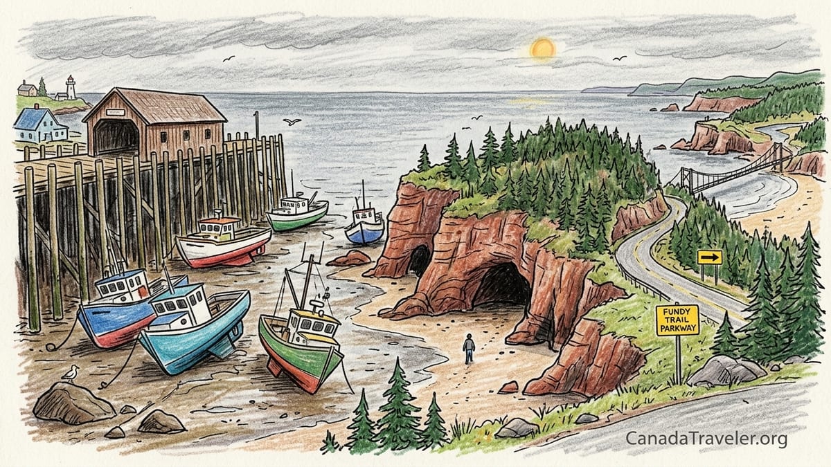
Walking down to the village harbor just after 8 a.m., I could see what those numbers meant in real life. The fishing boats that float level with their moorings at high tide were tilted at sharp angles, resting directly on the exposed harbor bottom. Muddy channels snaked between sandbars like veins. The wooden pilings of the wharf seemed improbably tall when you imagine them surrounded by water again in only a few hours. It is one of the more startling everyday sights on this coast: the same boats that had bobbed quietly overnight now sitting on their keels, waiting for the sea to come back.
The air was cool, around single digits Celsius, with a low ceiling of overcast cloud that turned the Bay of Fundy slate grey. A few locals in rubber boots moved around the wharf, unfazed by the drama of the tide cycle. For visitors, it looks almost like a harbor abandoned at low lake level. For people who live here, it is simply the “off” phase of a twice-daily transformation.
Because the Bay of Fundy tides are so dramatic, the difference between seeing St. Martins at high tide and low tide is like visiting two different villages. Before you plan a trip here, it pays to look up a specific tide table for the exact date you intend to travel, not just an average description. On this October day, the early low tide shaped the entire rest of my schedule, from when I could safely walk under the sea cliffs to when I would start driving the parkway.
Walking to the Reddish Sandstone Sea Caves at True Low Tide
Tourism brochures often tell you that you have about two hours either side of low tide to explore the St. Martins sea caves on foot. That rule of thumb is useful, but it is only a starting point. Conditions on any given day depend on recent weather, the exact height of that particular low tide and your own comfort moving over wet rock. I wanted not just a theoretical exploration window but a very real one, so I aimed to be on the beach within about an hour of the predicted low.
From the small cluster of restaurants and parking areas near the shore, I walked down onto the wet sand, which still held the mirror-like sheen of freshly retreating water. The reddish sandstone cliffs that make this area so photogenic were streaked with darker vertical bands where water had recently drained away. The sea caves, visible but not yet fully accessible at mid-tide, now stood largely exposed, their entrances wide and inviting. Shallow tide pools reflected the muted sky, and bands of pebbles crunched underfoot between smoother stretches of sand.
As I made my way toward the caves, the footing shifted from firm wet sand to a mix of small cobbles and slick rock shelves. Sections of the rock were coated in seaweed that looked innocuous from a distance but turned out to be extremely slippery up close. It was immediately obvious that this is not a place to rush or to push your luck with the clock. I stepped around the darkest green patches, testing each surface with one boot before committing my full weight.
Inside the first large cave, the sandstone glowed a deep rust color, shot through with lines of cream and deeper red where layers had compacted at different speeds. The ceiling arched overhead, rough and scalloped, with rounded pockets that told their own story of centuries of waves grinding in and out. Looking back out toward the bay, the opening framed a ribbon of exposed sea floor, and beyond that, a dull silver band of distant water. Even on a calm morning, you could feel how quickly this scene would change once the tide turned.
I did not walk all the way to the furthest cave recessed under the headland because I was watching both the time and the subtle clues around me. The water’s edge had stopped retreating and hung in place in that deceptive pause before it starts to creep back. Small rivulets that had been running seaward began to slow. This is where that often-quoted “two hours on either side of low tide” can lull people into overconfidence. Charts are based on predictions under normal conditions, not on your personal walking speed or how distracted you might get taking photos. I turned around while the access route was still entirely dry, choosing a conservative margin instead of waiting to see how long I could stretch my stay.
Leaving the Caves Before the Tide Returns
On the walk back along the beach, I could already see subtle changes in the landscape that would be invisible if you had just arrived. A few pools that had been isolated now showed the faintest ripple as new water threaded through pebbled channels. The noise of the surf shifted from a distant hiss to a more insistent rhythm. It was a reminder that the Bay of Fundy’s extreme tides are not just a tourism talking point but a real force that shapes what is safe and what is not.
At the edge of the parking area, a sign reminded visitors to consult daily tide times and to avoid being caught by rising water near the cliffs. Staff at local businesses echoed the same message when I grabbed a mid-morning coffee and a basic breakfast sandwich from a small café near the shore. The approximate rule of “about two hours each side of low” can be accurate in many cases, but it is no substitute for checking an actual tide prediction service and local advice on the day you visit. If in doubt, they told me, leave earlier than you think you need to. The caves will still be there the next day, but wading out with the tide chasing you around rock outcrops is a very different experience than strolling back over dry sand.
Before leaving St. Martins for the drive along the Fundy Trail Parkway, I rinsed sand and mud from my shoes at a simple outdoor tap near the parking area washrooms. My out-of-pocket costs so far that morning were modest: a few dollars for coffee and breakfast, a small fee for parking close to the shore and some fuel for the car from the previous afternoon’s fill-up in Saint John, where petrol was hovering around the typical New Brunswick price range for late 2026. The real investment was time, structured so that I could enjoy the caves at their most impressive and still have a full day to drive the coastal parkway.
Entering Fundy Trail Provincial Park by Car
By late morning, I was on the short drive from St. Martins to the western entrance of Fundy Trail Provincial Park, which includes the 30 kilometre Fundy Trail Parkway. The road hugs forested hills with occasional glimpses of water, climbing gently until a staffed gatehouse appears where you pay the daily vehicle entry fee. For the 2026 season, the official fee for a vehicle with up to ten occupants is 23.48 Canadian dollars before tax, a price confirmed by the province’s published park fee schedules. With New Brunswick sales tax added, the total comes out noticeably higher at the till, but the base number is useful for planning.
At the gate, staff spoke briefly about the day’s conditions. The overcast sky from St. Martins had started to thin, and the forecast called for a cool, dry afternoon with little wind. That is nearly ideal for driving and for short walks to lookouts, though it can feel brisk when you step out of the car at exposed viewpoints. I was given a simple paper map that marked major stops along the parkway: Long Beach, the Big Salmon River area, and the access point for the Walton Glen Gorge trail among them.
Fundy Trail Parkway is not a fast through-road but a scenic drive intentionally peppered with pullouts, lookouts and signed parking areas. The pace is relaxed, limited by both the speed limit and the near-constant temptation to stop. The full drive from one end of the parkway to the other, without breaks, can take under an hour, but that would miss the entire point. I set my expectations for at least half a day and potentially more, especially since I wanted to line up one of the major stops, Long Beach, with a relatively low tide.
One of the key advantages of this parkway is that many of the most impressive coastal experiences are within a short walk of your parked car. This accessibility makes the road a very different proposition from its famous backcountry cousin, the 64 kilometre Fundy Footpath, which roughly parallels sections of the same coastline but demands serious fitness, multi-day planning and comfort with challenging terrain. On this October trip, I was here to sample Fundy’s wild edges from a car, not a tent.
Long Beach and the Expanding Bay of Fundy Shoreline
My next anchor point in the day, after the sea caves, was Long Beach. On the map it looks like a simple crescent of shoreline partway along the parkway, but in reality it might be the single most tangible demonstration within the park of how dramatically the Bay of Fundy reshapes itself between high and low tide. I arrived in late morning when the tide was once again trending downward, though not at its deepest ebb, and parked at the signed lot above the shore.
From the parking area, a short path and stairway lead down to the beach. At higher water levels, this feels like a typical pebbled Fundy shoreline, with the waves reaching almost to the base of the bank. At lower tide, as I found it, the sea had pulled so far out that the exposed zone of sand, gravel and shallow pools stretched for hundreds of metres. You can feel the scale of the tide here in your legs. It takes several minutes of steady walking just to reach the new waterline, passing over bands of rounded stones, compressed sand and patches of rippled mud.
Every texture underfoot tells you something about the previous tide cycle. Smooth cobbles near the upper beach have been rolled and polished by countless waves. Lower down, the finer sand still held the faint patterns of the last receding swash, like a fingerprint. Tide pools formed miniature worlds with barnacles, snails and small branching bits of seaweed. Looking back toward the shore from the lower flats, cars in the parking area seemed toy-like against the wooded rise and the road beyond. A few other visitors walked slowly along the water’s edge, silhouetted against the grey-blue strip of open bay.
I knew from the tide tables that this window of soft sand and easy walking would narrow again as the hours passed. In summer, people picnic here, children dig in the sand and families linger for long stretches between visits to viewpoints. On this fall day, with a cool breeze blowing directly up the bay, most visitors stayed in motion, walking just long enough to absorb the sense of space before retreating to the warmth of their vehicles. For me, Long Beach provided a complementary perspective to the sea caves at St. Martins. There, you watch the tide determine whether a cliffside cave is reachable or not. Here, you see a modest strip of shore balloon into an impressively wide apron of beach, then shrink back again, twice every day.
Big Salmon River and Navigating Around the Closed Suspension Bridge
Continuing east along the parkway, I descended toward the Big Salmon River valley, one of the central hubs of activity in Fundy Trail Provincial Park. This is where the road swings inland briefly, crossing the river near its mouth, and where several trailheads, picnic spots and viewpoints cluster. Historically, one of the marquee features here has been the Big Salmon River suspension bridge, which allows walkers to cross the river on a long, gently swaying span. In 2026, however, that bridge is closed to visitors due to maintenance and safety considerations, and I planned my time accordingly.
At the main Big Salmon River area, the parking lot had well-maintained washrooms and several picnic tables with views up and down the valley. Interpretive panels explained the area’s logging and shipbuilding history, as well as the ecology of the river and its estuary. I walked down to the accessible viewpoints near the riverbank, where I could see the suspension bridge structure spanning the water, but barriers and signage clearly indicated that it was off limits. There is no crossing the bridge during closure, and I did not attempt to do so.
Instead, I explored the river mouth from the open sections of trail on my side, watching how the tide level altered the character of the scene. At lower water levels, the river carved a more distinct channel through exposed gravel bars near its meeting point with the bay. As the tide rose over the course of the afternoon, more of those bars vanished, and the river seemed to widen and slow as seawater pushed inland underneath the surface. The suspension bridge, even idle, provided a helpful visual scale for just how much vertical change the water undergoes each tide cycle.
For visitors who are used to swinging footbridges as the highlight here, the closure in 2026 may be a disappointment, but there is still substantial value in stopping. Several short, signed trails lead to river and coastal viewpoints that do not require the bridge at all. I spent close to an hour walking these, stopping at an elevated vantage point where the river valley opens out to the Bay of Fundy, the tide line tracing a gentle arc along the shore. Lunch was a simple affair at a picnic table: a sandwich and drink picked up earlier from St. Martins, augmented by snacks I had in the car. The cost was modest, especially compared with dining in a sit-down restaurant, and it allowed me to stay flexible with the day’s shifting schedule.
Walton Glen Gorge and How the Parkway Compares to the Fundy Footpath
From Big Salmon River, I continued toward one of the most dramatic inland highlights of the parkway, the Walton Glen Gorge area. Signage along the road directed me to a dedicated parking lot and trailhead. From there, a relatively short, well-marked trail leads to viewpoints over the so-called “Grand Canyon of New Brunswick,” where a deep, narrow gorge cuts through the forested plateau.
The walk to the main viewpoint is not technically difficult for most reasonably fit visitors, though there are roots, rocks and some short steeper sections that make sturdy footwear a good idea. The payoff is a platform or fenced lookout perched above a plunging green chasm, with cliffs dropping away on either side. On the day I visited, autumn color still tinged the hardwoods, and fragments of cloud caught on the upper slopes, while the bottom of the gorge remained dark and cool.
Standing there, it was easy to imagine the multi-day Fundy Footpath, which runs for 64 kilometres through this broader region, threading its way through much more demanding terrain down closer to sea level. The Footpath is known among hikers for its steep ascents and descents, muddy sections and remote feel, and it requires serious preparation, from gear and food to navigation and safety planning. In contrast, the parkway’s road-accessible experiences provide many of the same visual rewards without committing you to long, strenuous days under a heavy pack.
That accessibility does not make the parkway a mere drive-by experience, however. Even with a car, fully appreciating Fundy Trail means getting out at multiple stops, layering in an hour here for a beach, forty-five minutes there for a gorge viewpoint, half an hour for an interpretive walk near a river mouth. By the time I reached Walton Glen Gorge and returned to my vehicle, I had accumulated several hours of walking spread across the day, without ever being more than a short drive from amenities or my own supplies.
Time, Weather, Costs and Facilities on a Tidal Road Trip
By mid-afternoon, clouds had thinned into high, bright overcast, with occasional filtered sun lighting the water far below the cliffs. The temperature remained cool but comfortable for hiking in a light jacket. My total road time from St. Martins through the parkway, including all the major stops, ended up being a full day’s outing rather than a half-day spin.
From leaving the sea caves area in late morning to exiting at the eastern end of the parkway in late afternoon, I spent roughly six to seven hours within Fundy Trail Provincial Park. That included the Long Beach stop, at least an hour at Big Salmon River, my hike to the Walton Glen Gorge viewpoints, and numerous shorter pauses at roadside lookouts. The actual driving segments between those stops rarely lasted more than fifteen or twenty minutes at a time.
In terms of costs, the largest single outlay directly connected to the parkway was the 23.48 Canadian dollar vehicle-entry fee (before tax) at the gate. With tax, the amount was higher but still reasonable for a full day of access for my carload. I added to that a modest amount for fuel from Saint John, breakfast and coffee in St. Martins, and my picnic-style lunch. Had I chosen to eat at one of the seasonal restaurants closer to the park in peak summer, the food budget could have doubled or more. Late in the season, some businesses were already closing or on reduced hours, so packing snacks and drinks proved useful.
Facilities along the parkway itself were straightforward but adequate. Main stops like Long Beach and Big Salmon River had clearly signed parking, toilets and trash receptacles. Smaller viewpoints might only offer a pullout and a railing. Mobile reception varied, dropping out in some lower sections of the road, which made it important to have a paper map from the gate and a pre-downloaded tide table screenshot rather than relying entirely on online access. None of these practicalities detracted from the experience, but they shaped how I structured the day.
A Reusable Itinerary Timed Around Low Tide
Looking back at the day as a whole, the Bay of Fundy tide cycle was the backbone of my schedule. Starting with the early morning low tide at St. Martins allowed me to safely experience the sea caves on foot, then transition smoothly into a long, unhurried drive along the Fundy Trail Parkway. If you want to adapt this into a reusable itinerary, the key is to start by identifying the low tide that best fits your available date, and then work outward in blocks of time.
For a similar visit in any season when the park is open, one workable pattern looks like this. Aim to be in St. Martins about one hour before low tide, with a plan to spend no more than ninety minutes total walking out toward the caves and back, while leaving a conservative buffer before the water returns to narrow the route. After rinsing off and grabbing a simple breakfast or coffee, allocate around twenty minutes for the short drive to the Fundy Trail western gate. Once you have paid your vehicle fee and picked up a map, allow three to five hours within the park to make the most of the drive without feeling rushed.
Within those hours, you might spend forty-five minutes to an hour at Long Beach, especially if you can catch it within a couple of hours of low tide, when the shoreline is at its widest. Plan at least an hour at Big Salmon River for viewpoints, short walks and a picnic, adjusting your expectations in 2026 to account for the continued closure of the suspension bridge. Add another hour to ninety minutes for Walton Glen Gorge, including the walk to and from the main viewpoint. Any remaining time can be distributed among shorter lookouts and unscheduled stops that catch your eye along the route.
As for whether the parkway deserves a half-day or a full day, my experience argues strongly for the latter, especially if you are already timing your morning around the St. Martins sea caves. Attempting to do both in a rushed half-day is technically possible in midsummer when daylight is long, but it would turn what should be a contemplative coastal journey into a series of checkboxes. A full day, by contrast, allows you to sit with the scale of the tides, to watch Long Beach change shape over a single visit and to appreciate how a river mouth like Big Salmon transforms between low and high water in real time.
The Takeaway
Driving from St. Martins to Fundy Trail Provincial Park on a tide-timed day feels less like ticking off attractions and more like following a slow, predictable pulse. The fishing boats resting on the harbor floor at low tide, the broad reveal of the reddish sandstone sea caves, the long reach of sand at Long Beach and the muted rise of water at the Big Salmon River mouth are all chapters in the same story of Fundy’s daily transformation.
By paying attention to the actual tide tables for your travel date, respecting the limits of safe access around the caves, and giving the 30 kilometre Fundy Trail Parkway the better part of a day, you stack the odds in favor of a rewarding visit. The 23.48 Canadian dollar vehicle fee, before tax, spreads easily across hours of scenic driving, accessible viewpoints and gentle walks, especially if you bring your own picnic and treat restaurant stops as a bonus rather than a necessity.
Most of all, planning your trip this way invites you to experience the Bay of Fundy not as a static backdrop but as a living system. Instead of simply arriving at a viewpoint and snapping a photo, you watch boats float high one hour and rest in the mud the next, beaches shrink and grow and river mouths breathe with the tide. It is a simple framework for a day trip that feels anything but ordinary.
FAQ
Q1. How close to low tide should I arrive at the St. Martins sea caves?
Plan to arrive about one hour before the predicted low tide, then give yourself no more than ninety minutes total to walk out and back while keeping a conservative safety buffer.
Q2. Is the “two hours on either side of low tide” window for the caves always safe?
No. It is only a rough guideline. Actual safe access depends on conditions, the specific height of that day’s tide and your pace. Always check current tide predictions and local advice.
Q3. Were the fishing boats in St. Martins floating or resting when you visited?
On the morning of October 28, 2026, I saw the fishing boats resting on the exposed harbor bottom at low tide, tilted on their keels below tall wharf pilings.
Q4. How much does it cost to drive the Fundy Trail Parkway in 2026?
In 2026, the published vehicle-entry fee for Fundy Trail Provincial Park is 23.48 Canadian dollars before tax for a vehicle with up to ten occupants.
Q5. Can I cross the Big Salmon River suspension bridge right now?
No. During the 2026 season, the Big Salmon River suspension bridge is closed to visitors, and you should not plan on crossing it as part of your visit.
Q6. How is the parkway different from the 64 kilometre Fundy Footpath?
The parkway is a road-based scenic drive with short walks to viewpoints and beaches, while the Fundy Footpath is a demanding multi-day backcountry hiking route that requires significant fitness and preparation.
Q7. How long should I budget for the Fundy Trail Parkway itself?
If you want to stop at places like Long Beach, Big Salmon River and Walton Glen Gorge, plan at least three to five hours, which effectively makes it a half to full day activity.
Q8. Is it necessary to bring food, or can I rely on park facilities?
Bringing at least a picnic-style lunch and snacks is wise, especially later in the season when nearby restaurants may have limited hours. Picnic tables are available at major stops.
Q9. Do I need special equipment to walk to the St. Martins sea caves?
You do not need technical gear, but sturdy footwear with good grip is important. Surfaces can be very slippery, with wet rock and seaweed underfoot, even at low tide.
Q10. Is the Fundy Trail Parkway worth the entry fee if I only have a few hours?
Yes, as long as you focus on a handful of highlights like Long Beach and Big Salmon River. However, the experience feels richer if you can devote most of a day and align your visit with a low tide.