


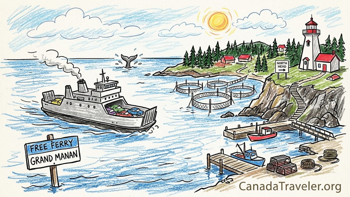
The first hint that Grand Manan Island is not a typical resort getaway comes before you even leave the mainland. At Blacks Harbour, in a queue of pickup trucks, contractor vans and dented hatchbacks, the ticket agent tags my car for the 90-minute crossing to North Head and waves me forward without asking for payment. The fare, she reminds me, is only collected on the way back. It is the island’s quiet way of saying: you are crossing into a working Bay of Fundy community, and you are welcome to stay a while.
Crossing the Bay of Fundy to a Working Island
I arrived in Blacks Harbour with a reservation for an afternoon sailing on the Grand Manan Adventure, one of the two roll-on, roll-off ferries that connect the island to mainland New Brunswick. Check-in was straightforward: I joined the line of vehicles, rolled down my window at the booth, confirmed my name and sailing time, and received a hanging tag for the rear-view mirror. The crew directed me into a lane with lobster boats and fuel trucks ahead of me, and a family minivan full of camping gear behind.
What catches most first-time visitors off guard is the fare system. There is no charge at all to sail from Blacks Harbour to Grand Manan. The crossing to the island is free. All fares are collected only when you sail back to the mainland, an arrangement that has been in place for years. On my October 2026 trip, as a non-resident, the posted return benchmark was about 13 Canadian dollars for an adult on foot and roughly 39 dollars for a standard car, not including the driver. In practice, my own ticket for one adult plus an ordinary car, paid at the North Head terminal on the way back, came to a little over 50 dollars in total after tax and fees.
The crossing itself took about 90 minutes. We left Blacks Harbour under a sky that could not decide between fog and sun, typical of the Bay of Fundy. I parked on the vehicle deck, grabbed my daypack and climbed to the passenger lounge, where a mix of commuters, students and visitors spread out at simple tables. Through the salt-flecked windows I watched the mainland shrink and the outline of Grand Manan rise ahead: a low dark bar of spruce forest, then the cliffs of North Head, and finally the slender finger of land that holds one of the most photographed beacons in New Brunswick.
As we swung toward the harbor, the ferry passed below Swallowtail Lightstation, poised high on its own rocky peninsula. The white wooden tower and cluster of red-roofed buildings were backlit by soft late-afternoon light. From the water the place already felt like the island’s handshake, a reminder that navigation and survival here have always depended on people who know these tides and ledges by heart.
First Stop: Swallowtail Lightstation and the Edge of the Island
Once the ferry ramp clanged down in North Head and the line of vehicles rolled ashore, I drove less than five minutes up Route 776 and turned toward Swallowtail Road. The parking area sits on a height of land with its own superb view, and for some visitors this is as far as they go. Even from here, looking down, you see the jagged necklace of cliffs, the narrow isthmus of rock, and Swallowtail’s tower looking out over the rippled slate of the Bay of Fundy. Interpretive panels explain the lightstation’s history and the mechanics of herring weirs that arc through the coves below.
I wanted to feel the place at ground level, so I followed the signed path toward the lighthouse. Access is not a casual stroll. First comes a steep descent of 54 wooden steps, then a sturdy wooden footbridge, and then an undulating gravel path that traces the spine of the headland. The steps are solid but exposed. I paused halfway down, turned back toward the parking area, and saw another visitor decide that the view from above would be enough. It is worth stressing that the descent and climb back up can be demanding for anyone with mobility issues or limited stamina, which makes that upper viewpoint an important, genuinely scenic alternative.
At the base of the stairs the footbridge bounces slightly underfoot and delivers you to a narrower, wilder feeling of the headland. The buildings here are modest rather than grand: a simple white tower, the keepers’ house, and smaller outbuildings that speak to decades of practical use. Wind moves through waist-high grass and low shrubs, and the only real sounds are surf and the distant thrum of the ferry’s engines. I walked past benches and a commemorative deck and found a spot where I could look back at the mainland and down at the shapes in the water. The semi-circular fences that seemed to float at the edge of the cove were not fences at all, but herring weirs, a traditional way of catching schooling fish by guiding them into maze-like corrals of poles and netting driven into the seabed.
Standing at Swallowtail, it is tempting to romanticize the scene. But the signs of work are everywhere. In the distance, lobster boats passed between buoys that mark individual traps. A small truck rattled along the access road as a local volunteer headed down to the site’s welcome center and museum. Grand Manan’s postcard moments are inseparable from its working identity; the same geography that draws painters and photographers also dictates where fishers set their gear and how safely vessels can move in fog or driving snow.
Driving Through North Head and Along the Working Coast
From Swallowtail I looped back into North Head, the northern gateway village. This is not a polished resort town so much as a compact service hub for the island. There is a grocery store, a gas station, a scattering of restaurants and take-out counters, and the ferry terminal itself. Down side streets, wharves reach into Whale Cove and neighboring inlets, clustered with lobster boats and small work skiffs. Stacks of traps, coiled rope and plastic bait boxes line the edges of gravel parking lots. In early October, the wharf felt between seasons, with the heavy summer whale-watching traffic easing and preparations underway for different fisheries.
Route 776 runs the length of Grand Manan, loosely following the island’s eastern shore. Heading south, I passed clusters of houses and small businesses, then longer stretches of spruce forest and the occasional view-slot of open water. A side road led past the entrance to Hole-in-the-Wall Campground, which controls day access to the famous rock arch and cliff-top viewpoints. On this trip I did not walk that trail, in part because I wanted to focus my limited time on the island’s harbors and headlands rather than race to every named landmark. It is important to say clearly: if you want to visit Hole-in-the-Wall, you should expect to stop at the private campground’s gatehouse and pay a day-use fee for trail access.
Farther south, the settlements thin and the landscape opens. At several points small dirt lanes led toward the shore, sometimes marked as private drives. Grand Manan is not dominated by large swaths of public coastal land; much of the shoreline is tied to generations of family ownership tied to fishing rights and wharf access. Visitors are welcome, but there is an unspoken expectation that you respect “No Trespassing” signs and remember that fishers’ yards and sheds are workplaces, not open-air museums.
My first full stop after North Head was at Pettes Cove, a simple shingle and boulder beach on the island’s east side. Kelp and dulse lay tangled at the high-tide line, and a handful of locals with woven sacks methodically picked through the wrack. Grand Manan has long been known for dulse harvesting. Dulse is a purple-brown seaweed that grows on rocks exposed at low tide; it is cut, gathered and dried on nets or open-air racks and then sold for snacking or cooking. I did not see the full drying process on this visit, so will not describe it in false detail. What I did see was the unhurried, practiced way people moved along the rocks, eyes down, selecting what they wanted before the tide turned again.
Seal Cove, Lobster Traps and the Memory of Herring
By late afternoon I rolled into Seal Cove, one of the island’s most evocative working harbors. The road drops toward a long basin framed by weathered buildings on wooden pilings, relics from the peak of the herring smokehouse era. Some of the old plants are now museums or artist spaces, others stand silent with sun-silvered boards and missing planks. At low tide, boats rest on the harbor floor, propped in the famous vertical Fundy tide range. At high tide, they float almost at street level.
I parked near the wharf and walked slowly, trying to balance curiosity with respect. Men in rubber boots hauled bait barrels. A forklift moved a pallet of traps. The air smelled of seaweed and diesel. Plastic crates printed with the names of local fishing families were stacked shoulder-high. Herring weirs no longer dominate the island’s economy as they once did, but the logic of concentrating gear and processing infrastructure around these coves still shapes the community. It is easy to imagine the days when this harbor brimmed with herring boats rushing to deliver their catch to the smokehouses before it spoiled.
Today, lobster is the star species for many fishers. Lobster seasons in the Bay of Fundy are strictly defined and shift by zone, but the physical evidence is clear year-round. Traps are everywhere. Traditional wooden traps are rarer now, but you still see a few, their slatted sides bleached and patched. Newer metal and plastic-coated wire traps, stacked four or five high, fill entire wharf corners. Colored buoys, each pattern tied to an individual license holder, hang in bunches from sheds or rattle softly against hulls.
Seal Cove also hints at the multiplicity of island work beyond fishing. Beside the wharf, an artist’s studio occupied part of an old smokehouse; farther up the road, a small café served chowder and fish cakes to visitors. Tourism weaves through the community economy, but it has not displaced boats and gear as the dominant visual language. Grand Manan presents itself less as a stage set for tourists and more as a place where visitors can watch everyday coastal life unfold.
Out to Sea: A Half Day with a Local Whale-Watching Operator
I devoted my first full morning on the island to going out on the water. Grand Manan has several whale-watching operators, and I chose a family-run company based out of Seal Cove whose schedule fit my dates. Their vessel for that shoulder-season trip was a mid-sized, covered tour boat rather than an open Zodiac, which felt like the right choice given the cool wind and the Bay of Fundy’s often lively surface.
The trip lasted just over four hours, including time in the harbor as passengers boarded and received a safety briefing. Seas that day were moderate: a noticeable swell with the boat rising and falling, but not enough to make movement on deck difficult. Layers and a windproof shell were essential. We left Seal Cove, rounded the southern part of the island, and headed toward known feeding areas where deep currents and underwater ledges concentrate plankton, herring and other baitfish.
Our sightings that day were rewarding without becoming a highlight reel. Early in the trip, a small group of harbor porpoises surfaced ahead of the bow, dark backs and small dorsal fins slicing through the chop. Later, we saw minke whales several times. Minkes are among the smaller baleen whales that visit the Bay of Fundy, and they can be subtle: a dark back, a fin, then gone. At one point, a minke surfaced close enough that we saw the clean curve of its back and the brief exhale before it slipped beneath the boat’s wake.
We did not see humpbacks, fin whales or the endangered North Atlantic right whales on that particular trip, and the crew was clear from the outset that no species is guaranteed. The Bay of Fundy is rich feeding water, and multiple whale species use it seasonally, but their movements shift with food availability, sea temperatures and even broader ocean changes. That uncertainty felt like an honest part of the experience. We spent part of the return leg watching shearwaters and gannets instead, while the guide pointed out Machias Seal Island in the hazy distance and explained how some Grand Manan boats run trips there in summer for seabird and puffin viewing.
Southwest Head and the Drama of the Cliffs
After returning to shore and refueling with a simple lunch of fish chowder and tea at a local café, I pointed the car further south along Route 776 toward Southwest Head. The road narrows and the houses thin until, quite suddenly, the forest funnels you toward an open parking loop and the abrupt end of the island. Southwest Head feels like a frontier. A small lighthouse and fog-signal building stand back from the brink, while informal footpaths lead toward the cliff edges where signs advise caution.
The cliffs here fall almost vertically to the Bay of Fundy. On my afternoon visit the wind was sharp but the visibility remarkable. The water directly below shifted from deep blue to metallic grey as clouds passed, and lines of tide rip marked submerged ledges. Far out, I could see the faint silhouette of a boat, likely another tour or fishing vessel working a productive edge. Closer to shore, currents swirled in arcs and boils that hinted at just how powerful the tides are in this part of the bay.
Southwest Head is one of the best places on Grand Manan to appreciate how closely human activity is tied to geography. The lighthouse is not especially large or ornate. Its main job is visibility and reliability. Adjacent towers and antennas support communications and navigation. There are no concession stands, no interpretive centers here, only a few signs, a gravel lot and the sound of wind. On the short loop trail that curves inland from the main viewpoints, I passed only two other people, both island residents out for a quick leg-stretch between chores.
In the late afternoon light I sat on a flattish rock and scanned the horizon for a while. I thought about the fishers who work along these ledges, often leaving home in the dark and returning long after I would be back in my inn. Whale-watching boats use some of the same channels and lookouts, but the primary daily traffic belongs to those whose livelihoods depend on the sea. The coexistence feels mostly organic. Operators and fishers share knowledge about where whales have been seen, where gear is set and which areas are best avoided. The island’s ability to welcome visitors without overcrowding still depends on that mutual respect.
Second Morning: Trails, Tides and Everyday Errands
On my second day I traded boat time for more exploration on land. After breakfast I returned briefly to North Head, not for another viewpoint but for errands that any traveler eventually faces. Grand Manan has only a small number of services compared with mainland towns. There is a central gas station and a limited choice of grocery and convenience stores. I topped up the fuel tank, picked up snacks and checked the small notice boards where locals shared information about community events, seasonal ferry schedule changes and even used boating gear for sale.
With practicalities handled, I chose a stretch of the Lighthouse Trail system near the island’s northern end, accessible without any additional passes or fees. I followed a signed side road to a modest roadside pull-off and picked up a forest path that soon broke out into cliff-top clearings. While I did not attempt the full multi-day coastal traverse that some hikers undertake, even this short section delivered classic Grand Manan scenery: spruce woods, mossy rocks, glimpses of Fundy through the trees and sudden windows of open cliff where you can look straight down to the water.
That morning the Bay of Fundy felt almost mild, with a light breeze and scattered high clouds. I walked for about ninety minutes out and back, taking time to sit on sun-warmed rock and watch rafts of eiders bob in the swells. I did not spot whales from the cliffs on this particular hike, though some walkers do in late summer and early fall. What I did notice was how close the trail passes to private land, and how dependent access is on the goodwill of owners who tolerate hikers passing near their fields and yards. Staying on marked paths, packing out trash and keeping noise down are small courtesies with real consequences for the long-term survival of these routes.
By midday I was back on the road, slowing through villages where laundry snapped on lines and children biked between houses. Here and there, small hand-painted signs advertised fresh fish for sale, craft studios or home bakeries. Grand Manan Island may sit out in the Bay of Fundy, but it is not frozen in time. Cell phones ring on the wharves. New trucks sit beside cottages that have seen generations of storms. The island’s economy has diversified, with tourism, art, research and remote work all playing roles alongside seafood. Yet the daily rhythm still feels tuned to tides, ferry horns and weather fronts more than to any abstract clock.
Staying, Eating and Moving Around Without a Car
For my two nights on Grand Manan I stayed in a small inn near North Head, within a short drive of the ferry terminal. The property overlooked a sheltered cove and combined simple, clean rooms with a common lounge and breakfast area. Rates on the island in 2026 tended to sit below those in some higher-profile Atlantic Canada destinations, though seasonal demand still drives prices up in July and August. Other visitors I met were camping at the provincial park south of Seal Cove or at the private campground near Hole-in-the-Wall, or renting cottages for a week at a time along quieter stretches of the coast.
Dining expectations should be adjusted to fit a working island. There is no dense strip of waterfront bistros or nightlife. Instead you will find several family restaurants, take-out counters and cafés scattered between North Head, Grand Harbour and Seal Cove. On my visit I ate excellent fish and chips one evening, and a bowl of seafood chowder followed by homemade pie on another. Local lobster and scallops featured when in season, and many menus included straightforward burgers, sandwiches and pasta for those who prefer familiar options. Opening hours can be shorter in shoulder seasons, and some places close entirely over the winter months, so it pays to check times locally rather than assuming year-round schedules.
Fuel is available near North Head and in the central part of the island, but travelers used to multiple big-box stations should not cut things too fine. Topping up before long days of exploring is wise, especially if you are heading back and forth between the southern headlands and northern lighthouses. Basic supplies, including groceries, are easiest to find near the island’s main crossroads. Specialty items may not be available, and prices can be higher than on the mainland because of transport costs, so bringing particular foods or equipment from Saint John or St. George can make sense for longer stays.
Public transportation is extremely limited. There is no full-scale bus network looping the island, and while taxis exist, they are few and may need to be booked ahead. Some accommodations offer limited shuttle services, but in general Grand Manan is a place where having your own vehicle makes exploring far simpler. It is not impossible to visit as a foot passenger and rely on a mix of walking, occasional rides and perhaps a rented bicycle arranged through your inn, but reaching remote viewpoints, Southwest Head or multiple harbors in a single day becomes significantly harder without wheels.
Living by the Ferry and Why the Island Merits Two Nights
Perhaps the single most important logistical fact about Grand Manan is its dependence on the ferry. The crossing from Blacks Harbour to North Head is the island’s primary public transport lifeline, carrying residents, school groups, freight, fuel and visitors. Schedule changes, mechanical problems or poor weather can all affect departures and arrivals. During my stay the service ran smoothly, but locals were quick to share stories of earlier summers when mechanical issues temporarily reduced capacity and made leaving or arriving more complicated.
This dependency has a direct impact on trip planning. It is technically possible to visit Grand Manan as a long day trip, especially during high summer when additional crossings provide more options. A traveler could take an early morning ferry from Blacks Harbour, spend a handful of hours on the island, and return on an evening sailing. In practice, that kind of compressed schedule barely scratches the surface. It leaves little room for weather, for simply sitting on a headland and watching the tide, or for understanding the island as more than the wharf where you boarded a whale-watching boat.
Two nights felt like a reasonable minimum to appreciate Grand Manan as a working community rather than a quick stop. On my own visit, that amount of time allowed for an unhurried afternoon and sunset at Swallowtail Lightstation, a full morning at sea with a whale-watching operator, an exploration of Seal Cove and the south-end cliffs, short hikes along the Lighthouse Trail, and the everyday tasks of buying fuel and groceries and chatting with people on the wharves. It also built in enough slack that if one ferry crossing had been delayed or if fog had cancelled a boat trip, the entire experience would not have collapsed.
Grand Manan rewards travelers who are willing to align their expectations with the island’s natural and working rhythms. Tide tables, fishing seasons and ferry timetables matter more here than attraction opening hours. The real highlights are not just the iconic photographs of Swallowtail at sunrise or the moment when a whale surfaces beside your boat. They are also the quieter scenes: a crew repairing traps at dusk, children biking down to the wharf to greet a returning parent, a dulse harvester folding full sacks atop a rock before the fog rolls in again.
FAQ
Q1. How long is the ferry from Blacks Harbour to Grand Manan, and do I pay both ways?
The ferry crossing between Blacks Harbour and North Head on Grand Manan takes roughly 90 minutes. Travel to the island is free, and fares are collected only on the return sailing to the mainland.
Q2. How much did your 2026 ferry trip actually cost with a car?
On my October 2026 visit, as a non-resident, my total payment made at North Head for one adult passenger plus an ordinary car was just over 50 Canadian dollars, including taxes and fees.
Q3. Is Swallowtail Lightstation accessible if I cannot manage many stairs?
Yes. Reaching the lighthouse itself involves descending 54 steps, crossing a footbridge and walking a gravel path, which can be strenuous. However, there is an excellent accessible viewpoint near the parking area that offers sweeping views of the lightstation and coastline without using the stairs.
Q4. Can I visit Hole-in-the-Wall without staying at the campground?
You can generally access Hole-in-the-Wall as a day visitor, but it sits within a private campground near North Head. A day-use or trail pass from the campground gatehouse is typically required, and there may be a fee. I did not hike there on my trip, so I did not use the pass system personally.
Q5. What kinds of whales might I see around Grand Manan?
Several whale species use the Bay of Fundy as seasonal feeding grounds, including minke, humpback and fin whales, and occasionally the endangered North Atlantic right whale. No operator can guarantee sightings of any particular species on a given trip.
Q6. Do I need a car to explore Grand Manan properly?
A car makes exploring much easier. Public transport on the island is minimal, and taxis or shuttles are limited. Without a vehicle, reaching places like Southwest Head, Seal Cove and some Lighthouse Trail sections becomes difficult in a single short visit.
Q7. Is Grand Manan mainly a tourist island or a working community?
Grand Manan is first and foremost a working Bay of Fundy community with active fisheries for lobster, herring and other species, as well as dulse harvesting. Tourism is important but fits around wharves, boatyards and other everyday island work.
Q8. How many nights should I plan to stay on Grand Manan?
While a long day trip is possible, two nights on the island provide a much better balance. That length of stay allows time for at least one boat excursion, visits to Swallowtail and Southwest Head, and a chance to see everyday harbor life without rushing.
Q9. What are lodging and dining options like on the island?
Lodging ranges from small inns and motels near North Head to cottages, a provincial park campground and private campgrounds. Dining centers on family restaurants, cafés and take-out counters serving seafood and simple comfort food rather than high-end fine dining.
Q10. When is the best time of year to combine whale watching with hiking and sightseeing?
Late June through early fall usually offers the best combination of whale activity, accessible hiking trails and a wider choice of accommodations and restaurant hours. Shoulder seasons like September and early October can be excellent for fewer crowds and vivid coastal scenery, though some services may reduce hours.