


The Alberta Rockies deliver some of the most dramatic mountain scenery in North America, and the classic arc from Calgary through Banff, Lake Louise, the Icefields Parkway and Jasper rewards those who slow down. This ten-day itinerary is built as a mountain-focused road trip, not a frantic province-wide dash, with realistic driving distances, concrete fuel and cost tips, and clear advice on how to handle winter conditions and Jasper’s ongoing 2026 wildfire recovery.
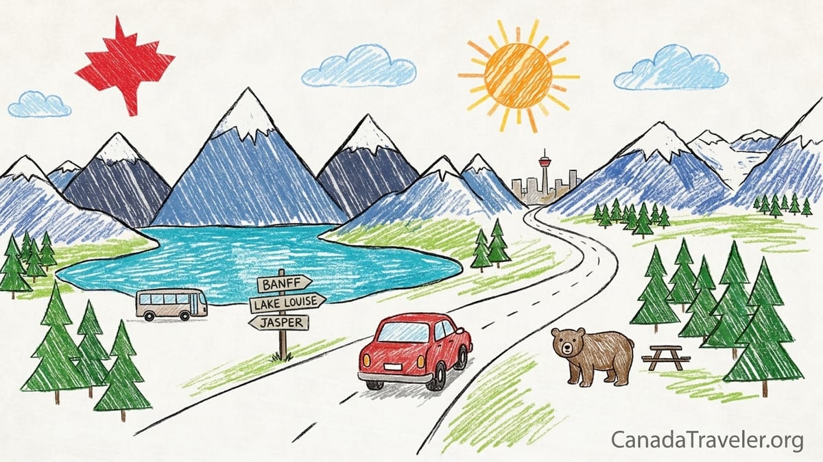
How This Alberta Rockies Road Trip Works
This itinerary assumes you arrive and depart via Calgary, pick up a rental car there, and focus entirely on the mountain corridor between Calgary, Banff, Lake Louise and Jasper. It stretches over ten days: Days 1–2 in Calgary and Canmore, Days 3–4 in Banff, Days 5–6 around Lake Louise and Moraine Lake using prebooked shuttles, Day 7 driving the Icefields Parkway, and Days 8–10 based in Jasper. You will drive roughly 800 to 1,000 kilometres in total, depending on side trips, with most individual driving days under three hours of wheel time.
The itinerary is designed to minimise one-night hotel hops. You sleep two nights in each of Calgary or Canmore, Banff, Lake Louise area and Jasper, with a single continuous transit day along the Icefields Parkway. This keeps packing and unpacking to a minimum, and gives you time to settle into the rhythm of each place rather than treating Canada’s flagship national parks as a checklist of roadside stops.
Travel is possible year-round, but conditions change dramatically. From November 1 to March 31, winter or mountain-rated tires or chains are mandatory on Highway 93 North, the Icefields Parkway, and on key approaches, and Parks Canada regularly closes the parkway during storms or when avalanche control is underway. In summer you will trade snowdrifts for full parking lots and peak hotel prices, but the full network of hiking trails and shuttles is available, including Moraine Lake access by prebooked transport only.
Park passes are required for all national park areas. As of late 2026, adults pay a daily admission fee set by Parks Canada, or you can purchase a Discovery Pass that covers a full year in multiple parks. You can buy passes online or at the park gates between Calgary and Banff. Even if you are simply driving the Trans-Canada Highway through Banff or continuing up the Icefields Parkway to Jasper, you must pay this federal park fee.
Days 1–2: Calgary Arrival and Canmore Warm-Up
Most visitors land at Calgary International Airport and collect a rental car from a major agency such as Enterprise, Avis or Hertz. For a classic Rockies road trip, a compact SUV like a Toyota RAV4 or Nissan Rogue is often a good balance between cost, comfort and winter capability. In winter you should explicitly reserve a vehicle with proper winter tires; in summer, all-season tires are standard. Expect daily rental rates that fluctuate widely by season, with July and August often costing several times more than shoulder months like May or October.
On Day 1, consider staying the night in downtown Calgary or near the airport if you arrive late. The city is roughly 130 kilometres from Banff, about a 90-minute drive in clear conditions, so there is no need to rush straight into the mountains after a long-haul flight. Use your first afternoon to adjust to the time zone, pick up groceries and bear-safe food storage containers for later camping nights, and explore a little of Calgary’s riverfront neighbourhoods or the Calgary Tower for an initial sense of the prairie-to-mountain setting.
On Day 2, drive west along the Trans-Canada Highway to Canmore. This takes about 1 hour 15 minutes from central Calgary. Canmore sits just outside the national park boundary, so you do not yet need a park pass if you are only overnighting there and not driving further into Banff National Park that day. Many travellers choose Canmore for its slightly lower accommodation prices and condo-style rentals. It is an ideal place to ease into short hikes such as the Policeman’s Creek boardwalk or Grassi Lakes, which give instant views of turquoise water and jagged peaks without committing to a full-day backcountry outing.
If you plan to camp later in the trip, Canmore is the best place to stock up at a large supermarket and outdoor retailers. Buying a fuel canister for your stove, bear spray, and basic picnic supplies here tends to be more convenient than relying on smaller outlets deeper inside the parks. This is also the time to download offline maps from your preferred navigation app; mobile data coverage is generally good along the Trans-Canada Highway, but becomes patchy inside the park system and particularly along the Icefields Parkway.
Days 3–4: Banff Townsite, Gondolas and Viewpoint Hikes
On the morning of Day 3, continue from Canmore to Banff, a short 25-kilometre hop that usually takes about 20 minutes of driving. Once you pass the Banff National Park gates, your Parks Canada pass becomes essential; keep the receipt or hang tag on your dashboard to avoid fines in parking areas. Most visitors choose to sleep directly in Banff townsite for two nights to enjoy its easy access to restaurants, shuttles and lower valley trails that stay open later into the year.
High-cost sightseeing in Banff includes the Banff Gondola on Sulphur Mountain and Lake Minnewanka boat cruises. The gondola typically costs a significant fee per adult for a return trip, depending on time and date, and delivers you to a summit boardwalk with panoramic views of the Bow Valley, especially rewarding at sunset in early autumn. Lower-cost alternatives are plentiful, however. The Tunnel Mountain trail climbs from the edge of town to a viewpoint over the Bow River in two to three hours round trip, with only a modest elevation gain. The Bow Falls viewpoint, reachable on foot from central Banff in under 20 minutes, shows the power of the river as it surges below the Banff Springs Hotel.
On Day 4, use Banff as a base for one or two half-day hikes or scenic drives. In summer, the Lake Minnewanka loop road provides access to picnic areas, the Stewart Canyon trail, and viewpoints where bighorn sheep sometimes graze near the road. In winter, some sections see seasonal closures for wildlife protection and avalanche control, so check current notices before setting out. If your budget allows, horseback trail rides and guided small-group hikes can add context to the landscape, but a self-guided approach is perfectly viable with a good paper map and offline navigation.
Driving distances these two days are short, typically under 50 kilometres in total if you keep to the Banff area, which leaves plenty of time for strolls in the heritage district and long evenings in local cafes. Parking in downtown Banff now often involves pay stations or time limits, so many visitors park once at their accommodation and move around town on foot or by local shuttle bus instead of re-parking multiple times.
Days 5–6: Lake Louise and Moraine Lake with Prebooked Transport
On Day 5, you transfer your base to the Lake Louise area, about 60 kilometres northwest of Banff along the Trans-Canada Highway. The drive usually takes 45 minutes to an hour in good conditions. Here the focus shifts from town-centre wandering to classic alpine lakes. However, private vehicle access is now heavily restricted, particularly at Moraine Lake. You should plan to use prebooked transport, such as the Parks Canada shuttle system, commercial bus tours, or private tour operators, to reach both Moraine Lake and the upper Lake Louise lakeshore parking during peak months.
Shuttle reservations for Moraine Lake and Lake Louise typically open months before summer, and popular morning departures can sell out quickly. Prices are structured per person rather than per vehicle, which can make this a noticeable line item in a family budget but still far cheaper than staying directly at a luxury lakeshore hotel. The advantage is reliable access without circling for parking at dawn. Lower-cost options might include taking standard local transit service from the Lake Louise Park and Ride to the lakes, or focusing on walks that begin from the village and highway area, such as the Louise Creek trail, if shuttle seats are unavailable during your dates.
On Day 5, after checking into accommodation in Lake Louise village or nearby campgrounds like Lake Louise Campground, use the afternoon for a shorter lakeshore stroll. The 2-kilometre walk along the Lake Louise shoreline from the main hotel area to the end of the lake is almost entirely flat and gives famous views of Victoria Glacier. This route functions as a quick viewpoint rather than a serious hike and is suitable even if you arrive mid-afternoon. In contrast, the Plain of Six Glaciers or Lake Agnes teahouse trails require several hours and significant elevation gain, and are better tackled early the following morning when temperatures are cooler and crowds lighter.
Day 6 is then dedicated to Moraine Lake if it is in season. Once at the lake via shuttle or tour bus, you have two primary options. The short rockpile viewpoint, a 10 to 15-minute climb on a wide trail, yields the iconic “ten peaks” photo with minimal effort. For a more involved outing, the Consolation Lakes trail leads away from the crowds into a quieter basin and takes roughly two to three hours return along a well-defined path. Facilities are minimal beyond toilets and limited café services, so bring your own water and snacks. Because personal vehicles are not permitted, you can leave your rental car parked at your accommodation and avoid driving entirely this day.
Day 7: The Icefields Parkway from Lake Louise to Jasper
Day 7 is the heart of the trip: the 232-kilometre drive along the Icefields Parkway from the Lake Louise area to Jasper. Although navigation apps might show this as about three hours of continuous driving, you should allow a full day of eight to ten hours to account for viewpoints, short hikes and photo stops. There is no reliable mobile coverage along most of this corridor, and services are extremely limited. Saskatchewan River Crossing, about 80 kilometres from Lake Louise, has the only fuel station on the parkway, and it is typically open seasonally from roughly late spring to early autumn with higher prices than in Banff or Jasper.
Fuel planning is essential. Before leaving Lake Louise, fill your tank completely, even if it is mostly full, and consider refuelling again at Saskatchewan River Crossing if you are below half a tank. In winter, or outside the fuel station’s operating dates, you should assume there will be no fuel between Lake Louise and Jasper. Travelling with a printed map or an offline map download is wise, as even simple tasks like checking the next viewpoint distance will not be possible using live mobile data.
The first segment north from Lake Louise brings you to Bow Lake and Peyto Lake. Bow Lake features a straightforward roadside parking area with a lakeshore walk of 10 to 20 minutes each way, effectively a quick viewpoint stop. Peyto Lake, accessed via a signed turnoff, involves a short but slightly uphill walk of about 15 to 20 minutes on a paved or well-graded path to reach the main viewpoint platform. Both can be enjoyed in under an hour each if you keep moving, although photographers often linger longer at sunrise or sunset.
Further north, Mistaya Canyon deserves more time. From the roadside parking, a roughly 10 to 15-minute downhill walk leads to a bridge over the narrow canyon where the Mistaya River has carved curved potholes into the rock. You can see a great deal from the bridge itself, so it works as a quick viewpoint stop, but walkers who carefully explore downstream along informal paths may spend an hour or more. Continue to Saskatchewan River Crossing, where you can access limited food services, toilets and fuel, then push on towards the Columbia Icefield. Here you must decide between free viewpoints and paid experiences. The Columbia Icefield Centre offers ticketed glacier coach tours and a glass-floored skywalk attraction operated by a private concession. These are high-cost sightseeing options that can easily absorb a half day and a significant share of your budget.
If you prefer a low-cost experience, focus on the forefield trails near the Athabasca Glacier, where short, clearly marked paths lead to viewpoints of the ice and interpretive signs showing the glacier’s retreat over the past century. Remember that walking onto the glacier without a guide is dangerous because of hidden crevasses; stay within signed areas. From the icefield, continue north to Sunwapta Falls and Athabasca Falls. Both are well-developed roadside sites with parking lots, toilets and maintained viewing platforms. Each can be visited as a quick 30- to 45-minute stop with minimal walking, but both also have short extension paths along the canyon rims that reward an extra half hour. Arriving in Jasper in the early evening, you will likely have driven for three to four hours in total and spent another five or six hours exploring stops along the way.
In winter, this entire day changes character. The Icefields Parkway can be closed with little notice because of heavy snow, serious collisions or active avalanche work. From November 1 to March 31, vehicles must have winter tires marked with the mountain snowflake or M+S symbol, or carry chains. Rental car companies in Calgary may offer winter tire packages at extra cost, and you should budget for this if travelling anytime from late October into early April. Always check the latest road reports before leaving Lake Louise. If closures are likely, consider spending an extra night around Lake Louise or detouring your itinerary entirely rather than pushing into a high-risk corridor without services.
Days 8–10: Jasper in Recovery
By the time you reach Jasper, the pace of the trip slows again. The townsite sits in a broad valley ringed by peaks, with a more low-key feel than Banff and generally slightly lower accommodation prices in comparable categories. However, the 2024 Jasper wildfire heavily affected areas near Maligne Canyon and sections of surrounding forest. By 2026, Parks Canada reports that virtually all trails have reopened, and major destinations such as Maligne Lake, Valley of the Five Lakes, Pyramid Lake and Tonquin Valley are accessible. At the same time, Maligne Canyon and Cavell Road, including the Edith Cavell area, remain closed for the 2026 season while rehabilitation continues and hazards are removed.
Plan Days 8 to 10 around what is open rather than what guidebooks from earlier years might suggest. Good low-cost outings include the Valley of the Five Lakes loop, which offers classic reflections of forest and peaks in a half-day hike, and strolls along the Athabasca River from town. Pyramid Bench trails, Old Fort Point, and lakeside walks at Lake Edith and Lake Annette are all part of the reopened network. For a paid highlight, the Jasper SkyTram carries you up Whistlers Mountain for extensive views; ticket prices depend on season and time of day, and advance reservations are strongly encouraged in July and August.
Accommodation choices span hotels, motels, hostels, cabin complexes and several campgrounds. Whistlers Campground, for example, offers hundreds of sites with varying levels of service, from unserviced tent pads to full-service RV sites. Parks Canada charges nightly camping fees plus the daily park admission, so campers should factor both into their budget. If you want to keep costs down, a common pattern is three nights in a basic motel or cabin in Jasper, self-catering most meals, and booking one signature paid activity such as a Maligne Lake boat cruise or the SkyTram.
Because Jasper is in active recovery mode, visual signs of the 2024 fire will be part of your experience. Hillsides with blackened trunks and new undergrowth are visible from several roads and trails, and interpretive signage explains how fire fits into the park’s long-term ecology. Some travellers choose to spend time at local visitor centres and exhibits that discuss the wildfire’s impact on the community and ecosystems, adding context beyond the purely scenic aspect of the trip.
Practicalities: Seasons, Safety, Costs and Park Rules
Seasonal planning is critical in the Alberta Rockies. July and August are the busiest months, with the most stable hiking conditions, fully operating campgrounds, and all shuttle systems in service. May, June, September and early October can be rewarding shoulder seasons, but high trails may still hold snow, and some roads or facilities can be closed. From November through April, you are effectively on a winter trip: lakes freeze, many hiking trails shift to snowshoe or cross-country ski routes, and the Icefields Parkway demands respect as a remote, avalanche-prone highway.
Wildlife encounters are a defining feature of the Rockies. It is common to see elk near Banff and Jasper townsites, and black bears or occasionally grizzly bears along road verges. Parks Canada emphasises keeping at least several car lengths distance from large animals and never approaching for photographs. Stopping in the middle of the road to take pictures of bears can create dangerous wildlife jams, so use designated pullouts whenever possible. If you plan to hike away from busy lakeshores, carry bear spray, keep it accessible, and make noise when travelling through brushy or low-visibility sections. Store all food and scented items in vehicles or bear-proof lockers in campgrounds.
Costs vary widely depending on your mix of hotels, paid attractions and meals out. As of 2026, a midrange hotel room in Banff or Jasper in peak summer can cost more than in Calgary, while campgrounds charge significantly less per night but require you to bring gear. High-cost sightseeing might include the Banff Gondola, Columbia Icefield coach tours, Maligne Lake boat tours, horseback rides and guided hikes. A lower-cost approach centers on viewpoints and self-guided hikes: Bow Lake, Peyto Lake, Mistaya Canyon, Sunwapta Falls, Athabasca Falls, Valley of the Five Lakes and many short townsite trails can all be enjoyed without tour tickets.
Park rules and fees are non-negotiable. In addition to the daily park pass or Discovery Pass, you pay separate reservation fees when booking front-country campgrounds or popular backcountry trips. Fire bans may be in place during dry spells, affecting whether you can use wood campfires or must rely on gas stoves only. Fishing, boating and some special activities require separate permits. Before each driving leg, particularly the Icefields Parkway, check official bulletins for road closures, wildlife advisories and avalanche control notices so you can adjust your schedule rather than being caught by surprise.
Seven-Day and Fourteen-Day Versions
Not every traveller has ten days, and some have longer. A realistic seven-day compressed version of this itinerary trims some overnight stays without turning the trip into a blur. One workable pattern is to spend one night in Calgary or Canmore, two nights in Banff, two nights in Lake Louise, one long day on the Icefields Parkway, and two nights in Jasper. This removes one Jasper night and one Canmore or Calgary night, while preserving the basic structure: you still have a full day for Moraine Lake, and you still devote an entire day to the Icefields Parkway instead of racing it as a simple transfer.
The key tradeoffs in seven days are fewer rest days and less time in Jasper. You may need to choose between paid highlights like the Jasper SkyTram and Maligne Lake cruises, instead of doing both. In Banff, you might prioritise either the Banff Gondola or a full-day hike, but not both. Daily driving distances increase slightly as you have more point-to-point segments, but still stay within two to three hours most days, apart from the Icefields Parkway day.
A fourteen-day slower version is ideal for travellers who prefer to keep driving well below two hours on most days and to build in weather flexibility. You could spend three nights in Canmore, three in Banff, three in Lake Louise, one at a wilderness hostel or basic lodge partway up the Icefields Parkway, and four in Jasper. This allows full-day hikes like Sentinel Pass, longer backcountry overnights with proper planning, and slack days for rain or wildfire smoke, which can affect visibility some summers. It also makes it easier to choose lower-cost accommodations in shoulder nights, since you are not locked into fixed weekends.
In the fourteen-day version, you might allocate one day entirely to the Yoho National Park side of the Continental Divide, accessed via a short detour from Lake Louise, and still have ample time for extra hikes in the Bow Valley. You can also book more affordable midweek stays at campgrounds, saving hotel nights for either end of the trip. This slower pacing particularly benefits families or older travellers, as it reduces the sense of constantly moving on and gives more opportunities to adapt to changing conditions.
The Takeaway
A ten-day Alberta Rockies road trip from Calgary to Jasper, structured around mountain time rather than highway mileage, rewards careful planning. By concentrating on Calgary, Canmore, Banff, Lake Louise, the Icefields Parkway and Jasper, and resisting the temptation to detour to every corner of Alberta, you give each landscape room to breathe. The dedicated Icefields Parkway day, with its combination of quick viewpoints like Bow and Peyto Lakes and more immersive stops such as Mistaya Canyon and the Columbia Icefield area, becomes a highlight rather than a rushed transit between two townsites.
Thoughtful choices around season, vehicle type, winter tires, shuttles and accommodation will do more to shape your experience than any particular viewpoint. Travellers who lean on high-cost attractions like gondolas and glacier tours can have a richly guided experience with relatively little hiking, while those on tighter budgets can build an equally satisfying journey from free lakeshores, short hikes and roadside waterfalls. In Jasper, the 2026 reality of a park in recovery adds depth, as you see both the scars of the 2024 wildfire and the rapid regrowth on reopened trails, even as Maligne Canyon and Cavell Road remain off the table for now.
Perhaps the most important decision is to avoid stitching your journey together from a string of one-night stays. Sleeping a minimum of two nights in Banff, Lake Louise and Jasper each means fewer mornings spent loading and unloading the car, and more time actually out in the mountains. Whether you compress this plan into seven days or expand it to fourteen, keeping overnight changes to a rhythm rather than a scramble turns the Alberta Rockies from a series of stops into a coherent, restorative road trip.
FAQ
Q1. How many kilometres will I drive on this 10-day itinerary?
Across ten days, expect roughly 800 to 1,000 kilometres of driving, including Calgary to Banff, Banff to Lake Louise, the 232-kilometre Icefields Parkway, local side trips and the return to Calgary.
Q2. Do I really need winter tires for the Icefields Parkway?
From November 1 to March 31, winter or approved mountain-rated tires, or chains, are mandatory on the Icefields Parkway and related highways, and they are strongly recommended whenever snow or ice is present.
Q3. How long should I allow for the Icefields Parkway drive from Lake Louise to Jasper?
Although the distance can be driven in about three hours without stopping, you should plan a full day of eight to ten hours to enjoy viewpoints, short hikes and safe breaks.
Q4. Can I visit Moraine Lake in my own car?
General private vehicle access to Moraine Lake is no longer available in peak season; you must use prebooked shuttles, commercial tours or other authorised transport to reach the lakeshore.
Q5. What has reopened in Jasper after the 2024 wildfire?
By 2026, most front-country and backcountry trails have reopened, including areas like Valley of the Five Lakes and Maligne Lake, but Maligne Canyon and Cavell Road remain closed for the 2026 season.
Q6. How far in advance should I book accommodation in Banff and Jasper?
For peak summer dates, many hotels and popular campgrounds fill months ahead, so booking three to six months in advance is wise, especially for weekends and holiday periods.
Q7. Is this itinerary suitable for a low budget traveller?
Yes. By focusing on camping or basic motels, self-catered meals, free viewpoints and self-guided hikes instead of gondolas and glacier tours, you can keep costs significantly lower.
Q8. Do I need a national park pass if I am only driving through?
Yes. A valid Parks Canada pass is required whenever you are in national park boundaries, including simply driving the Trans-Canada Highway or the Icefields Parkway without overnight stops.
Q9. Why is it better to avoid one-night stays on this route?
Frequent one-night stays mean constant packing, check-ins and early departures, which reduces your time on trails and at viewpoints and makes the road trip feel rushed rather than relaxing.
Q10. Is mobile phone coverage available along the Icefields Parkway?
Coverage is very limited along most of the Icefields Parkway, so you should download offline maps, share your plans with someone in advance, and not rely on mobile data for navigation or emergency calls.