

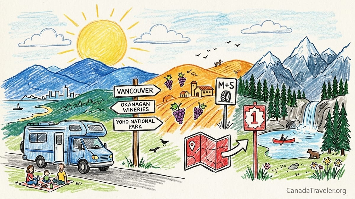
British Columbia’s mainland delivers a rare combination of Pacific city life, desert-like interior valleys and glacier-cut Rocky Mountain passes. A 12 to 14 day road trip from Vancouver through the Okanagan and Revelstoke to Yoho National Park gives you beaches and vineyards, railway history, national park hiking and classic mountain scenery in a single loop. This guide breaks down day-by-day driving distances, hiking options, park fees, seasonal rules such as winter tire requirements and realistic budgets for rental cars and campervans, with a final section on condensing the journey into 10 days.
Trip Overview and When to Go
This itinerary is designed as a 12 to 14 day loop that starts and ends in Vancouver and focuses on mainland British Columbia. It contrasts three distinct landscapes: the coastal metropolis around Vancouver, the hot and relatively dry Okanagan interior, and the higher, cooler Selkirk and Rocky Mountains around Revelstoke, Glacier and Yoho national parks. Daily driving distances are generally between 150 and 350 kilometres, leaving time to stop in small towns, walk short trails and sample local food and wine.
The most popular season is late June through September, when mountain roads are clear of snow and most campgrounds, viewpoints and trails are open. July and August bring the warmest temperatures in the Okanagan and the biggest crowds around lakes and in the national parks. Early June and late September usually mean quieter trails and easier bookings, but some alpine hikes around Revelstoke and Rogers Pass may still have snow or only open in stages. Shoulder season travel is possible in May and October but requires more flexibility, especially at higher passes.
From October 1 each year, many designated highways in British Columbia require winter-rated tires or chains, with requirements on most routes lasting to April 30 and on a few lower-elevation routes ending March 31. This includes major corridors you will use such as Highway 1 over Rogers Pass and inland highways connecting the coast to the interior. Drivers without proper tires can be turned around at checkpoints and may be fined, so fall, winter and early spring road trippers should confirm their rental vehicle meets winter requirements before leaving Vancouver.
This guide assumes you will travel in a standard rental car or campervan and stay in a mix of hotels, motels and campgrounds. If you are visiting from abroad and plan to combine this loop with Banff, Lake Louise or Jasper, it is important to understand that those parks are in the province of Alberta and technically outside this British Columbia-focused itinerary, even though the border between the two provinces is crossed near Yoho National Park.
Choosing Your Inland Route: Highway 3 or the Coquihalla
There are two practical ways to leave Vancouver for the Okanagan on a road trip like this. One option follows Highway 3 east through E. C. Manning Provincial Park to the desert town of Osoyoos before bending north into the southern Okanagan. The other uses the faster Coquihalla corridor via Highways 1 and 5 toward Merritt and then Highway 97C and 97 into Kelowna. Both are rewarding, but they lead to very different first impressions of inland British Columbia and you realistically need to choose one, rather than trying to combine them into a single tidy route.
Highway 3 through Manning Park and Osoyoos is the more scenic and slower choice. From Vancouver to Manning Park resort area is roughly 220 kilometres and often takes three to four hours with stops, including the climb over Allison Pass. Continuing to Osoyoos adds another 150 kilometres and two to three hours, with mountain curves and changing weather. This route is ideal if you want your first inland day to focus on subalpine hiking, lakes and viewpoints, and if you are curious about Canada’s only true pocket desert around Osoyoos. It suits a 14 day itinerary where you can afford an extra overnight at Manning Park or Osoyoos.
The Coquihalla route prioritises efficiency. Vancouver to Kelowna via Highway 1 to Hope and then Highway 5 and 97C is around 390 kilometres and usually takes about four and a half to five hours of driving in good conditions. With short breaks for fuel and viewpoints, it is still reasonable as a travel day on a 12 day schedule. This corridor has wide, fast-moving lanes and long climbs and descents, which can be tiring in poor weather but allow you to reach Okanagan wine country more quickly if you prefer to spend more time around lakes and vineyards rather than in subalpine terrain.
If you choose Highway 3, plan one night at Manning Park or Osoyoos and arrive in Penticton on day 3. If you use the Coquihalla, you might spend your first night in Kelowna or Penticton and skip Manning Park and Osoyoos entirely. Attempting to drive both Highway 3 to Osoyoos and the Coquihalla into Kelowna in the same itinerary quickly adds more than 300 extra kilometres and an additional day of driving, and it dilutes your time in the areas many travellers find most memorable, such as Yoho and the Okanagan lakes.
Days 1–3: Vancouver to Manning Park or Kelowna
Starting from Vancouver, allow at least one full day in the city before you pick up a car. This lets you adjust to the time zone, explore neighbourhoods like Gastown and Kitsilano on foot and understand local driving norms. Central Vancouver is compact and walkable, and parking rates can be high, so many visitors wait to collect a car until the morning they leave for the interior. Larger national rental brands and local agencies have locations both at Vancouver International Airport and downtown.
If you choose the Highway 3 option, aim for an early start for the 220 kilometre drive from Vancouver to Manning Park. With coffee and lunch stops in communities like Hope, expect about three to four hours on the road. Manning Park offers more than 500 frontcountry campsites in several campgrounds and also has a lodge and cabins run by Manning Park Resort. Frontcountry sites in provincial parks such as Manning can typically be reserved up to about two or three months in advance through the BC Parks reservation service in peak season, and demand around long weekends and sunny summer Fridays is high. Plan two to three hours of hiking to viewpoints such as Heather Trail access points or Lightning Lake circuits on arrival, depending on current conditions and your fitness.
On day 2, continue roughly 150 kilometres from Manning Park to Osoyoos, where Highway 3 descends through dry hills into Canada’s warmest lake. With winery visits in the Oliver and Osoyoos area and beach time on Osoyoos Lake, this is still only about two and a half hours of pure driving. Base yourself at a lakeside motel, full-service resort or private campground. Budget travellers can look for basic motels on the approach to town, while those with more flexibility might book an upscale lakeside property with on-site restaurants and beach access.
If you prefer the Coquihalla route, your first inland day will be longer on the highway. Leaving Vancouver on Highway 1, it is about 150 kilometres to the town of Hope and then a further 240 kilometres to Kelowna via Highways 5 and 97C. In clear summer weather it is realistic to cover the roughly 390 kilometres in about five hours of driving with fuel and rest stops. This route is less about frequent scenic pullouts and more about covering distance, so many travellers plan a simple evening stroll along the Kelowna waterfront on Okanagan Lake and a casual dinner after checking into a central hotel or lakeside resort.
Days 4–6: Penticton, Naramata and the Heart of the Okanagan
Whether you arrive from Osoyoos or directly from Kelowna, Penticton and the Naramata Bench are a natural base for two to three nights in the Okanagan. The drive from Osoyoos to Penticton along Highway 97 is about 65 kilometres, usually done in under an hour and a half with winery or fruit stand stops. Kelowna to Penticton is a similar distance in the opposite direction. Penticton sits on the southern end of Okanagan Lake and offers a mix of lakeside motels, boutique hotels and campgrounds, with summer rates that can rise significantly on July and August weekends.
Use at least one full day here for vineyards and the Kettle Valley Rail Trail. The Naramata Bench, less than 15 kilometres from central Penticton, is home to numerous wineries that can be linked by car or, for shorter distances, by e-bike. Guided wine tours by minibus are common and can be a good option if you prefer not to drive between tastings. For an active contrast, allow three to four hours for a cycling outing on the Kettle Valley Rail Trail section above Naramata, where the gentle railroad grade and lake views suit a wide range of fitness levels. Local rental shops in Penticton supply standard bikes and e-bikes for half-day and full-day rates, and many offer shuttles to popular trailheads.
Another day can focus on the water. Okanagan Lake has several public beaches near downtown Penticton, and small operators rent kayaks, stand-up paddleboards and small powerboats in summer. A relaxed schedule might include two to three hours of morning paddling followed by an afternoon wine tasting or a visit to farmers’ markets and roadside fruit stands. If you are travelling with children or prefer simple walking rather than structured activities, the lakefront promenade and parks on both sides of the city core provide enough for a low-key full day.
From Penticton to Kelowna, plan on around 65 to 70 kilometres of driving, taking about one and a half hours including traffic through West Kelowna. Instead of treating the transfer as just a transit day, schedule one or two winery stops in the Summerland or Peachland area along the lake. Kelowna is the Okanagan’s largest city and works well as an overnight hub, especially if you prefer urban amenities and a broad selection of hotels, chain restaurants and supermarkets before heading north toward the mountains.
Days 7–9: Kelowna to Sicamous, Revelstoke and the National Parks Corridor
The transition from dry interior to mountain corridor happens quickly as you leave the Okanagan. From Kelowna to Sicamous via Highway 97A through Vernon is roughly 125 to 140 kilometres and about two hours of driving, depending on your exact route. Many travellers opt to continue directly to Revelstoke, which lies about 220 kilometres from Kelowna via Vernon and Highway 1, for a total of around three and a half hours in the car. This is manageable as a half-day drive, leaving time in the afternoon for a short hike or visit to a museum.
Revelstoke makes an excellent base for two or three nights. The town has a walkable centre with heritage buildings, cafes and restaurants, and a mix of independent hotels, chain properties and vacation rentals. Mount Revelstoke National Park begins right above the town, and in summer the Meadows in the Sky Parkway allows you to drive high into the subalpine zone. A typical day in Revelstoke could combine two to four hours of hiking on short interpretive trails near the parkway with a visit to the railway museum in town, which explains the importance of the Canadian Pacific Railway in opening this mountainous region to settlement and tourism.
Entry to Mount Revelstoke, Glacier and Yoho national parks is subject to Parks Canada daily admission fees. Recent adult day entry prices for Mount Revelstoke and Glacier have been around 12 dollars per person, with family or group day passes available at a modest discount and free entry for youth 17 and under. If you plan to visit several national parks on this trip or combine this itinerary with parks in Alberta such as Banff or Jasper, a Parks Canada Discovery Pass, which provides annual admission to multiple national parks, can be more economical than paying daily at each gate. Fees are adjusted from time to time, so travellers should verify current rates on the Parks Canada website before departure.
Revelstoke also has national park campgrounds at Mount Revelstoke and nearby Glacier National Park, in addition to private RV parks. National park frontcountry campsites near Revelstoke typically require advance reservations for peak summer dates and charge nightly fees that are higher than most provincial parks, with additional daily fire permit charges if you plan to use firewood. If you prefer the flexibility of last-minute decisions, small motels and rooms above pubs in Revelstoke sometimes have availability within a few days, but options narrow significantly in July and August and during popular mountain biking or music events.
Days 10–12: Rogers Pass, Golden, Field and Yoho National Park
From Revelstoke, the Trans-Canada Highway (Highway 1) continues east across Rogers Pass through Glacier National Park and into the Rocky Mountain trench before reaching Golden and then the tiny community of Field in Yoho National Park. The drive from Revelstoke to Golden is about 150 kilometres and typically takes just under two and a half hours of steady driving, but it is worth allowing half a day with stops. Short interpretive walks near the summit of Rogers Pass, viewpoints of the Illecillewaet Glacier and the national park visitor centre add context to the steep grades and avalanche sheds you see from the highway.
From Golden to Field is another 55 kilometres, about 45 minutes along the Kicking Horse River. You can base yourself in either Golden or Field to explore Yoho, each with trade-offs. Golden is a small but full-service town with supermarkets, gas stations, chain hotels and a broader choice of restaurants. It sits outside any national park, which can make some accommodation slightly more affordable or more available at short notice. Field, by contrast, is the only community inside Yoho National Park and consists mainly of a few streets of homes, guesthouses and a small number of lodgings and eateries nestled below steep mountain walls.
Staying in Field reduces your daily driving to Yoho sights but requires more advance planning. In peak season, Field’s limited rooms and guesthouses often book months ahead, especially for July and August weekends. There are also several campgrounds within or near Yoho that are managed by Parks Canada and, like those near Revelstoke, generally require reservations for popular dates. There is no public transportation network inside Yoho that allows you to freely move between Emerald Lake, Takakkaw Falls and other major locations. Apart from a limited shuttle system for specific backcountry experiences such as Burgess Shale fossil hikes, you should plan to have your own vehicle to make the most of the park.
A full day in Yoho should include Emerald Lake, where a level lakeshore trail of roughly one to two hours offers views of surrounding peaks and the option to rent canoes in summer, and the short walk to Natural Bridge on the Kicking Horse River. Another half day can be devoted to Takakkaw Falls, reached by a side road from the Trans-Canada Highway. From the parking area, the flat walk to the base of the falls takes about 15 to 30 minutes each way at a relaxed pace, suitable for families. Those interested in earth history may also plan ahead for a guided Burgess Shale hike, a full-day backcountry excursion that requires advance booking with Parks Canada or authorised guiding companies and a good level of fitness.
While planning this portion, it is worth remembering that Banff, Lake Louise and Jasper lie just over the provincial boundary in Alberta. They are often combined with Yoho in classic Rockies road trips, but doing so meaningfully usually requires several extra days and careful coordination of national park accommodations in both provinces. If your available time is limited to 12 to 14 days and you want to return to Vancouver without excessively long driving days, it can be more satisfying to focus on Yoho and the BC interior described in this itinerary and leave the Alberta parks for a future trip.
Optional Return via the Columbia Valley or Southern Kootenays
For travellers with 14 days rather than 12 and a strong interest in hot springs and quieter backroads, an optional loop through the Columbia Valley adds variety without making the driving unreasonable. One practical version leaves Yoho and heads south from Golden along Highway 95, following the Columbia River toward towns such as Radium Hot Springs and Invermere. Golden to Radium Hot Springs is about 105 kilometres, around one and a half hours of driving on a scenic but straightforward highway.
From Radium or Invermere, you can continue south along the valley, eventually rejoining the main east-west corridors toward Revelstoke or the Okanagan. However, it is important to watch total kilometres and hours so that the loop remains comfortable. Extending from Yoho down to Radium, then west toward Revelstoke and later back to Vancouver can add 250 to 400 extra kilometres compared with the direct return via Golden and Revelstoke. For many travellers, one or two nights in the Columbia Valley is enough to enjoy lake time and a soak at a commercial hot spring complex before turning back toward the coast.
A more ambitious alternative dips into the southern Kootenays along quieter secondary highways that link communities such as Nelson, Kaslo or Nakusp. These add significant distance and are best reserved for itineraries of at least two to three weeks. For a 12 to 14 day plan aimed at first-time visitors, a modest Columbia Valley detour or a simple return via Revelstoke and Kamloops is generally more realistic.
On your westbound journey, a common approach is to drive from Field or Golden back to Revelstoke for one night, then continue to Kamloops and finally down to Vancouver. Revelstoke to Kamloops via Highway 1 is about 210 kilometres and roughly two and a half to three hours of driving. Kamloops to Vancouver is approximately 350 kilometres via the Coquihalla corridor, often done in four to five hours in good weather. Breaking the journey with a night in Kamloops keeps your longest driving day under six hours and leaves room for rest stops and meals.
Practicalities: Kilometres, Safety, Park Fees and Bookings
Across 12 to 14 days, this itinerary typically involves between 1,700 and 2,300 kilometres of driving, depending on whether you include detours like Osoyoos or the Columbia Valley. Most individual days demand only two to four hours behind the wheel, with a few longer transfers of up to five hours. A rough breakdown might be around 220 kilometres from Vancouver to Manning Park or 390 kilometres from Vancouver to Kelowna, 60 to 70 kilometres between Okanagan towns, 220 kilometres from Kelowna to Revelstoke, 150 kilometres to Golden and 55 kilometres to Field, with a similar distance pattern on the return.
Wildlife is an important safety consideration at every stage. Deer, elk and occasionally black bears and other animals can appear on the shoulder or directly on the road, particularly at dawn and dusk. In national park corridors such as Glacier, Yoho and Mount Revelstoke, speed limits reflect both road design and wildlife presence, and speeding fines are heavily enforced. When hiking, carry basic knowledge of bear safety, travel in small groups where possible, make noise in dense forest, keep all food and scented items secured at camp and consider carrying bear spray where it is legal and you understand proper use. At campgrounds, follow posted guidance on food storage in hard-sided vehicles or lockers.
Regarding fees, your main categories will be provincial park camping charges, national park admission and camping, and private accommodation. BC Parks camping fees vary by park and site type, but many frontcountry vehicle sites in this region fall in a range comparable to modest motel rates when translated across several nights of travel. National park camping around Revelstoke and Yoho is usually more expensive per night than provincial parks, with additional optional charges if you purchase fire permits or rent equipment from private operators. Because fee structures can change and discounts may be available for youth or families, it is wise to confirm current rates a few months before departure through official channels.
Advance booking is essential for certain segments in high season. Popular provincial park campgrounds such as those in Manning Park, as well as national park sites near Revelstoke and Yoho, typically open reservations on a rolling basis several months ahead and can sell out soon after during summer weekends. Hotels in Penticton, Kelowna, Revelstoke and Golden also see heavy demand when festivals, long weekends or school holidays align with good weather. International visitors in particular should plan to secure key nights, such as Yoho base nights in Field or Golden and first and last nights near Vancouver, well before arrival.
British Columbia’s winter tire and chain rules are especially relevant if you travel between October and April. On designated routes, including many highways that connect Vancouver with the interior and the national parks, passenger vehicles must use winter-rated tires or carry chains from October 1 through at least March 31, and in many cases through April 30. Qualifying winter tires are marked with either the mountain and snowflake symbol or the M+S (mud and snow) designation and must meet minimum tread depth requirements. Drivers without proper tires can be directed to turn around or may receive fines at enforcement stops, even if the weather appears dry on the day.
Rental Cars, Campervans and a 10-Day Shortened Version
Most visitors begin this route in a rental car collected at Vancouver International Airport or a downtown depot. Daily rental prices vary significantly with demand and season. In recent years, midsize cars from major brands at Vancouver have often ranged from roughly 70 to 120 Canadian dollars per day in summer before taxes and surcharges, with discounts sometimes available for longer bookings. Adding a second authorised driver, insurance top-ups and one-way fees, if applicable, can increase the daily total. Booking months ahead for July and August travel usually yields better choice and avoids last-minute price spikes.
Renting a campervan or motorhome offers more flexibility for camping but comes at a higher base cost. Campervan and RV rental platforms and specialist local companies around Vancouver often list compact vans suitable for two to three people and larger motorhomes for families. Recent survey data for the wider Pacific Northwest indicates that median campervan rentals can exceed 200 dollars per night in peak season, with Vancouver-area listings frequently clustering around or just below this level, depending on vehicle age and equipment. To this, you must add campground fees, fuel, propane and potential cleaning or mileage surcharges, though you save on some hotel nights.
Fuel is another factor. Distances in this itinerary are moderate compared with some cross-country drives, but mountain grades increase consumption. If petrol prices hover between moderate and high levels during your visit, a compact or midsize car with good fuel economy will keep costs noticeably lower than a large RV over 2,000 kilometres of driving. For example, a fuel-efficient car might consume eight to ten litres per 100 kilometres, while a large motorhome may use twice that or more on mountain sections, roughly doubling your fuel budget for the same distance.
If you need to compress the trip into a 10 day schedule, the simplest adjustment is to prioritise. One realistic 10 day version omits Manning Park and Osoyoos and focuses on the Coquihalla corridor and Okanagan, then Revelstoke and Yoho. In practice, this could look like day 1 in Vancouver; day 2 driving to Kelowna; days 3 and 4 split between Kelowna and Penticton; day 5 to Revelstoke; day 6 in Revelstoke; days 7 and 8 based in Field or Golden for Yoho; day 9 back to Kamloops; and day 10 returning to Vancouver for your onward flight. This still gives you meaningful time in each landscape while keeping most driving days to four or five hours or less.
Travellers who especially value hiking in Manning Park and the desert-like landscapes near Osoyoos can instead drop one Okanagan base. For instance, you might spend a night at Manning Park, one night in Osoyoos, two in Penticton, two in Revelstoke, two in Field and finish with a break in Kamloops. This means skipping Kelowna as a base but still passing nearby Okanagan lakes and vineyards. As always, the best version depends on your interests and willingness to drive slightly longer distances on some days.
The Takeaway
A road trip from Vancouver through the Okanagan and Revelstoke to Yoho National Park delivers a cross-section of British Columbia that feels much larger than the kilometres on a map. You touch the Pacific fringe, sunlit vineyards and lakes, rainforest-clad slopes and glacier-fed rivers, all within a two-week loop that balances driving with genuine time on trails and by the water. Success depends less on squeezing in every possible detour and more on giving yourself enough unhurried days in a few key bases such as Penticton, Revelstoke and Field or Golden.
Making early choices about your inland route, understanding the realities of park fees and campground bookings, and respecting seasonal regulations such as winter tire requirements will all contribute to a smoother journey. Whether you choose a compact rental car and lakeside motels or a campervan and national park campgrounds, the core elements remain the same: manageable daily distances, thoughtful pacing and a willingness to slow down once you reach each region. Treated this way, a 12 to 14 day British Columbia road trip from Vancouver to the Rockies becomes less of a checklist and more of a layered introduction to one of Canada’s most varied provinces.
FAQ
Q1. How many days do I really need for this Vancouver to Rockies loop?
Ten days is the practical minimum if you skip Manning Park and Osoyoos and move efficiently between bases; 12 to 14 days allows time for relaxed stops, short hikes and weather flexibility.
Q2. Which inland route is better, Highway 3 via Manning Park or the Coquihalla?
Highway 3 is more scenic and slower, with hiking and desert landscapes around Manning Park and Osoyoos, while the Coquihalla is faster and better for travellers who want to maximise time in the Okanagan, Revelstoke and Yoho.
Q3. Do I need winter tires for this road trip and when?
On designated BC highways used in this itinerary, winter-rated tires or chains are legally required from October 1 to at least March 31 and on many routes until April 30; outside those dates, they are not mandatory but may still be wise in shoulder seasons at higher elevations.
Q4. How much driving is there each day?
Most days involve between 150 and 250 kilometres, or two to four hours of driving, with a few longer transfers of up to about 350 kilometres, such as Vancouver to Kelowna or Kamloops to Vancouver, which typically take four to five hours with breaks.
Q5. Is public transport an option inside Yoho National Park?
Yoho has very limited shuttle services tied to specific backcountry experiences, but there is no general public transport network for sightseeing, so a private vehicle is effectively essential for reaching Emerald Lake, Natural Bridge and Takakkaw Falls.
Q6. How far in advance should I book campgrounds and hotels?
For July and August, securing key nights in places like Manning Park, Revelstoke and Field or Golden several months ahead is strongly recommended, especially for weekends; shoulder seasons are more forgiving but still benefit from at least a few weeks of lead time.
Q7. What kind of hikes fit into this itinerary without making days too long?
Plan for one short to moderate hike of two to four hours on many days, such as lakeside loops in Manning Park, sections of the Kettle Valley Rail Trail above Naramata, short Summit-area walks in Mount Revelstoke and the Emerald Lake circuit in Yoho.
Q8. Are Banff, Lake Louise and Jasper part of this road trip?
They are often combined in marketing and traveller stories, but all three lie in Alberta rather than British Columbia, and including them meaningfully usually requires several extra days beyond this 12 to 14 day BC-focused loop.
Q9. What should I budget for a rental car or campervan?
In recent years, midsize rental cars from Vancouver often range around 70 to 120 Canadian dollars per day in summer before taxes and extras, while campervans suitable for two or three people frequently cost more than 200 dollars per night in peak season, plus campground fees and higher fuel costs.
Q10. Is it safe to drive this route for visitors not used to mountain roads?
Yes, provided you take your time, respect speed limits, avoid driving tired, watch for wildlife and check road and weather conditions, especially when crossing higher passes like the Coquihalla or Rogers Pass; many first-time visitors complete this loop each summer without difficulty.