


Few countries reward a road trip quite like Canada. From the ice carved peaks of the Rockies to British Columbia’s coastal fjords, the lake dotted heartland of Ontario and Quebec, and the rugged cliffs of Atlantic Canada, the country is built for long drives, scenic pullouts and nights under vast skies. This guide focuses on practical, commercial details for planning a one to three week Canadian road trip, with real driving distances, rental car and RV advice, fuel expectations and concrete example itineraries across the Rockies, British Columbia, Ontario and Quebec, and Atlantic Canada.
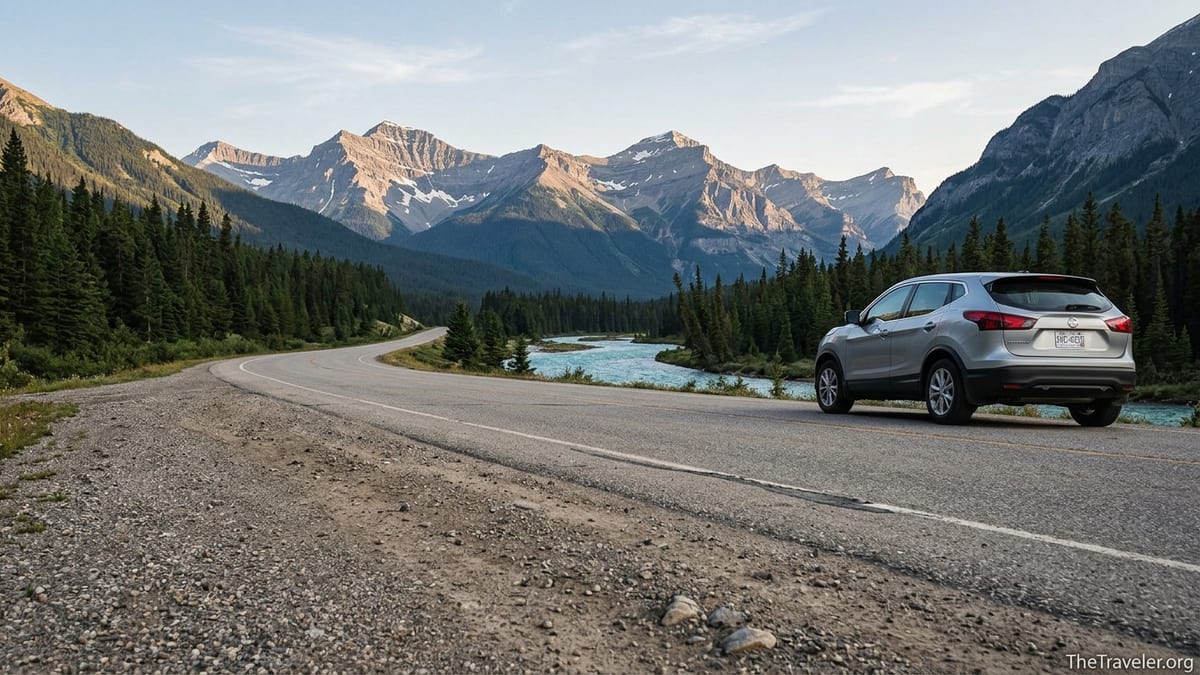
Essential Planning, Rentals and Road Rules
Most international travelers start their Canadian road trip by flying into a major hub such as Calgary, Vancouver, Toronto or Montreal and picking up a rental car or campervan at the airport. Large brands like Enterprise, Hertz, Avis and Budget operate in all four cities, along with Canadian companies and RV specialists. In high season from June to September, a compact car in Calgary or Vancouver typically runs from roughly 60 to 100 Canadian dollars per day before insurance, while a small Class C motorhome from a national RV rental company commonly starts around 180 to 300 dollars per day depending on length, mileage packages and insurance add ons. Booking three to six months ahead for July and August is strongly recommended, especially in the Rockies and Atlantic Canada where supply is tight.
Standard North American driving rules apply across Canada. You drive on the right, seatbelts are mandatory, and blood alcohol limits are strict, so many rental contracts specify zero tolerance. Speed limits on major divided highways such as the Trans Canada Highway, Highway 401 in Ontario or Autoroute 20 in Quebec typically sit around 100 kilometers per hour, dropping to 80 or less on two lane roads and lower through towns. In mountain regions such as the Icefields Parkway between Lake Louise and Jasper, expect slower posted limits and steep grades up to around 8 to 11 percent in sections, so plan extra time and use lower gears on descents.
Fuel availability is generally good on main corridors but can be sparse in national parks and more remote stretches. In 2026, gasoline prices in most Canadian provinces have hovered in the range of roughly 1.60 to 2.00 dollars per liter, with higher prices common in British Columbia and remote Atlantic communities. For context, a 1,000 kilometer loop in a mid size SUV that averages 9 liters per 100 kilometers will burn around 90 liters, or roughly 150 to 180 dollars in fuel at those prices. On famous scenic routes such as the Icefields Parkway in Alberta, there are only a small number of service stations between Lake Louise and Jasper, so it is wise to top up in Banff or Lake Louise and again at Saskatchewan River Crossing rather than relying on the last bar of the gauge.
Cross border and rental policies still deserve attention if you are combining Canada and the United States. Many major rental brands allow their Canadian plated vehicles to cross into the United States and back, but you must declare this when booking and confirm any one way drop fees, which can be substantial if you plan to collect a car in Calgary and drop it in Vancouver or Toronto. Transport Canada allows certain one way rentals of U.S. vehicles entering the country for short periods, but those rules mainly affect how rental companies manage their fleets rather than how travelers book. In practice, you should assume that one way rentals across long distances will carry a separate per trip surcharge, and sometimes a per kilometer cap, especially on RVs, so compare a loop route to a one way when pricing your trip.
Driving the Canadian Rockies: Calgary, Banff, Lake Louise and Jasper
The classic Canadian Rockies road trip starts and ends in Calgary, which is well served by direct international flights and major car rental depots. From Calgary International Airport to the town of Banff is a scenic drive of about 130 kilometers on the Trans Canada Highway, typically 90 minutes in good weather. Banff National Park and neighboring Lake Louise sit at the core of the Rockies experience, with turquoise lakes like Lake Louise and Moraine Lake, popular day hikes and a network of campgrounds that book up early. A realistic budget for two adults might include three nights in Banff or Canmore, spending on a hotel or campsite, plus a Parks Canada Discovery Pass to cover entry to multiple national parks during the trip.
From Banff and Lake Louise, most road trippers continue north toward Jasper via the Icefields Parkway. This famed highway spans roughly 230 kilometers between Lake Louise and Jasper and is routinely cited by national park agencies and travel publications as one of the most scenic drives in Canada, with glaciers, waterfalls and frequent wildlife sightings. It is a full day outing if you stop at viewpoints like Bow Lake, Peyto Lake, the Columbia Icefield area and Sunwapta Falls, and it is common to break it with a night near the Columbia Icefield or in the small cluster of accommodations at Saskatchewan River Crossing. Steep grades and changing mountain weather mean you should carry warm layers, check road conditions and gas up before leaving Lake Louise.
Jasper National Park lies about 400 kilometers northwest of Calgary by road, though most visitors reach it by that Icefields Parkway route rather than the more direct but less scenic Yellowhead Highway. Jasper townsite is smaller and quieter than Banff and works well as a two to three night base for drives to Maligne Lake, Athabasca Falls and Miette Hot Springs. Parks Canada suggests around seven days for a Calgary to Banff to Jasper round trip focused on the mountain parks, which aligns well with a one week itinerary. For a two week Rockies road trip, you can expand the loop by adding Yoho National Park near Field, British Columbia, and Kootenay National Park with Radium Hot Springs to the west, extending the driving distance but giving a deeper sample of the Canadian Rocky Mountain Parks.
For RV travelers in the Rockies, campsites in places like Tunnel Mountain near Banff, Lake Louise campground, Whistlers campground near Jasper and overflow or first come options along the Icefields Parkway are the main targets. Service levels vary from full hookups to dry camping only, and many national park sites now use online reservation systems that open months before the peak season. A typical day’s drive in a motorhome in the Rockies should be planned at 200 to 300 kilometers at most due to mountain grades and frequent photo stops. For example, a comfortable three day leg might be Calgary to Banff, Banff to Lake Louise and Icefields Parkway viewpoints, then Icefields area to Jasper.
Coastal British Columbia: Vancouver, Sea to Sky and Pacific Rim
British Columbia’s southwest corner offers dramatic coastal and mountain scenery within manageable driving distances from Vancouver, Canada’s third largest metro area. One of the most popular short road trips is the Sea to Sky Highway, the name used for the stretch of Highway 99 between West Vancouver and Whistler. The drive is about 120 kilometers and usually takes around two hours without stops, but many travelers plan a full day to allow for detours at Porteau Cove, Shannon Falls, the Sea to Sky Gondola above Squamish and viewpoints near Brandywine Falls. This route was upgraded in the run up to the 2010 Winter Olympics, improving its safety and capacity, yet it remains a winding mountain highway where winter tire rules apply from fall into spring.
Continuing beyond Whistler, Highway 99 threads through Pemberton, Lillooet Lake and Joffre Lakes Provincial Park before eventually meeting the interior highway system toward Kamloops. This makes it possible to connect a Vancouver to Whistler to interior British Columbia loop without retracing your steps. However, the sections beyond Whistler involve steeper grades and more remote stretches with fewer services, so some first time visitors prefer to simply return to Vancouver the way they came, especially in shoulder seasons when snow is possible at higher passes. In any season, it is wise to carry drinking water, snacks and a basic emergency kit in the trunk.
Another classic coastal BC road trip involves a mix of driving and ferries to reach Vancouver Island and the wild outer coast. From Vancouver, many travelers drive onto a ferry to the island and then continue by road across to Pacific Rim National Park Reserve near Tofino and Ucluelet. The drive from the ferry terminal near Nanaimo to the park area is roughly 200 kilometers along a two lane highway that climbs through rainforest clad mountains and passes lakes that are busy with paddleboards and kayaks in mid summer. A one week Vancouver and Vancouver Island itinerary might split nights between the city, the central island around Parksville or Nanaimo, and the Pacific Rim coast.
Fuel costs in British Columbia are often higher than the Canadian average, so budgeting a little extra for gas on long BC drives is prudent. Since British Columbia also enforces specific winter tire or chain requirements on many mountain highways between October and April, anyone renting a car in fall or winter should confirm that the vehicle comes equipped with properly rated tires. Rental companies in Vancouver typically maintain winter rated all season or dedicated winter tires on a subset of their fleets, but you may need to request this category at booking. RV rentals that cross interior mountain passes should be planned carefully around snowfall forecasts and potential wildfire related closures in late summer.
Ontario and Quebec Corridors: Toronto, Ottawa, Montreal and Quebec City
Central Canada’s most popular road trip corridor runs along the Great Lakes and St. Lawrence lowlands, connecting the cities of Windsor, Toronto, Ottawa, Montreal and Quebec City. Toronto is the main entry point, with a dense network of rental car and RV outlets near Pearson International Airport. From Toronto to Ottawa, most drivers either follow Highway 401 east along Lake Ontario then turn north on Highway 416, or use a more rural route that heads northeast toward Algonquin Provincial Park before dropping into the Ottawa Valley. The 401 and 416 option is the fastest, clocking around 450 kilometers and a drive time of about five hours in light traffic.
From Ottawa to Montreal, the Trans Canada Highway designation follows Ontario’s Highway 417 which becomes Autoroute 40 at the Quebec border. This is an efficient four lane freeway that covers roughly 200 kilometers between the two cities. Many travelers then continue along the St. Lawrence to Quebec City via Autoroute 20 or Autoroute 40 on the north shore. A Toronto to Montreal to Quebec City loop with a stop in Ottawa can be comfortably done in about one week, with days alternating between driving and city exploration. For instance, a realistic plan is two nights in Toronto, one in Ottawa, two in Montreal and two in Quebec City, with average daily drives of 250 to 500 kilometers.
For those seeking more lakes and wilderness along this corridor, detours to Algonquin Provincial Park in Ontario or the Laurentians north of Montreal provide canoeing, hiking and cabin stays within a half day’s drive of the big cities. A Toronto to Algonquin to Ottawa route often involves provincial highways north of the 401, then merging onto Highway 417 toward the capital. In Quebec, small towns in Charlevoix and along the north shore of the St. Lawrence east of Quebec City appeal to travelers interested in whale watching near Tadoussac or quiet coastal drives. These add distance and require more time, so they are best built into a two to three week itinerary that allows rest days between long driving legs.
Rental car costs in Ontario and Quebec follow similar patterns to Alberta and British Columbia, with compact or economy cars sometimes dipping lower outside peak summer. Urban traffic is a more important planning factor here than mountain weather, especially through Toronto where Highway 401 is among the busiest freeways in North America. It is wise to schedule departures from Toronto, Montreal or Ottawa outside weekday rush hours and to reserve extra time for navigating construction zones. Parking availability and daily rates also matter more in large cities, so choosing hotels with included parking or planning to park once and explore on foot or by transit can keep costs and stress manageable.
Atlantic Canada and Newfoundland: Cabot Trail, Ferries and Coastal Drives
Atlantic Canada rewards slower, more exploratory road trips that link together Nova Scotia, New Brunswick, Prince Edward Island and sometimes Newfoundland and Labrador. Halifax is the usual fly in and car rental hub for the region. A common one to two week loop heads from Halifax to the Annapolis Valley, across to New Brunswick’s Bay of Fundy coast, over the Confederation Bridge to Prince Edward Island, then back through Nova Scotia with time on Cape Breton Island and the Cabot Trail. Distances between major points are moderate: Halifax to Charlottetown is around 330 kilometers, Halifax to Baddeck near the start of the Cabot Trail is around 350 kilometers, and the circuit of the Cabot Trail itself is roughly 300 kilometers of winding coastal and highland road that many travelers spread over two days.
For those adding Newfoundland, the logistics become more involved but the rewards are substantial. The typical entry point is a Marine Atlantic ferry from North Sydney in Nova Scotia to Port aux Basques in western Newfoundland, a sailing of several hours that can be booked as a day or night crossing for vehicles and passengers. Many travelers then drive north to Gros Morne National Park for multi day stays that combine hikes, boat tours and scenic drives. A sample three week Atlantic itinerary from central Canada might run from Ottawa through Quebec City to Fredericton and Saint John in New Brunswick, cross to Nova Scotia and Prince Edward Island, loop Cape Breton and the Cabot Trail, then take the ferry to Newfoundland for a week split between Gros Morne and the west coast before returning by ferry and road.
Road conditions in Atlantic Canada vary from divided highways to rural two lane roads that may have frost heaves, potholes and rough shoulders, especially after winter. Local drivers often describe bumpy stretches on some inland routes of Cape Breton Island, while recommending sticking to the main Trans Canada Highway segments when towing trailers. Fuel and grocery costs can be a bit higher in remote coastal communities and on Newfoundland compared with major inland cities, reflecting longer supply lines. As a practical guideline, many road trippers plan to refuel when they reach half a tank in rural areas, particularly on long stretches between New Brunswick, Nova Scotia and Newfoundland where services are more widely spaced.
For RV rentals in Atlantic Canada, choice is more limited than in Alberta or British Columbia, so many travelers either drive their own rigs from central Canada or rent a smaller campervan from specialist firms around Halifax. Booking campsites well ahead for summer in hotspots like Cape Breton Highlands National Park, Prince Edward Island National Park and Gros Morne is important. National park campgrounds in these areas often provide unserviced or partially serviced sites suitable for smaller motorhomes and trailers, with separate private campgrounds offering full hookups. Driving days of 200 to 300 kilometers are sufficient to link most of the major stops in this region, leaving afternoons free for coastal walks and small town visits.
Sample One to Three Week Canada Road Trip Itineraries
For a focused one week trip, it works best to choose a single region rather than attempting a cross country drive. In the Rockies, a typical seven day loop could begin in Calgary, then spend two nights in Banff or Canmore, two in Lake Louise or nearby Field in Yoho National Park, one night at or near the Columbia Icefield along the Icefields Parkway, and two nights in Jasper before returning to Calgary by the same route or by a longer loop through the foothills. Daily driving distances would range from 130 kilometers on the Calgary to Banff leg to around 230 kilometers on the full Icefields Parkway section, which is manageable even with frequent photo stops.
For a two week itinerary that combines city and coast in British Columbia, a practical plan might start with three nights in Vancouver, allowing time for a day trip along the Sea to Sky Highway to Whistler and back, then a ferry crossing to Vancouver Island. After that, you could spend two nights near Parksville or Nanaimo, three nights near Pacific Rim National Park Reserve by Tofino or Ucluelet, and then return to the mainland for a final night near the Fraser Valley or back in Vancouver. The total driving distance on Vancouver Island from Nanaimo to the Pacific Rim area and back is roughly 400 to 500 kilometers depending on your exact routing, while the Sea to Sky round trip to Whistler is about 240 kilometers.
A classic three week central Canada loop might link Ontario, Quebec and the Atlantic provinces. One reasonable structure would be Toronto to Ottawa to Quebec City in the first week, focusing on urban and cultural sights. The second week could trace the St. Lawrence eastward to New Brunswick and then on to Nova Scotia, with stops in Fredericton or Saint John and time in Halifax and on the South Shore. The third week might include Prince Edward Island and Cape Breton Island, with at least two nights allocated for driving and exploring the Cabot Trail. This style of itinerary can easily exceed 3,000 kilometers of driving, so it is important to schedule non driving rest days and consider sharing the wheel between at least two licensed drivers.
Travelers with a full three weeks to devote to western Canada could also design an ambitious loop that links the Rockies and the Pacific coast. For example, after a week in the Banff, Lake Louise and Jasper area, you might continue west to the interior city of Kamloops or the Okanagan Valley, then turn south and west toward Vancouver, finishing with several days on the coast before flying out. Such a journey can cover well over 2,500 kilometers and crosses several major mountain passes, so it is vital to monitor road reports for closures due to wildfire, heavy rain or avalanche risk, especially from late spring to early fall. Many experienced drivers recommend building at least one buffer day into this kind of itinerary to absorb delays.
The Takeaway
A successful Canada road trip starts with realistic scope. The country is vast, and even the most efficient highways span hundreds of kilometers between major centers. Focusing on one or two regions per journey, rather than trying to see it all in a single shot, usually leads to a more relaxed trip that balances driving with time out of the car. Whether you are circling snow tipped peaks in the Canadian Rockies, skirting the fjords and islands of coastal British Columbia, tracing the Great Lakes and St. Lawrence corridor through Ontario and Quebec, or following cliff lined roads around Atlantic headlands, the key is to plan your fuel, rentals and daily distances with the terrain and season in mind.
By anchoring your plans to concrete examples of distance and time, and by using sample itineraries as templates rather than rigid checklists, you can adapt the journey to your interests, from hiking and wildlife watching to city dining and coastal villages. Reserving rental cars, RVs and key campgrounds months in advance for peak season, watching for regional tire and road rules, and building in weather or construction buffer days will all help keep the trip on track. With thoughtful planning, a one to three week Canadian road trip can move smoothly from prairie edge cities to high mountain passes, through vine covered valleys to maritime harbors, revealing the scale and diversity of the country at a human speed.
FAQ
Q1. Do I need an international driving permit to rent a car in Canada? Most visitors with a valid license in English or French do not need an international driving permit, but travelers whose licenses are in other languages may be asked for one by rental companies, so it is worth obtaining before you travel.
Q2. How far in advance should I book rental cars or RVs for a Canada road trip? For July and August trips in the Rockies, British Columbia coast or Atlantic Canada, booking three to six months ahead is strongly recommended for both cars and RVs, while shoulder season rentals can sometimes be secured closer to departure.
Q3. Are Canadian gas stations widely available on scenic highways like the Icefields Parkway? On major highways gas stations are frequent, but on routes such as the Icefields Parkway between Lake Louise and Jasper there are only a few fuel stops, so it is wise to start that drive with a full tank and refuel when the opportunity arises.
Q4. What is a comfortable daily driving distance for a family road trip in Canada? Many families find that 200 to 400 kilometers per day is comfortable, with the lower end preferred in mountain or coastal areas where roads are winding and there are many viewpoints and short hikes.
Q5. Can I sleep overnight in my car outside of campgrounds in Canadian national parks? Overnight camping, including sleeping in a vehicle, is generally restricted to designated campgrounds in Canadian national parks, and rangers may ask you to move if you park overnight in regular day use areas or roadside pullouts.
Q6. Is it better to do a loop route or a one way route when driving across Canada? Loop routes that start and end in the same city usually avoid high one way rental drop fees and can be easier to book, while one way trips save backtracking but often come with extra charges and more complex logistics, especially for RVs.
Q7. What months offer the best driving conditions for Canadian Rockies and coastal routes? Late June through early September generally provide the most reliable conditions for high mountain passes and coastal roads, though even in midsummer you should be prepared for rapid weather changes in the Rockies and occasional wildfire or heavy rain related closures.
Q8. Are winter tires required for road trips in British Columbia and Quebec? British Columbia mandates winter tires or chains on many mountain highways between fall and spring, and Quebec requires most passenger vehicles to use winter tires during a defined winter season, so visitors renting cars in those regions in colder months should confirm tire type with the rental company.
Q9. How expensive is fuel on a long Canada road trip compared with the United States? Fuel in Canada is sold by the liter and is often somewhat more expensive on average than in the United States, with higher prices common in British Columbia and remote Atlantic or northern communities, so Americans in particular may wish to budget extra for fuel.
Q10. Can I combine Canada and U.S. destinations on the same road trip using a Canadian rental car? Many major rental agencies allow their Canadian vehicles to cross into the United States, but you must declare this when booking and verify insurance coverage and any restrictions, as well as potential extra fees for international travel or one way drops.