


Route 132 around Québec’s Gaspé Peninsula is one of eastern Canada’s great coastal road trips, a near-900-kilometre loop that feels distinct from broader Québec itineraries. It leaves the St. Lawrence River behind, slips past cliffs and small fishing wharves, and eventually meets real Atlantic swell. Yet many travellers still try to race around it in four or five days and come home wondering what they missed. This guide focuses on the peninsula loop itself, using Bonjour Québec’s 885-kilometre Gaspésie circuit as the backbone, then explaining how and when to extend into the longer Bas-Saint-Laurent–Gaspésie “grand loop” of roughly 1,270 kilometres over 10 days.
Understanding the Route 132 Gaspésie Loop
The Gaspésie loop is built around Québec’s Route 132, which leaves the busier south shore of the St. Lawrence and circles the Gaspé Peninsula before returning inland through the Matapédia Valley. Bonjour Québec promotes this as a roughly 885-kilometre circuit tucked between sea and mountains, separate from its longer Bas-Saint-Laurent–Gaspésie itinerary that also includes the lower St. Lawrence shoreline between, for example, Rivière-du-Loup and Sainte-Flavie. That distinction matters when you are planning. A full peninsula loop from, say, Mont-Joli back to Mont-Joli is one trip. A grand loop from Québec City through Bas-Saint-Laurent and then around Gaspésie is something more ambitious.
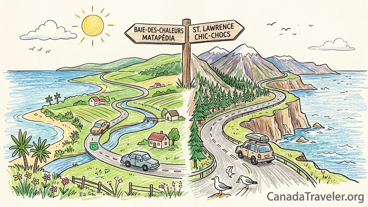
In practical terms, most travellers access the loop from the west, joining Route 132 at Mont-Joli or Sainte-Flavie, where the road splits into two branches. One branch hugs the north shore of the peninsula along the St. Lawrence and on toward Sainte-Anne-des-Monts, Parc national de la Gaspésie and Gaspé. The other follows Baie-des-Chaleurs to New Richmond and Carleton-sur-Mer before turning inland through the Matapédia Valley. These two branches reunite near Sainte-Flavie, forming a natural circle that makes one-way rentals unnecessary for most trips.
Bonjour Québec’s broader Bas-Saint-Laurent–Gaspésie itinerary, which is often described as about 1,270 kilometres over 10 days, pulls in an extra stretch of Route 132 and Route 132-adjacent roads along the St. Lawrence between Québec City and Sainte-Flavie. That longer route gives a softer build-up of scenery, visiting places like Kamouraska, Rivière-du-Loup, Rimouski and Grand-Métis before the more dramatic coastal and mountain drives of Gaspésie itself. Deciding whether you can reasonably add those extra days is one of the most important calls in planning.
Because Route 132 is a two-lane highway with frequent villages, it is slower than its kilometre count suggests. A 300-kilometre day along the north Gaspé coast with stops can easily run five to six hours of elapsed time in summer. Add roadwork, photo stops at lookouts like Cap-Chat’s wind farm, or a picnic at a municipal beach, and the pace slows further. Treat the official Bonjour Québec distances as basic structure and then add generous buffer time for the views you will inevitably want to enjoy.
Clockwise vs Counter-clockwise: Which Way Around?
The classic planning question for Route 132 is whether to drive clockwise or counter-clockwise. Clockwise usually means leaving from the Matapédia Valley or the Baie-des-Chaleurs side, driving east through New Richmond and Gaspé before returning along the St. Lawrence north shore. Counter-clockwise flips this, starting along the St. Lawrence side toward Sainte-Anne-des-Monts and Forillon, then finishing with the Baie-des-Chaleurs and inland valley. The choice affects where you spend your longest days, how quickly the scenery escalates, and even how the light hits the viewpoints.
Drivers who are prone to motion sickness or nervous about cliffs often prefer a counter-clockwise loop. On the north coast, Route 132 sometimes rides above drop-offs with the water side on the passenger side when driving counter-clockwise, which can feel more comfortable than hugging the guardrail on the driver’s side. It also means that from Sainte-Flavie to Gaspé your passenger sits on the water side, which is better for photography. On a clear summer evening, heading eastward toward Haute-Gaspésie with low light on the St. Lawrence and the Chic-Choc Mountains inland can feel like a gradual reveal rather than an abrupt arrival.
A clockwise loop, by contrast, front-loads some of the gentler driving and lets you “save” the St. Lawrence side for your final days. For example, if you start in the Matapédia Valley, you might spend your first night in Carleton-sur-Mer or Bonaventure, your second in Percé, then have a full day in Forillon before ending with longer but relatively straightforward drives back via Sainte-Anne-des-Monts and Rimouski. Travellers who know they will be tired on their final day often appreciate having the more open, less twisty sections of Route 132 near Rimouski and Trois-Pistoles at the end rather than the cliffside descents close to Forillon.
Season and accommodation can decide the direction for you. If you manage to book a coveted coastal auberge near Percé or a campsite inside Forillon National Park for fixed dates, you may naturally build the loop around those nights. In July and August many Gaspésie lodgings insist on two-night minimum stays, and popular spots can fill months ahead, so you sometimes must accept the direction that fits what is still available rather than the other way around. When that happens, it is better to adjust your expectations than to try to cram the loop into too few nights.
Where the St. Lawrence Starts to Feel Like the Sea
One of the pleasures of this loop is feeling the gradual transformation of the St. Lawrence from broad river to maritime estuary to what your eyes and nose register as the sea. Travellers coming from Québec City along the south shore see the river widen near Kamouraska and Rivière-du-Loup, but the real psychological shift toward “ocean” happens as you approach the north Gaspé coast between Matane and Sainte-Anne-des-Monts. Here, tidal flats give way to rockier coves, the horizon empties, and salt spray and stronger winds become more obvious.
By the time you reach Sainte-Anne-des-Monts, especially on a blustery day, the St. Lawrence feels less like an inland waterway and more like open water, with long fetch and whitecaps. As you drive farther east past Cap-Chat, Mont-Saint-Pierre and Grande-Vallée, the shoreline steepens. Parking lots by small municipal wharves, where lobster boats and whale-watching vessels share space, underline that you are now very much in a maritime region. On stormy days in late summer, it is not unusual to see lines of swell rolling in that would not be out of place on an Atlantic coast.
Still, the true transition to the Gulf of St. Lawrence happens around Gaspé and Forillon. Maps show this is where the estuary opens fully into the gulf, and the feeling on the ground matches. Winds are more variable, fog more common in early summer, and you will often see larger seabirds such as gannets and shearwaters. Boat excursions from Percé, Gaspé and Grande-Grave rarely speak in terms of “river” wildlife. They talk about seals, whales and seabird colonies in the gulf, which is one reason this section of the loop feels so different from the more protected Bas-Saint-Laurent shoreline near Rimouski or Rivière-du-Loup.
On the Baie-des-Chaleurs side, the water feels calmer again, almost like a broad bay on a good day, but it remains strongly maritime. Beaches at Carleton-sur-Mer and New Richmond can be warm enough for swimming in July, and small waves lap against sandbars in a way that feels more like the Northumberland Strait than like a riverbank. Experiencing those changing waters is part of the value of not rushing. A loop that moves too fast compresses these distinct coastal moods into a blur of blue on your passenger’s side window.
Zones of the Loop: From Matapédia Entry to Baie-des-Chaleurs
For planning, it helps to divide the Route 132 loop into clear zones with different characters. The first is the Matapédia Valley and western entry. Many travellers from Montréal or Québec City reach Gaspésie by following Autoroute 20 and then cutting inland, emerging near Amqui or Causapscal. This valley is gentler and greener than the coasts, with farms, rivers and bridges. Towns like Amqui and Matapédia offer supermarkets, pharmacies and fuel, which makes them good places for a big grocery shop before heading into sections where opening hours are more limited.
The second zone is the northern Gaspé coast along the St. Lawrence, between roughly Sainte-Flavie or Mont-Joli in the west and Gaspé in the east. This stretch includes Matane, Sainte-Anne-des-Monts and smaller villages such as Mont-Saint-Pierre and L’Anse-Pleureuse. It combines short river valleys with one of Québec’s most scenic seacoasts, with Route 132 sometimes pressed between cliffs and water. Many people break this into at least two driving days, for example Saint-Ulric to Sainte-Anne-des-Monts and then Sainte-Anne-des-Monts to Gaspé, to allow time for stops and bad-weather surprises.
The third zone is Parc national de la Gaspésie, inland from Sainte-Anne-des-Monts along Route 299. Technically this is a spur off Route 132, but for many it is the heart of the trip. The park protects a section of the Chic-Choc Mountains and is known for demanding hikes, including summits that reach well over 1,000 metres. Even if you do not plan a full-day hike, simply driving in and doing a three or four-hour trail can easily absorb a day. Driving from Sainte-Anne-des-Monts to the park visitor centre and back already adds roughly 90 kilometres to your daily total, which is why building in dedicated hiking days here is more realistic than trying to “swing by” on a long transit stage.
The fourth zone is Forillon National Park and the Gaspé headland. Route 132 loops around the park perimeter, while park roads and signed trailheads peel off toward capes, pebble beaches and forested highlands. Parks Canada notes that Forillon covers almost 245 square kilometres, with a range of hiking trails from short 30-minute walks to full-day treks, along with whale-watching cruises and sea kayaking. It is easy to underestimate how long you will want to linger. A day with a four-hour hike, an afternoon stroll to Cap-Gaspé lighthouse and an evening whale-watching cruise is already full without much driving.
The fifth zone is Percé and the surrounding coast, including Grande-Rivière and Bonaventure. This is where tour boats head toward Parc national de l’Île-Bonaventure-et-du-Rocher-Percé and its bird cliffs, and where cafés and small hotels cluster around harbour streets. The temptation is to let Percé Rock dominate your plans. In reality the wider area rewards slower exploration, from small coves east toward L’Anse-à-Beaufils to inland viewpoints above Bonaventure’s clear, swimmable river.
The final zone is Baie-des-Chaleurs and the return via the Matapédia Valley. Towns such as Carleton-sur-Mer, New Richmond and Paspébiac combine beaches with a softer coastal landscape, and there are campgrounds and seafront motels that face long sunsets. From here, Route 132 bends inland toward Matapédia, closing the loop. This last arc is often underestimated. A day that starts with a morning walk on the beach in Carleton-sur-Mer and ends with a late drive to Rimouski can quietly reach 400 to 500 kilometres, which is too much if you are trying to remain alert and enjoy the scenery after a week of exploring.
Why Four or Five Days Is Not Enough
It is technically possible to drive around the Gaspésie loop in four or five days, especially outside peak season when traffic is lighter. The question is what kind of trip you want. A rushed circuit might look like Québec City to Matane on day one, Matane to Percé on day two, Percé to Carleton-sur-Mer on day three, and then a long push back via the Matapédia Valley and Autoroute 20. On paper that looks efficient. On the ground it means few real stops, no full day in Parc national de la Gaspésie or Forillon, and a quick photo of Percé Rock before moving on.
Once you factor in the kind of experiences that make the peninsula special, five days starts to unravel. For example, a reasonably fit hiker who tackles a six to eight-hour summit route in Parc national de la Gaspésie will almost certainly not want to drive another four or five hours afterwards. Legs are tired, the weather can change rapidly, and descending mountain roads to rejoin Route 132 requires concentration. The same logic applies in Forillon if you spend a day on a demanding trail such as Mont-Saint-Alban or a long coastal route, followed by a late-afternoon whale-watching cruise. Being back behind the wheel for a major transfer that evening is both less safe and less enjoyable.
Another constraint is how Gaspésie businesses operate. In smaller coastal villages, restaurants and cafes may open only for lunch and early dinner even in July and August, or close by 8 or 9 p.m. rather than serving late. Outside peak weeks in July, some dining rooms open only a few days per week. Gas stations are common on Route 132 but distances between them can be 60 kilometres or more in quieter stretches, and small stations may close in early evening. A tight schedule leaves little margin if your intended lunch stop is closed, or if roadworks delay you by an hour between Sainte-Anne-des-Monts and Gaspé.
Accommodation scarcity is a final practical reason not to rush. In peak summer, coastal motels and auberges often sell out days or weeks ahead, especially on weekends and near key hubs such as Sainte-Anne-des-Monts, Percé and Carleton-sur-Mer. If you are trying to improvise a four-day loop, you may be forced into longer driving days simply to reach the nearest available room or campsite. Travellers with fixed work schedules often discover that adding one or two extra nights transforms the trip from a stressful dash into a balanced mix of driving and immersion.
How Many Days You Really Need: 5-, 7- and 10-Day Versions
A realistic Gaspésie plan starts at five days only for travellers who accept that they will sample the peninsula rather than truly explore it. In five days, you might focus on the northern coast and Forillon, skipping Parc national de la Gaspésie hiking summits and treating Baie-des-Chaleurs as a through-corridor. For instance, you could drive from Québec City to Sainte-Anne-des-Monts on day one, spend day two at Forillon with a shorter hike and coastal drive, visit Percé on day three, then return via Baie-des-Chaleurs and the Matapédia Valley on days four and five. That still involves several 300 to 400-kilometre driving days and limited flexibility for weather.
Seven days allows the loop to breathe. A typical week-long version might give you a dedicated night for Parc national de la Gaspésie hiking, two nights shared between Gaspé and Forillon, one or two nights in or near Percé and Bonaventure, and one or two nights along Baie-des-Chaleurs or in the Matapédia Valley. That schedule can still feel full, but it permits a genuine mountain hiking day and a separate day for a boat excursion such as a whale-watching cruise from Gaspé or a seabird outing from Percé. It also gives at least one built-in “buffer” day in case of heavy rain or fog on the north coast.
The 10-day version, particularly when you fold in Bas-Saint-Laurent, is better suited to travellers who value depth over distance. Here you might start in Québec City, spend two or three days along the lower St. Lawrence in villages like Kamouraska and Rimouski, then join the Gaspésie loop near Sainte-Flavie for six or seven days around the peninsula before returning inland. This approach provides time for slow mornings, local museums, and second chances at viewpoints obscured by fog on the first try. It also lets you keep most individual driving days under 250 kilometres, which is better aligned with family travel or anyone who tires quickly behind the wheel.
Choosing between those versions comes down to who you are. A pair of friends happy with four to six-hour hiking days and three to four-hour drives afterward might manage a focused seven-day loop. A family travelling with young children or an older parent will find that the same route benefits from nine or ten days, more two-night stays and more unstructured afternoons. If your calendar is fixed, the better compromise may be to accept a partial Gaspésie visit and plan to return, rather than pushing for the full 885-kilometre loop at any cost.
Driving Practicalities: Fuel, Food, EV Charging and Weather
The Gaspésie loop is not remote in an Arctic sense, but its services are spread out enough that planning matters. Fuel is generally available every 60 to 100 kilometres along Route 132, especially in larger communities such as Matane, Sainte-Anne-des-Monts, Gaspé, Percé, Chandler, New Richmond and Carleton-sur-Mer. However, smaller independent gas stations may operate shorter hours, closing by early evening or on certain weekdays outside July and early August. A simple rule is to refuel when your tank reaches half full rather than waiting for the warning light, particularly before driving longer stretches like Sainte-Anne-des-Monts to Gaspé or Gaspé to Percé late in the day.
Electric vehicle drivers should plan more carefully. Public fast-charging infrastructure in Québec has expanded in recent years, and many towns along Route 132 now have Level 2 stations in municipal lots or near supermarkets. Fast chargers, however, are still concentrated in regional hubs rather than every village. Before departure, check current maps from major networks for stations in places like Mont-Joli, Matane, Sainte-Anne-des-Monts, Gaspé, Chandler and New Richmond, and confirm whether your accommodation offers overnight Level 2 charging. Downtown chargers can be busy on summer weekends, so travelling with a flexible schedule and some buffer in your battery is more comfortable than assuming you can always “top up quickly” at the last minute.
Restaurant patterns also shape your days. In larger centres, you will find a choice of bistros, microbreweries and family restaurants open through the evening, though even in Matane and Gaspé many kitchens close by 9 p.m. Smaller villages along the coast sometimes have only one or two options, which might be snack bars that close in late afternoon or weekly seasonal pop-ups. A typical pattern might be a road-side casse-croûte serving burgers and seafood at lunchtime and early evening, plus a grocery store open until 7 or 8 p.m. Carrying picnic supplies, snacks and a simple breakfast kit in your vehicle reduces pressure to hit restaurant opening windows exactly.
Weather is another reason to avoid aggressive driving schedules. Along the north coast and around Forillon, fog and low cloud are common, especially in June and early July. Heavy rain can reduce visibility on curving cliffside sections, and wind gusts near exposed capes demand slower speeds. If your plan includes a long summit hike in Parc national de la Gaspésie, accept that conditions may force you to swap days around. In that sense, having at least one wild-card day in a seven or ten-day itinerary is almost essential. The best views in Forillon or from Gaspésie’s mountain ridges often appear on the second or third attempt, not the day you fixed months earlier.
Hiking, Boat Excursions and Wildlife: Balancing Activities with Driving
Hiking and boat excursions are two of the biggest reasons to drive Route 132, but they are also physically demanding, which limits how far you can safely drive afterward. In Parc national de la Gaspésie, classic summit hikes can run from about four to eight hours return, with significant elevation gain. Even moderate circuits may still involve rocky terrain, roots and staircases. After a full day ascending one of the higher peaks, many travellers report that they prefer a short transfer of under 100 kilometres to their lodging, not a three-hour push to the next major town. Build this into your plan by pairing big hiking days with shorter driving stages or two-night stays.
Forillon National Park offers a broad spectrum of hiking options. Parks Canada’s visitor materials list several popular trails, including short universal access walks near the visitor centre and moderate coastal routes of one to three hours, along with more ambitious itineraries that can take most of the day. Even the moderate Mont-Saint-Alban or Les Graves routes combine climbs, descents and long coastal sections without shade. On a warm day you may finish tired, sun-exposed and ready for a quiet evening. Scheduling a full driving day immediately afterward deprives you of time to enjoy the park’s beaches or lookouts, and increases fatigue behind the wheel.
Boat excursions introduce fixed departure times into your schedule. In high season, Percé typically has several daily sailings to Île Bonaventure and around Percé Rock, while Forillon-area ports such as Gaspé or Grande-Grave host whale-watching trips that may run two to three hours. These often depart morning or mid-afternoon to match tides and typical wildlife movements. To make a 9 a.m. whale cruise after a late arrival the previous night, you must either cut short the prior day’s exploration or accept driving in the dark, which is less safe given the presence of deer and, in some inland areas, moose.
Wildlife sightings are best treated as bonuses rather than guaranteed events, but the region does offer real chances. Seals are frequently seen near Forillon and Percé. Whale-watching operators out of Gaspé may encounter minke and fin whales, and occasionally humpbacks, in the Gulf of St. Lawrence in summer, but conditions change year to year. Inland, Parc national de la Gaspésie has a reputation for woodland caribou and moose, though strict conservation rules and varying visibility mean you should set expectations modestly. Driving at dawn and dusk increases both your odds of seeing animals and the risk of sudden road crossings, another argument for limiting night driving on a tight schedule.
Who Should Extend into Bas-Saint-Laurent
The decision to add Bas-Saint-Laurent to your Gaspésie loop is less about checklists and more about tempo. If you have 10 days or more, starting and finishing along the lower St. Lawrence can ease you into the trip. Villages like Kamouraska, Rivière-du-Loup, Trois-Pistoles and Rimouski offer accessible riverfront promenades, lighthouses and comfortable small hotels. You can visit gardens at Grand-Métis, stop at a museum in Rimouski, and adjust to a slower pace before reaching the stronger mountain and sea contrasts of the Gaspésie loop. These towns also provide good EV charging coverage and a denser selection of restaurants, useful at both the start and end of a longer journey.
Families with young children often benefit from including Bas-Saint-Laurent. Shorter drives between river villages make it easier to build in playground time, bakery stops and naps. You can structure the first two or three days as gentle 150 to 200-kilometre hops before tackling the longer sections between Sainte-Anne-des-Monts, Gaspé and Percé. Retirees or travellers who prefer multiple nights in one place also appreciate being able to stay, for example, two nights in Kamouraska and two nights near Rimouski before moving on, rather than jumping straight from city traffic into a long coastal haul.
On the other hand, if you have only five or seven days in total and your priority is the Gaspésie headlands, trying to fit Bas-Saint-Laurent into the same trip can work against you. Each added night west along the St. Lawrence is one fewer night in Parc national de la Gaspésie, Forillon or Baie-des-Chaleurs. In those cases, it can be wiser to reach the loop as directly as possible, perhaps with a single overnight stop in Rimouski or Mont-Joli, then dedicate the bulk of your time to the peninsula itself. You can always plan a shorter, separate Bas-Saint-Laurent visit built around river scenery and regional cuisine.
A final consideration is how you handle the return journey. The grand 1,270-kilometre Bas-Saint-Laurent–Gaspésie itinerary often includes a longer final day of up to 500 kilometres from Baie-des-Chaleurs or the Matapédia Valley back toward Québec City or Montréal. After nine or ten days of driving and activities, that is a demanding end. Travellers uneasy with that kind of finale might instead choose a shorter loop focused on Gaspésie, then break their homeward trip with one last night in Bas-Saint-Laurent along Autoroute 20. Spreading the distance across two days keeps you safer and gives the trip a gentler landing.
The Takeaway
A Gaspésie road trip on Route 132 is not just another Québec drive. It is a dedicated peninsula journey that deserves its own planning, separate from broader provincial circuits. Whether you choose a compact five-day version, a more rounded seven-day loop or a ten-day itinerary that weaves in Bas-Saint-Laurent, the central principle is the same: match your distances to your energy and interests, not to what looks efficient on a map. Once you factor in hiking days in Parc national de la Gaspésie, coastal trails in Forillon, boat excursions out of Percé or Gaspé and unhurried evenings along Baie-des-Chaleurs, it becomes clear that simply closing the 885-kilometre circle as fast as possible misses the point.
Plan around experiences rather than viewpoints. Give yourself permission to spend a full day on one major hike and a second on a whale-watching cruise and short coastal walks, even if that means you skip a few famous lookouts. Accept that restaurants may close earlier than you expect and that accommodation in July and August is scarce enough that you should book ahead and be flexible with direction. Check fuel and EV charging in advance, and top up conservatively.
Most of all, use the structure of the loop wisely. Think in terms of zones, choose clockwise or counter-clockwise based on your comfort, and decide early how many days you can devote. A well-paced Gaspésie circuit is a sequence of distinct regions that each deserve their own daylight. With enough nights, Route 132 shifts from a marathon to a memorable arc of river, gulf and bay that feels like a journey, not a race.
FAQ
Q1. How many days do I really need to drive the Gaspésie Route 132 loop?
Most travellers should plan at least seven days for the peninsula loop, which allows one full hiking day, time in Forillon and Percé, and avoids exhausting daily drives.
Q2. Is it better to drive the loop clockwise or counter-clockwise?
Both work, but many visitors prefer counter-clockwise so passengers face the water on the north coast and cliffside driving feels less exposed for the driver.
Q3. When does the St. Lawrence start to feel like the sea on this trip?
The river begins to feel more like open sea east of Matane and especially between Sainte-Anne-des-Monts and Gaspé, where swell, wind and seabirds become more prominent.
Q4. Can I drive the peninsula in four or five days without rushing?
You can complete the loop in that time, but it usually means sacrificing hiking days, boat excursions and relaxed evenings, so most people find it uncomfortably rushed.
Q5. How hard is it to find fuel and food along Route 132?
Fuel and groceries are available in all larger towns, but smaller coastal villages have shorter opening hours, so it is smart to refuel early and carry basic snacks.
Q6. Is Gaspésie practical for electric vehicles right now?
Yes for careful planners. Level 2 chargers exist in many towns, but fast chargers are still concentrated in hubs, so check current maps and use overnight charging where possible.
Q7. Do I need to book accommodation in advance in summer?
In July and August, coastal motels, inns and campgrounds around Sainte-Anne-des-Monts, Forillon, Percé and Baie-des-Chaleurs often sell out, so advance booking is strongly recommended.
Q8. How much driving is realistic after a major hike?
After a six to eight-hour mountain or coastal hike, most people are comfortable with no more than one to two hours of driving, ideally to an already-booked nearby base.
Q9. Should I add Bas-Saint-Laurent to my Gaspésie road trip?
Add Bas-Saint-Laurent if you have around ten days and want gentler river villages and shorter first driving days. With only a week, focus on the peninsula instead.
Q10. What is the best season to drive Route 132 around Gaspésie?
Late June to early September offers the best combination of open services and milder weather, though July and August are busier and require more advance reservations.