


In early August 2026, I drove into British Columbia with a colour-coded road trip spreadsheet, a trunk full of hiking gear and the naive belief that if a destination was still legally open, my plans were safe. By the time the province ended its wildfire state of emergency on August 27, my route had been redrawn three times, hundreds of dollars in non-refundable bookings were gone and most of the mountain views I had come for were lost in a thick, sour haze of smoke.
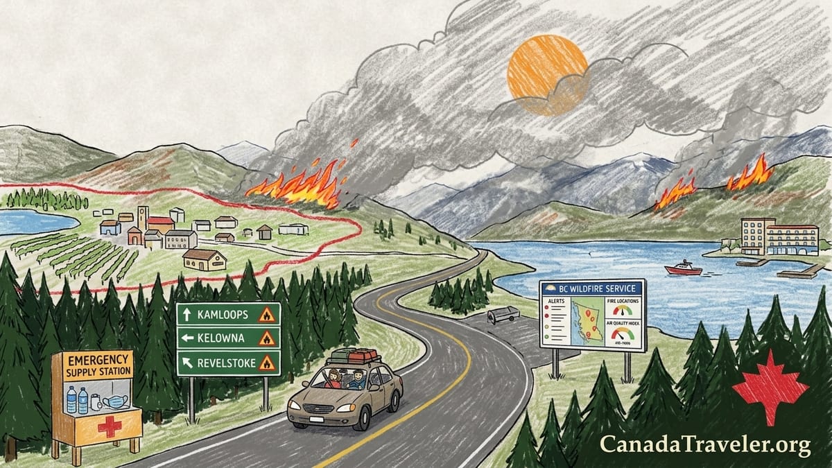
Driving Into a Province Under Fire
I planned my two-week loop through southern British Columbia to hit the supposed sweet spot of the season: August 10 to 24. The provincial state of emergency due to wildfires was declared just two days before I crossed the border on August 10, after the fast-moving Bald Range wildfire forced mass evacuations around Summerland and the central Okanagan and pushed total evacuees in the province above 20,000. Yet almost every tourism website I checked still led with glossy images of clear blue lakes and golden vineyards, with only short banner notes acknowledging “active wildfires in some areas.”
Crucially, nothing I had booked was technically closed. Highway 3 from Hope to Osoyoos was open. Kelowna’s waterfront hotels were taking guests. Campgrounds in the Shuswap and around Revelstoke were not under evacuation order. On paper, it looked like the disruption was limited to specific fire zones and that I could simply drive around them. In reality, wildfire smoke and the constant threat of new evacuation alerts turned my efficient, tightly packed itinerary into a daily risk calculation.
I had chosen a loop that started in Vancouver, cut east along Highway 3 through Manning Park and the Similkameen, then dipped into the South Okanagan before continuing north through Vernon, Salmon Arm and Revelstoke, with a return via the Trans Canada corridor. Every night was pre-booked, mostly on non-refundable rates: a mid-range chain hotel in Kelowna, a boutique lakeside property in Peachland, prepaid campsites near Sicamous and a guided glacier hike in the Revelstoke area. It was an itinerary designed for savings and maximum activity, not for a landscape where conditions could change between breakfast and lunch.
Even before I left Vancouver, the map on my phone told a different story from the cheery hotel confirmation emails. The BC Wildfire Service interactive dashboard was already crowded with red and orange fire icons across the southern Interior. Government news briefings made it clear that while highways and towns remained open, officials expected to stay in an “intense wildfire response” mode through late August. I told myself I would stay flexible, but my bookings told a different truth: my flexibility was mostly gone.
What an Evacuation Alert Really Means for Travelers
The first shock came on August 11 in the Similkameen Valley. I had stopped in Keremeos for fuel and to check my phone. Overnight, a community further up my route had been placed under an evacuation alert. For locals, an alert means get ready to leave quickly: pack documents, medications and essentials, monitor updates closely, but you are not required to go yet. For travelers, it creates a grey zone that most guidebooks barely acknowledge. The town was still open, the highway still operating, and my accommodation provider simply emailed that they were “monitoring the situation.”
The key distinction I learned, reading provincial emergency bulletins on my phone in the gas station parking lot, is that an evacuation alert is a warning to prepare, while an evacuation order is a legal directive to leave immediately and not return until the order is rescinded. Under an order, police and local officials can enforce roadblocks and turn people away. Hotels may be turned over to evacuees and staff themselves might not be able to remain. Yet every glossy brochure I had thumbed through before the trip had conflated “not under evacuation order” with “everything is fine,” which in 2026 was clearly not true.
I decided to proceed but shorten my stay, reasoning that if an alert escalated to an order, I could drive out quickly. What that meant in practice was sleeping lightly and waking at 2 a.m. to refresh EmergencyInfoBC updates, the provincial portal that consolidates official evacuation alerts and orders from local governments and First Nations. The fire itself was kilometres away, but I was within a potential expansion zone if winds shifted. The mental cost of that uncertainty did not appear in any of my pre-trip calculations.
This became a recurring pattern. Throughout mid-August, communities such as those around the Okanagan, Shuswap and Cariboo regions saw changing patterns of alerts and orders as crews tried to protect populated areas while weather windows opened and closed. Even in towns with no flames on the horizon, visitors were often staying in places that could move from “welcome” to “you must leave now” in a matter of hours. My original plan had no slack days and no duplicate options, so every new alert became a potential domino that could topple two or three later bookings.
Smoke: The Invisible Line Most Guides Ignore
The biggest disruption to my trip did not come from fire perimeters or evacuation boundaries at all. It came from smoke. On August 13, as I drove from Osoyoos toward Kelowna, the ridgelines that usually define the Okanagan landscape disappeared behind a grey curtain. By the time I reached Peachland, the sun was a dull orange disc and the lake that sells the region in every brochure had faded into a lifeless, metallic sheet. Environment Canada’s Air Quality Health Index, accessed through the WeatherCAN app, put much of the central Okanagan in the high risk range due to wildfire smoke. Locals coming out of grocery stores wore N95 masks in the parking lots.
No guidebook had said that my winery cycling tour could be technically “operating as normal” while also being a terrible idea for anyone with lungs. The operator messaged that the tour would proceed as planned and that refunds were only available if they cancelled for safety reasons. My choice was to ride 30 kilometres in thick smoke, with visibility reduced and a strong smell of burning in the air, or to forfeit almost 200 Canadian dollars. I chose not to ride. My chest was already tight from walking a few blocks along the waterfront.
Smoke followed me north. In Kamloops on August 15, local news and municipal alerts noted that the city was seeing its first severe regional smoke event of the summer, with reduced visibility and AQHI values that tipped in and out of high risk. Parks were open, trails were technically accessible, and the highway remained clear, but my planned panoramic hike above the Thompson River became a short, wheezing walk to a viewpoint where there was nothing to see but grey air. I spent the afternoon indoors, refreshing BC’s air quality warnings page and watching the wildfire situation dashboard instead of exploring the city.
The lesson was blunt. A fire perimeter map tells you where flames are, not where the air is breathable or where the mountain views exist. Smoke can pool far from its source, especially in valleys like the Okanagan and the Thompson. On August 22, provincial air quality bulletins singled out regions west of Kamloops, parts of the Cariboo and the Chilcotin for elevated smoke impacts, even though many of those places were not under evacuation order. Hikers and paddlers who had driven hours for clear lakes and meadows instead found lifeguard stands empty, beaches deserted and locals warning one another to keep children and older adults indoors.
Learning to Read the Right Maps (and What They Do Not Say)
By the middle of my trip, my browser tabs were a roll call of provincial agencies I wished I had understood before leaving home. The BC Wildfire Service dashboard became my morning starting point. It shows active fires, their estimated perimeters, suspected causes and status updates. It is invaluable for understanding the scale of the season, but it does not tell you whether your specific campsite is under an evacuation alert or whether a town is asking visitors to stay away. For that, EmergencyInfoBC holds the official list of alerts and orders, searchable by community name and updated as local authorities issue new information.
Parallel to that, DriveBC became my constant companion on the road. It lists road incidents, planned work, wildfire-related closures and travel advisories, along with highway camera images. In 2026, travelers watched symbols appear and disappear along the Trans Canada and Highway 1 through the Fraser Canyon as wildfire activity forced temporary closures and escorts. I spoke with other drivers at rest stops who had re-routed through Highway 5 or Highway 3 after watching a closure notice pop up on their phones while they were still hours away. Importantly, DriveBC does not close a highway simply because there is a fire nearby. Closures usually mean a direct threat, heavy smoke that compromises visibility, or the need to reserve roads for emergency vehicles.
Layered on top of all this was Environment Canada’s Air Quality Health Index, which converts concentrations of common air pollutants, including fine particulate matter from wildfire smoke, into a 1 to 10+ scale with health messaging. Checking the AQHI for the next day became as important to my plans as checking the weather. A forecast of 8 or 9 in Kamloops meant I would not be spending hours on a paddleboard, even if the rental shack by the river was still operating and happy to take my money.
One subtle but crucial concept that very few tourism operators explained clearly is the difference between a fire perimeter and an evacuation boundary. The fire perimeter on the BC Wildfire Service map outlines where the fire footprint is mapped or estimated, often in rugged terrain. The evacuation alert or order boundary, set by local authorities, is about risk to people and infrastructure and can extend well beyond, or stay entirely inside, the fire’s edge depending on wind, topography and road access. On my trip, there were days when I slept close to a mapped fire perimeter but outside any alert zone, and other times when a town under alert sat many kilometres from active flame. A traveler who looks only at a perimeter map may assume “the fire is far away, so it must be fine,” while the actual evacuation planning says otherwise.
The Real Cost of Changing Course Mid-Trip
It took only a few days for my trip budget to start unraveling. The first hit came with that cancelled winery cycling tour near Kelowna, just under 200 dollars gone because the operator did not cancel and my lungs overruled my spreadsheet. Two nights in a lakeside hotel in Peachland, booked on a discounted but non-refundable rate months earlier, were next. By August 14, smoke had reduced visibility to the point that sitting on the balcony felt like being downwind of a campfire. The property remained fully open and the pool was scattered with determined staycationers, but I could not justify two more nights there when clearer air seemed possible further north. I checked out early and drove on, losing roughly 350 dollars in prepaid room nights.
My rental car contract, booked out of Vancouver, had specified a fixed return date and location. When it became clear that I might need to re-route to avoid a potential full closure of Highway 1 in the Interior, I called the rental desk from a smoky parking lot in Salmon Arm. To return the car a day early in Vancouver rather than at the originally booked time after an extra loop into the Kootenays, the change fee quoted was just under 100 dollars, on top of a modest adjustment in the daily rate. It was not a catastrophic cost, but it was money I had not expected to spend simply to maintain a margin of safety and avoid driving long, smoky hours on routes under travel advisories.
Fuel costs also climbed. With DriveBC showing intermittent incidents on major corridors and reports circulating of Fraser Canyon closures that had lasted weeks earlier in the season, many drivers, myself included, adopted a simple rule: do not let the tank dip below half full in the Interior. Detours around closures can add hundreds of kilometres. A last-minute decision to take Highway 3 back toward the coast, to avoid the most smoke-affected parts of the Trans Canada, added roughly four extra hours of driving and more than 60 dollars in additional fuel and roadside food over two days. That might not seem extreme on its own, but stacked with lost deposits, it tilted the trip from comfortably affordable to uncomfortably expensive.
Campsite bookings were a mixed picture. Provincial park reservations in the Shuswap region remained technically valid, and park staff were clear that sites were open unless they appeared in an official closure or evacuation order. On one smoky evening near Sicamous, I sat at a picnic table staring at the grey outline where a lake view should have been, scrolling through EmergencyInfoBC. I chose to pack up early and drive to a less affected valley, giving up a 35 dollar prepaid night. Later, as I compared notes with other travelers in a Revelstoke coffee shop, our collective tally of lost deposits, change fees and unused tour credits ran into the low thousands of dollars for a handful of itineraries.
When “Open” Does Not Mean Enjoyable (or Healthy)
What surprised me most was how insistent many tourism-facing businesses were on using the word “open” as if it were a complete safety and quality guarantee. During the peak of smoke in mid-August, operators in several Interior towns emphasized that they were fully open, not under evacuation order and grateful for visitors. All of that was true. It was also true that air quality advisories recommended limiting outdoor exertion, especially for children, older adults and anyone with respiratory or heart conditions, and that views touted on brochure covers were invisible.
On August 18, a day when provincial wildfire officials told media that extreme conditions would likely continue through late August, I watched a pair of visitors in Kamloops check in for a pre-booked river float. They had flown across the country for this holiday and were prepared to go ahead despite an AQHI reading that had reached the high risk category that morning. The operator, trying to keep staff employed and a business afloat, explained that they would shorten the route slightly but were not cancelling. No one was breaking rules. Yet everyone in that conversation was operating inside a framework that treated “not closed” as synonymous with “fine for tourism.”
None of this means that all or even most of British Columbia was suffering constantly in August 2026. There were pockets of relatively clear air even at the height of the state of emergency. Coastal communities, higher alpine zones and some northern areas offered blue skies and breathable air. I met travelers in Revelstoke who had driven from the smoky Okanagan and finally found the crisp views they were seeking two hours up the road. The risk lies in the assumption, encouraged by many glossy campaigns, that a summer road trip can still be planned like a static beach holiday in a predictable climate.
Rigid itineraries are especially fragile in this context. My own schedule had no spare days to wait out a smoke event and no preplanned inland-coastal alternates. Every time conditions worsened, the only response I had left was to cancel, absorb costs and move on. A looser plan, with flexible booking policies and built-in recovery days, would have let me pause in a safer community and resume outdoor plans when AQHI values dropped.
Designing a More Fire-Savvy BC Road Trip
By the time I handed my car keys back in Vancouver in late August, British Columbia had just ended its provincial state of emergency for wildfires while cautioning that regional alerts and orders were still active and that the underlying conditions remained serious. My lungs were grateful to be back at sea level, my camera roll was heavy on grey skies and close-up details instead of sweeping vistas, and my notebook was full of lessons I wished I had learned before booking anything.
The first lesson is that refundable or flexible bookings are not a luxury in a shifting wildfire climate. Choosing hotel and tour rates that allow cancellation up to 24 or 48 hours before arrival usually adds a modest premium, but in 2026 that premium would have been far lower than the hundreds of dollars I lost on non-refundable deals. Many larger chains now advertise “flex” rates and some smaller operators will offer similar policies if you email and ask directly, explaining that you are traveling during peak wildfire season and want to be able to cancel if your route is affected by alerts, orders or severe smoke.
The second is that offline maps and fuel planning are not only for remote backroads anymore. Smoke and fire-related visibility issues can knock out cell coverage or make for stressful drives through partially closed corridors. Downloading regional offline maps before leaving larger centres means you can still re-route if your navigation app stops updating. Keeping the fuel tank comfortably above half in the Interior adds a safety margin for surprise detours. In August 2026, drivers who were prepared in this way were able to respond to sudden closures or detours shown on DriveBC without scrambling for the nearest gas station along with half a highway’s worth of traffic.
The third lesson is to build alternate destinations into the plan from day one. If your dream is to hike above Okanagan Lake in August, pair that goal with a backup plan that might involve spending more time on the coast, in higher-elevation parks that may escape the worst of the smoke, or in urban centres where indoor cultural attractions can fill days when outdoor air quality deteriorates. In my case, if I had blocked a few unbooked nights and researched coastal stops well in advance, I could have shifted part of the trip to Vancouver Island when smoke settled over the Interior instead of simply bouncing from one hazy valley to the next.
The Takeaway
British Columbia in summer 2026 was not a province “closed by fire.” Highways remained open more often than not. Many communities welcomed visitors and depended on them economically even as smoke swirled above. Yet my own two-week road trip was shaped far more by air quality advisories, evacuation alerts and last-minute re-routing than by the glossy imagery and carefully curated seasonal advice that had inspired me to go in the first place.
Five planning vulnerabilities stand out from this experience. I relied on non-refundable bookings that locked me into smoky locations. I built a rigid, every-night-accounted-for itinerary that left no days to wait out bad conditions. I underestimated the impact of smoke on visibility and health, treating “no evacuation order” as a green light. I did not integrate tools like the BC Wildfire Service dashboard, EmergencyInfoBC, DriveBC and the Air Quality Health Index into my planning before departure. Finally, I failed to identify flexible alternate destinations that could absorb time and budget if my primary route became compromised.
A more resilient framework for future BC summer trips starts with choosing refundable or flexible accommodation and tours whenever possible, even at a premium. It continues with downloading offline maps for all candidate routes, keeping fuel levels comfortably high in the Interior and checking wildfire, road and air quality updates together each morning. It means understanding that a fire perimeter is not the same thing as an evacuation boundary and that smoke does not respect either line on a map. And it involves sketching at least one alternate itinerary, ideally in a different region or elevation band, that can be activated if your primary plan collides with a summer like 2026.
The goal is not to avoid British Columbia in summer, nor to spread unnecessary alarm about communities that may be clear, safe and in need of visitors. It is to acknowledge that in a warming climate, the old style of lockstep, non-refundable, every-day-booked road tripping through BC’s Interior is increasingly at odds with reality. Travelers who approach the province with flexible plans, healthy respect for official information channels and a willingness to trade a smoky lake view for a clear coastal horizon at short notice will be far better placed to enjoy the beauty that remains.
FAQ
Q1. Was all of British Columbia effectively closed to visitors during the August 2026 wildfires?
Not at all. The province declared a state of emergency from August 8 to 27 due to widespread wildfire activity and evacuations, but many regions, especially coastal and some northern areas, remained open and relatively unaffected. Even in the Interior, numerous towns and parks continued operating. The challenge for travelers was that conditions varied sharply by region and could change quickly.
Q2. What is the difference between an evacuation alert and an evacuation order in BC?
An evacuation alert is a formal warning that people in a specific area should prepare to leave on short notice. Residents and visitors are asked to pack essentials and monitor updates closely, but they are not yet required to leave. An evacuation order is a legally binding directive to leave immediately. Under an order, access can be restricted, and staying behind is strongly discouraged for safety reasons. Travelers should avoid entering areas under order and think carefully before booking or remaining in an area under alert.
Q3. How can I check current wildfire locations and evacuation information before driving?
The BC Wildfire Service online dashboard shows current wildfire locations, sizes and general status, which helps you understand where active fires are burning. For evacuation alerts and orders that affect specific communities, EmergencyInfoBC publishes official updates from local governments and First Nations. Checking both before you travel, and again each morning on the road, gives you a clearer picture than relying on social media or hearsay.
Q4. Where do I find road closure information related to wildfires?
DriveBC is the provincial source for real-time highway information. It lists incidents, wildfire-related closures, reduced visibility advisories, planned construction and detours. Many closures during fire season are localized or time-limited, so it is important to check your specific route and not assume that a closure in one corridor affects the entire region.
Q5. How do I know if smoke will affect my plans even if I am far from any fire?
Environment Canada’s Air Quality Health Index provides current and forecasted air quality levels for many BC communities, including the impact of wildfire smoke. A higher number on the 1 to 10+ scale signals higher health risk, especially for outdoor exertion. Provincial air quality warning bulletins also highlight regions where smoke is expected to be heaviest over the next day or two. Checking these alongside the weather forecast helps you decide whether to proceed with strenuous hikes, bike tours or paddling days.
Q6. Are non-refundable hotel and tour bookings a bad idea during wildfire season?
They are certainly riskier. In 2026, many travelers, myself included, lost money on non-refundable hotel nights and tours that remained technically open but were unpleasant or unhealthy to use because of smoke. Flexible or refundable rates usually cost more up front but can save you money and stress if you need to change course due to alerts, orders or poor air quality. Asking operators about their wildfire and smoke policies before booking is a smart move.
Q7. How much extra should I budget for wildfire-related changes on a BC road trip?
The additional cost varies widely, but you should be prepared for potential expenses like change fees on rental cars, lost deposits on accommodation or tours, and extra fuel and food for detours. In my case, wildfire-related changes added several hundred dollars over two weeks. Building a contingency cushion into your budget, even a few hundred dollars, can make it easier to prioritize safety without constantly worrying about every change.
Q8. What practical steps make a BC summer road trip more resilient to fire and smoke?
Several steps help significantly. Book key stays and experiences with flexible or refundable terms. Download offline maps for all planned and alternate routes. Keep your fuel tank at least half full in the Interior so you can handle unexpected detours. Check the BC Wildfire Service dashboard, EmergencyInfoBC, DriveBC and the Air Quality Health Index each morning before deciding on the day’s route and activities. Finally, build one or two alternate destination clusters into your plan, such as coastal towns or higher-elevation parks, so you can shift focus if your original region is heavily impacted.
Q9. Should I avoid traveling to BC in August altogether because of wildfire risk?
Not necessarily. August in BC can still offer remarkable experiences, and in many years significant parts of the province see little direct impact. However, conditions are becoming more variable and less predictable. Instead of avoiding the province outright, it is wiser to approach August trips with flexible plans, up-to-date information and a willingness to change routes or activities based on evolving conditions. Supporting communities responsibly when they are open and safe also matters, since tourism is a key part of many local economies.
Q10. How far in advance should I start monitoring wildfire and air quality conditions for my trip?
Begin paying attention a few weeks before you travel, especially if you are heading for the Interior or other fire-prone regions. Look at seasonal outlooks from official agencies and note any early fire activity. In the 7 to 10 days before departure, start checking the BC Wildfire Service dashboard, EmergencyInfoBC, DriveBC and air quality bulletins regularly. Once you are on the road, make it a daily habit. Conditions can change quickly, and timely information is your best tool for keeping both your trip and your health on track.