


Few road trips in Canada feel as wild and coastal as the 700 kilometre stretch of Highway 17 between Sault Ste. Marie and Thunder Bay. Hugging the northeast shore of Lake Superior, this corridor promoted by Destination Ontario as a signature scenic drive is not a mere transfer between cities. It is the trip itself: a multi-day journey of sweeping headlands, quiet sand beaches, thundering waterfalls and night skies bright with stars. With thoughtful planning for fuel, mobile-service gaps, hiking stops and overnight bases, this section of the Trans-Canada Highway becomes a rewarding self-drive adventure in its own right.
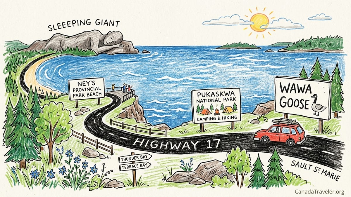
How Long to Allow on Highway 17 Between the Soo and Thunder Bay
The direct distance from Sault Ste. Marie to Thunder Bay on Highway 17 is roughly 700 kilometres. Driving it in one push takes about 7.5 to 8.5 hours of wheel time in good summer conditions, but that estimate ignores what makes the route special: beach walks at Batchawana Bay, hikes to Agawa Rock pictographs, lookouts over Old Woman Bay and side trips to parks like Pukaskwa, Neys and Sleeping Giant. In practice, treating this as a simple one-day transfer means blowing past most of the highlights.
For a relaxed trip that lets you stop for short hikes and scenic detours, many independent travelers split the drive into three or four days. A common pattern is to spend one night around Lake Superior Provincial Park or Wawa, one around Marathon or Terrace Bay, and a third near Sleeping Giant or in Thunder Bay itself. This pacing gives you time to walk at least one trail in each park, linger at beaches and still reach your next base before dark.
If you are camping or tackling longer hikes in places such as Lake Superior Provincial Park or Pukaskwa National Park, adding extra nights is worthwhile. Two or three nights based at Agawa Bay or Wawa allow for day hikes to waterfalls and coastal viewpoints. Similarly, a two-night stay near Marathon gives time for both Pukaskwa’s Hattie Cove area and Neys Provincial Park. Road conditions and weather can also slow you down, especially in shoulder seasons when fog or heavy rain are common along the lake. Plan your daily legs conservatively and avoid driving after dusk, when moose and deer are more active along the highway shoulders.
Think of Highway 17 here the way you might think about a classic coastal drive elsewhere. Just as most people would not rush the Cabot Trail in Nova Scotia or the Icefields Parkway in Alberta in a single day, this Lake Superior section deserves multiple days. Treating the road as the destination will shape better choices about where to stop, where to sleep and how to adjust when you inevitably discover an unplanned cascade or beach that begs for an extra hour.
Sault Ste. Marie to Batchawana Bay: Easing into Lake Superior
Leaving Sault Ste. Marie, services thin out quickly, so starting with a full tank is practical. From the city to Batchawana Bay is only about 75 kilometres, or roughly 50 minutes of driving, but it already hints at the scale of the lake. You pass forested Canadian Shield rock, views over Whitefish Bay and a scattered string of local motels, cabins and take-out stands that cater to summer traffic. Mobile coverage from major Canadian carriers is generally solid in this first section, but begins to drop in pockets as you approach the bay.
Batchawana Bay itself offers one of the gentlest entries to Lake Superior. The shallow, sandy arc of beach warms up more than many other points on the lake, so on a calm July or August afternoon you will often see families wading or paddling close to shore. There are provincial park day-use areas and private campgrounds in the broader bay area where you can pull in for a picnic, stretch your legs or spend a first night out of Sault Ste. Marie without committing to a long drive. For a concrete example, some travelers will leave the city after work, drive under an hour up Highway 17, and set up a tent or small trailer in time for sunset over the water.
From a practical standpoint, this section is also where you refine your rhythm for the days ahead: stopping every 60 to 90 minutes for viewpoints, restrooms and short walks rather than pushing through long stretches. You will find seasonal chip trucks and small diners near Batchawana Bay that give a sense of Northern Ontario road-trip culture, along with basic groceries and ice. Stocking up on snacks and water here reduces how often you need to hunt for supplies once you enter longer service gaps north of Montreal River and into Lake Superior Provincial Park.
Weather changes rapidly along this shore. A morning of sun in Sault Ste. Marie can turn into thick fog at Batchawana Bay by midday. Keeping a light jacket and rain shell accessible in the car is wise, especially if you plan to wander down to the beach or a nearby viewpoint for photos. These early kilometres are forgiving: short, scenic and with enough services to make adjustments, which is exactly why they are a good shakedown before the more remote stretches to come.
Lake Superior Provincial Park: Beaches, Pictographs and Waterfalls
Roughly 90 minutes north of Sault Ste. Marie, the highway enters Lake Superior Provincial Park, one of the largest parks in Ontario and a centrepiece of this drive. Here the road weaves between high rock walls and sweeping bays; many travelers describe the first sight of Agawa Bay or Old Woman Bay as the moment the trip becomes unforgettable. Inside the park, mobile phone service is patchy and often limited to high points or near the boundaries, so do not rely on continuous data or reception.
Driving from the park’s south boundary to Wawa is about 150 kilometres, which on paper might be two hours. In reality it often takes half a day because there are so many tempting stops along the way. At Agawa Bay, the main campground stretches behind a long shingle beach, offering car-accessible sites where you can step out of your tent or trailer onto the sand. Many sites book up months ahead for summer weekends. Day visitors can access the same beach via a parking area near the visitor centre, which also provides washrooms, a small interpretive exhibit and up-to-date information on trail conditions and closures.
Several short hikes branch off Highway 17 within the park and work well as road-trip breaks. The Pinguisibi trail follows the Sand River, with boardwalks and viewpoints over a series of small waterfalls and rapids close enough to hear from the trail. The Orphan Lake loop offers a moderate half-day hike that combines forest, an inland lake and viewpoints down to Lake Superior’s rocky coast. For many visitors, the Agawa Rock pictographs are a highlight: a short, sometimes steep trail down to a rock ledge where red ochre images painted by Indigenous Anishinaabe artists overlook the waves. Access can close in rough weather, and even on calm days the ledge can be wet and slippery, so you need sturdy footwear and respect for warning signs.
Overnight options inside or near Lake Superior Provincial Park include both front-country campgrounds like Agawa Bay and Rabbit Blanket Lake and roofed accommodations in nearby Wawa or small motels along the highway. After a day that might include two or three short hikes and multiple scenic pullouts, staying locally rather than pushing on helps avoid wildlife encounters at dusk and allows you to enjoy the dark skies. On a clear night, the Milky Way is often visible from the beach, and in shoulder seasons lucky travelers sometimes glimpse the northern lights reflecting on the lake.
Wawa, Pukaskwa and Marathon: Remote Coast and Deep Wilderness
North of Lake Superior Provincial Park, the town of Wawa is a practical resupply point and a good overnight base. It sits about 230 kilometres, or roughly three hours of relaxed driving, from Sault Ste. Marie if you have been stopping inside the park. You will find multiple fuel stations, grocery stores and a range of modest motels and cabins. The large roadside Wawa Goose statue has become a classic photo stop, and nearby beaches such as Sandy Beach offer quieter alternatives to the busier highway pullouts.
From Wawa to Marathon is approximately 190 kilometres, generally two to two and a half hours of driving time. This section feels noticeably more remote, with longer stretches between services and more frequent mobile dead zones. Hilly terrain and curves mean you will rarely maintain full highway speed, especially behind transport trucks in summer construction zones. Plan to top up fuel in Wawa before you leave. While there are smaller gas stations at White River and near Marathon, hours can be more limited than in larger centres.
About 15 kilometres east of Marathon, Highway 627 branches south to Pukaskwa National Park, the only national park on Lake Superior’s Canadian shore. It is a 15 kilometre drive from the junction down to Hattie Cove, the park’s main campground and day-use area. Hattie Cove offers front-country sites, some reservable, tucked among spruce and birch with access to sheltered coves ideal for short paddles. Short trails such as Boardwalk Beach or the Southern Headland trail provide big-lake views without committing to multi-day coastal backpacking routes. Because reservations can fill quickly in high season, some travelers base in Marathon’s motels or municipal campgrounds and day-trip into Pukaskwa for hiking and beach time.
Between Marathon and Terrace Bay, and on to Schreiber and Rossport, Highway 17 continues to roll over bedrock highlands and past inland lakes. Driving distances here look modest on a map but can still take longer than expected. Marathon to Terrace Bay is only about 60 kilometres, usually under an hour, yet there are multiple viewpoints and side roads to small harbours that tempt photo stops. It is common for travelers who intended to reach Thunder Bay by evening to realize in Marathon that they are happier slowing down, booking a last-minute cabin or campsite near Terrace Bay and giving themselves another full day for the final leg.
Terrace Bay, Neys and Nipigon: Beaches, Lookouts and Services
Terrace Bay, Schreiber and Rossport form a loose cluster of small communities around the north-central shore of Lake Superior. Terrace Bay has an easy-access waterfront area with a lighthouse-style lookout, beach and boardwalk that make a good late-afternoon or evening stroll. It is also a convenient base for exploring Aguasabon Falls, a powerful waterfall and gorge located just inland. A short walk from the parking lot leads to fenced viewpoints, making it a realistic stop even if you are breaking up a long driving day with only 30 minutes to spare.
West of Terrace Bay, Neys Provincial Park sits on one of the most dramatic natural sand beaches on the lake. The front-country campground stretches near the shoreline, with some sites offering direct beach access. On a calm day you might see paddleboards or canoes near shore, while on windy days waves crash along the length of the bay. Trails like the Under the Volcano route climb to viewpoints over Pic Island and the arching beach, though footing can be rough and weather changes quickly at higher points. Overnighting at Neys instead of pushing directly from Marathon to Thunder Bay allows you to swim or walk the beach in the evening and early morning when it is quietest.
From Neys to Nipigon is roughly 200 kilometres, often close to three hours of driving when you account for curves, elevation changes and occasional slow traffic. Schreiber and Rossport offer limited services, including small accommodations and seasonal restaurants, but this section also includes some of the most memorable viewpoints. Roadside lookouts with signed parking areas give commanding views over islands and bays, and many travelers use these as leg-stretching breaks. Cellular coverage improves in and near the towns but still dips to zero in more isolated segments, so it is wise to download maps offline and not count on streaming navigation.
Nipigon is a key junction, where Highway 17 from the east meets Highway 11 coming from the interior. It has full services for its size, including fuel, groceries and a selection of motels. The Nipigon River Bridge is a striking modern structure, and the surrounding cliffs hint that Thunder Bay is not far. Many itineraries use Nipigon as a final overnight if they want a short, leisurely approach to Thunder Bay the following day, leaving time for a detour to Sleeping Giant Provincial Park or for unhurried photo stops around the northern bay.
Sleeping Giant and Arrival in Thunder Bay
From Nipigon to Thunder Bay is about 100 kilometres, usually a 75 to 90 minute drive without detours. The highway leaves the close edge of Lake Superior more often here, but the presence of the Sleeping Giant peninsula dominates the horizon on clear days. To explore this area, drivers turn south onto Highway 587 toward Sleeping Giant Provincial Park on the Sibley Peninsula. The drive from the Highway 17 junction to the park is approximately 60 kilometres, roughly 45 minutes to an hour depending on road conditions and wildlife on the shoulders.
Sleeping Giant Provincial Park offers both front-country campgrounds and extensive hiking. Trails range from short lookouts over Thunder Bay to challenging full-day routes climbing toward the “top” of the Sleeping Giant formation. Many road-trippers choose the Middlebrun Bay or Sea Lion areas for quick visits, combining a short forest walk with access to sandy or cobble beaches. As with other parks on this route, mobile reception can be intermittent once you leave the main highway, and weather on the peninsula often differs from conditions in Thunder Bay or Nipigon.
Thunder Bay itself is a regional hub with full urban services including larger grocery stores, mechanics, chain hotels and independent guesthouses. After several days of coastal driving, many travelers appreciate a night or two in the city before heading inland or south toward the United States border. The city waterfront offers views back toward the Sleeping Giant and is a natural place to reflect on the route you have just driven from the opposite side of the bay. Because the Sault to Thunder Bay drive can be mentally tiring, scheduling at least one non-driving day at the end of your trip in Thunder Bay helps you finish rested rather than rushed.
Practically, Thunder Bay is also where many road-trippers handle logistics that would have been harder in smaller communities: rotating drivers, picking up specialty groceries, visiting outdoor stores to replace worn gear, or arranging minor vehicle checks if they plan to continue across the Prairies. Treat it as both a destination and a staging point, especially if your Lake Superior road trip is part of a longer cross-Canada journey.
Planning Fuel, Mobile Coverage, Safety and Seasons
Although Highway 17 is part of the Trans-Canada, large stretches between Sault Ste. Marie and Thunder Bay feel remote, especially outside July and August. As a practical rule, fill your tank in Sault Ste. Marie, Wawa, Marathon and Nipigon, and top up whenever you are below half a tank in between. Some independent gas stations in small communities keep shorter hours, particularly in late fall and early spring, so do not assume you can always refuel late at night. Diesel is widely available in the larger centres and along the main corridor, but travelers in electric vehicles should research current charging locations in advance and build in extra time.
Mobile phone coverage is strong in and near towns but becomes unreliable in the interior sections and within most parks. If you are depending on navigation apps, download offline maps spanning the entire corridor before you leave Sault Ste. Marie. It is also wise to keep a paper road map in the glove box. When planning hikes, note that you may not be able to check weather radar or call for help from the trail. Leave your plans with someone you trust, including which trailheads you intend to use and when you expect to be back, and always sign trail registers where they exist.
Wildlife and weather both demand respect. Moose, deer and black bears are present along this corridor, and dusk and dawn are the riskiest times for collisions, especially in low-lying or marshy areas. Choosing to be at your overnight base before sunset reduces stress and gives you time to cook, set up camp or check into accommodations in daylight. Fog banks rolling off Lake Superior can appear suddenly even on warm days, lowering visibility and slowing traffic. In shoulder seasons, sudden temperature drops can lead to frost or even early snow on the higher ridges, particularly in late October or early May.
Seasonality shapes the feel of the trip. In July and August, campgrounds can be busy and advance reservations are strongly advised for popular parks like Lake Superior, Pukaskwa, Neys and Sleeping Giant. In September, cooler nights and fall colours attract photographers and hikers; many day-use areas remain open but some smaller seasonal services, such as park snack bars or roadside restrooms, begin closing after the Canadian Thanksgiving weekend. Winter brings a different experience entirely, with portions of the route affected by snow and ice and many campgrounds closed, but hardy travelers still drive the corridor for its stark beauty. For a first-time road trip focused on beaches, hiking and camping, late June through early September offers the widest range of options and the most predictable conditions.
Choosing Overnight Bases and Camping vs. Roofed Stays
One of the most important choices for this road trip is where to base each night. For campers, a balanced three- or four-night route might include Agawa Bay or Rabbit Blanket Lake in Lake Superior Provincial Park, a night near Marathon or at Pukaskwa’s Hattie Cove, a night at Neys Provincial Park or in Terrace Bay, and a final night at Sleeping Giant before rolling into Thunder Bay. Each of these stops keeps daily driving under three hours of pure highway time and allows multiple short hikes or beach visits along the way.
If you prefer roofed accommodations, pairing Wawa, Marathon or Terrace Bay, and Thunder Bay makes sense. For example, you could leave Sault Ste. Marie mid-morning and explore Lake Superior Provincial Park on the way to a motel in Wawa. The next day might include a detour into Pukaskwa and end at a lakeside inn or cabin near Terrace Bay. On the third day, you could drive to Thunder Bay with a side trip toward Sleeping Giant. Booking cancellable accommodation gives you flexibility in case weather encourages you to stay an extra day in a favourite spot or adjust for construction delays.
Campsites in the provincial and national parks along this corridor often need advance reservations, especially electrical sites for trailers. Many travelers set an alarm for early booking windows several months ahead, particularly for long weekends. That said, there are also private and municipal campgrounds in or near Batchawana Bay, Wawa, Marathon, Terrace Bay and Thunder Bay that sometimes have more last-minute availability. A mixed approach works well: reserve key nights in must-see parks such as Lake Superior or Pukaskwa, then leave one or two nights flexible for spontaneous discoveries.
Whatever style you choose, consider alternating more rustic nights with ones that offer hot showers, laundry and reliable Wi-Fi. Spending two nights in a row at a serviced campground or motel midway through the trip gives you a chance to recharge devices, wash clothes and download offline maps or podcasts for the next remote stretch. This pattern can make a significant difference to how rested and safe you feel on the road.
FAQ
Q1. How many days do I really need for the drive from Sault Ste. Marie to Thunder Bay?
Most travelers are happiest with at least three full days and two or three overnights between Sault Ste. Marie and Thunder Bay. That pacing keeps daily driving under four hours and leaves room for hikes and beach stops in Lake Superior Provincial Park, near Marathon and at Sleeping Giant or around Thunder Bay.
Q2. Can I drive the Sault to Thunder Bay section in one day if I am short on time?
It is possible to cover the roughly 700 kilometres in one long day of 8 to 9 hours behind the wheel, but you will have little time for anything beyond fuel and washroom stops. For safety and enjoyment, even time-pressed travelers often break the journey with at least one overnight in Wawa, Marathon or Terrace Bay.
Q3. Where are the biggest gaps in fuel and services along Highway 17?
The longest stretches with fewer services are between Sault Ste. Marie and Wawa, and between Wawa and Marathon. In practice, topping up fuel in Sault Ste. Marie, Wawa, Marathon and Nipigon and never letting your tank drop much below half is a simple way to avoid stress. Smaller communities often have fuel, but hours can be limited.
Q4. Will I have mobile phone coverage for navigation the whole way?
No. Coverage is good in and around towns such as Sault Ste. Marie, Wawa, Marathon, Terrace Bay, Nipigon and Thunder Bay, but it drops to patchy or nonexistent in many interior sections and inside most parks. Download offline maps in advance and keep a paper map available as a backup.
Q5. What are some realistic day-by-day itineraries for this road trip?
A common three-night plan is: Night one near Lake Superior Provincial Park or Wawa, night two around Marathon or Pukaskwa, night three at Neys, Terrace Bay or Sleeping Giant, then roll into Thunder Bay. Slower itineraries add extra nights in Lake Superior Provincial Park or Sleeping Giant for more hiking and beach time.
Q6. Are there easy hikes suitable for families along this route?
Yes. In Lake Superior Provincial Park, the Pinguisibi (Sand River) trail and shorter coastal access paths work well for families. Around Marathon, boardwalk-style trails at Pukaskwa’s Hattie Cove and the short walk to Aguasabon Falls near Terrace Bay are good options. At Sleeping Giant, Middlebrun Bay offers a manageable forest walk to a beach.
Q7. How cold is the water in Lake Superior for swimming?
Lake Superior stays cold compared with many inland lakes, but some areas like Batchawana Bay and shallow beaches at Neys can feel more swimmable in late summer. Most people limit swims to short dips, even in July and August. Wearing a light wetsuit extends comfort if you plan to be in the water longer.
Q8. Do I need to book campsites and accommodations in advance?
For travel in July and August, booking popular campgrounds such as Agawa Bay, Pukaskwa’s Hattie Cove, Neys and Sleeping Giant well in advance is strongly recommended. Motels and cabins in Wawa, Marathon, Terrace Bay and Thunder Bay can also fill on peak summer weekends, though shoulder-season travelers sometimes find same-day availability.
Q9. Is this route suitable for RVs and trailers?
Yes. Highway 17 is a major paved highway and is commonly driven by RVs and trailers. The main campgrounds at Lake Superior, Pukaskwa, Neys and Sleeping Giant all have sites that can accommodate various rig sizes, though not every site is suitable for larger units. Check site length limits and be prepared for some hilly, winding sections.
Q10. What is the best time of year to drive from Sault Ste. Marie to Thunder Bay?
Late June through early September offers the most predictable conditions for camping and hiking, with long daylight hours and most services open. Early fall, particularly mid-September to early October, brings impressive colour and cooler temperatures but also fewer facilities and the possibility of early frost or storms. Winter driving is possible but demands experience with snow and ice and a different style of trip.