


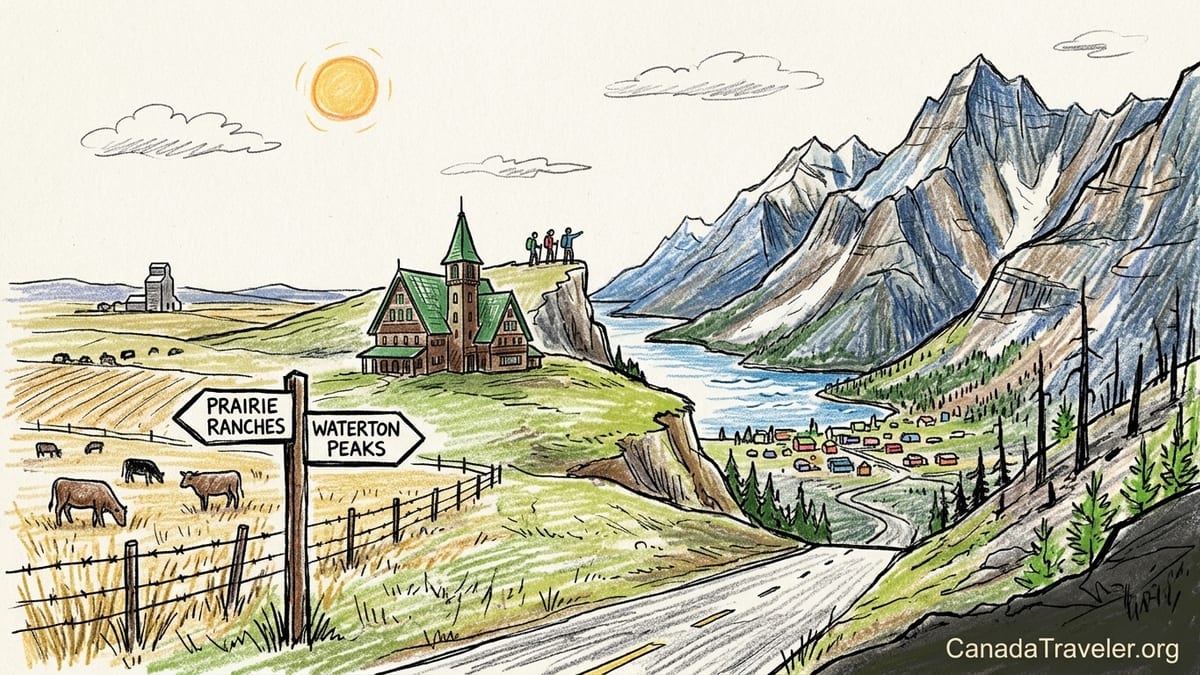
By the time I pulled into Waterton Lakes National Park on a cool October Friday evening, it felt like I had driven straight out of the prairies and into a wall of rock. In the span of less than an hour, Alberta’s open ranch country had risen abruptly into steep, shadowed peaks shouldering against a deep blue lake. I had come for a simple weekend escape, but those two days in Waterton left a very different impression from the bigger, busier resorts farther north in the Rockies.
Driving In: From Ranch Country To A Wall Of Mountains
I started from Lethbridge after lunch on a clear Saturday, heading south on Highway 5. For the first 45 minutes it was pure prairie: squared-off fields of stubble in late season, grain elevators marking small towns like Welling and Cardston, and roadside signs for cattle auctions and irrigation supply. The road is easy driving, mostly straight, and the horizon lies wide open in every direction. It felt far more like farm country than what most travelers imagine when they hear the word “Rockies.”
South of Cardston, the landscape began to shift. Highway 5 turned more southwest and the foothills appeared, almost in a single line, instead of a gradual build. You do not get rolling foothills for long here. The front range of the Rockies seems to erupt directly out of grazing land, and Waterton’s peaks fill the windshield with surprising speed. This contrast is one of the park’s defining sensations. One moment you are passing cattle pastures behind barbed wire; twenty minutes later you are threading between cliffs with avalanche paths visible on the slopes above.
Coming in from Calgary, the feeling is similar, just stretched across more hours. The route through Fort Macleod and then south on Highway 6 gives you extended prairie driving, often in strong wind, before the road bends toward those same steep mountains above Waterton village. Either way, there is a definite sense of crossing an invisible threshold from ranching country into a compact basin of rock, water and forest.
Just outside the park boundary, Highway 6 dips and rises gently past the Bison Paddock overlook and the turnoff for the Chief Mountain border crossing. I stopped at a roadside pullout simply to look. Behind me lay the open plains. Ahead, Upper Waterton Lake hid in a deep valley that cut into the heart of the mountains. It was the clearest visual of Waterton’s identity: a place where prairie and peaks share the same skyline instead of existing as separate regions.
First Impressions Of Waterton Townsite And The Lakeshore
Waterton townsite is tiny. After buying a park pass at the entrance kiosk, I was rolling down a short main street past a cluster of low hotels, small lodges, a couple of cafes, and outfitters that double as souvenir shops. Compared with Banff Avenue or Lake Louise village, it feels almost like a lakeside hamlet. Outside of peak summer, parking was straightforward, though information from Parks Canada had warned that in July and August the lakeshore lots often reach capacity by late morning.
My first stop was the public lakeshore in front of the marina. Upper Waterton Lake runs roughly north-south, so in late afternoon the western peaks were already casting long shadows over the water. A cold wind funneled up the lake, something regulars say is typical here, and whitecaps broke against the stone shoreline. A few people were clustered around the dock used by the Waterton Shoreline Cruise, which runs seasonal boats down toward the U.S. border and the Crypt Lake trailhead. The cruise schedule and ticket prices change year to year, so I had checked the latest details at the visitor centre earlier in the day rather than relying on older guidebooks.
I walked the short path along the lakeshore toward Emerald Bay, scanning the slopes for wildlife. Waterton has both deer and bighorn sheep that wander right into town, and it did not take long to see proof. A small group of mule deer picked their way between cabins at the edge of the village, so accustomed to people that they barely glanced up as we passed by with cameras. It is a reminder that this is still core wildlife habitat, even if the main street sells espresso and ice cream.
As the light dropped, the air cooled quickly. Many seasonal restaurants close or shorten hours by late September, and during my October visit I found only a handful open for dinner. I checked into a mid-range motel a block off the lake, paying just under 200 Canadian dollars per night including tax, which felt reasonable for a national park weekend but more than a comparable small-town Alberta room. After a simple burger and local beer at a casual grill that remained open weekends through October, I turned in early so I could catch the next morning’s light on the surrounding peaks.
Prince Of Wales Hotel: Icon On The Bluff, Two Very Different Experiences
The next morning I drove up to the Prince of Wales Hotel before breakfast. Perched on a grassy bluff just north of town, the 1920s-era hotel is one of Canada’s most photographed lodges. From the roadside pullouts below, you get the postcard view: a tall, steep-roofed, green-and-brown building standing alone above the deep blue lake, with sharp peaks rising behind it. Even if you do nothing else in Waterton, this is an essential stop, and it costs nothing if you are simply parking in the nearby lot and wandering around with a camera.
Many visitors, myself included, treat the Prince of Wales primarily as a viewpoint. I walked the mown grass around the hotel, circled the bluff for changing perspectives, and joined a half-dozen other early risers taking photos as sun lit the upper slopes while the lake remained in shadow. The wind was fierce on the exposed point, a factor to remember if you come in shoulder season. I wore a winter hat and gloves in early October and was glad I had packed them.
Staying at the Prince of Wales is a very different commitment from simply photographing it. Rooms in 2026 often ran well over 350 to 400 Canadian dollars per night once fees and taxes were included, and availability became tight on summer weekends. The historic building also has some quirks, such as smaller or less soundproof rooms than modern hotels. I chose not to stay there and instead reserved in town, where I could find more budget-flexible options and be closer to restaurants that stayed open a little later.
The third way to experience the hotel is to pay for afternoon tea in the lobby lounge, which overlooks the lake through massive windows. As of the 2026 season, travelers reported paying on the order of 65 to 70 Canadian dollars per adult for tea service, with reduced prices for young children. That is a splurge for sandwiches, scones and pastries, especially if you are traveling as a family, but it can be worth it if you value the setting and a slow afternoon indoors. I did not book tea this time, partly due to the cost and partly because I wanted to spend my limited time on the trails, but it is helpful to know that your choices range from completely free photographic visits to high-end heritage lodging and premium dining in the very same building.
Hiking Bear’s Hump: Short Distance, Serious Climb
Bear’s Hump was the one hike I knew I had to do, and it turned out to be the defining experience of my weekend. The trailhead is close to the visitor centre on the edge of town, and parking can be tight on summer days. I set out mid-morning, when the light had warmed but before the trail grew too busy. The official numbers say Bear’s Hump is about 2.8 kilometres return, with roughly 225 metres of elevation gain, and that sounds modest on paper. In reality, the grade and trail style make it feel much steeper.
The path starts in sparse forest and switches quickly into a steady uphill climb. Much of the route follows built, gravel-covered steps and short switchbacks, remnants of reconstruction efforts after the 2017 Kenow wildfire. That fire burned a large portion of the park but spared the townsite itself, and you can see evidence of the burn in standing dead trees and open views, along with thick regrowth of shrubs and young conifers along parts of the lower trail. The surface is mostly firm but can be dusty and slippery in dry weather or packed with snow and ice in shoulder seasons, so good footwear matters even though the hike is short.
I stopped several times to catch my breath and let my heart rate settle. This is not a gentle lakeside stroll. Families on the trail were doing the same, pausing at small rock outcrops with partial views of the townsite and Upper Waterton Lake below. There are no technical sections or exposure, but the grade does not give you many breaks. Hiking poles would be useful for anyone with sensitive knees, especially on the way down. I carried a litre of water, which was more than enough in cool weather but felt like the right amount for such a consistent climb.
The payoff at the top is enormous relative to the effort. The summit is a broad, flat rock dome that drops abruptly toward the lake, with railings at key viewpoints for safety. From this vantage, the prairie-mountain contrast is perfectly visible. To the south, Upper Waterton Lake narrows toward the international border and Glacier National Park. Below, the tiny townsite looks like a toy village wedged between water and cliffs. To the north and east, however, the land falls away toward rolling grasslands and agricultural fields in Alberta. On a clear day you can literally see where the Rockies stop and the plains begin.
Kenow Wildfire Scars And A Park In Regeneration
From Bear’s Hump and other viewpoints, the legacy of the Kenow wildfire remains obvious. Blackened tree trunks line portions of the slopes, and entire hillsides look more open than some older guidebooks’ photos suggest. Interpretive signs in town and at trailheads explain that the 2017 fire swept in from British Columbia and burned a large part of the park’s forest, including areas accessed from Red Rock and Akamina parkways, before it was contained. It did not, however, burn through the historic core of town or the Prince of Wales Hotel, which is why these landmarks remain intact.
Walking the post-fire landscape in 2026 feels less like visiting a disaster zone and more like observing an ecological reset in progress. Low shrubs and wildflowers have reclaimed many of the burned hillsides, and you can see bright green aspen and other young trees pushing up among the snags. Park information makes it clear that fire is a natural part of these ecosystems, and the Kenow event, while dramatic in scale and impact on infrastructure, is already giving way to new growth. It is important not to confuse this with more recent, unrelated fires elsewhere in the Rockies, such as the 2024 Jasper fire, which affected a different national park entirely.
Practical effects remain. Some backcountry routes changed or closed after Kenow, and trailhead facilities have been rebuilt or reconfigured. When planning my hikes, I relied on the current Parks Canada website and the Waterton visitor centre for up-to-date trail status instead of assuming that an older print guide still reflected reality. This is especially important if you are considering more demanding objectives like the Crypt Lake trail, where boat schedules and safety advisories can shift between seasons.
On a more human level, locals I spoke with in a cafe mentioned that the fire and subsequent closures changed the rhythm of tourism for several seasons. Yet by 2026 most key front-country experiences, from Bear’s Hump to Red Rock Canyon and Cameron Lake, are very much open and part of a typical visitor’s weekend, just set in a landscape that clearly shows both loss and renewal.
Day Two On Red Rock Parkway: Prairie Valley And Reddish Stone
My second day focused on Red Rock Parkway, the 14-kilometre road that runs northwest from the townsite into a gradually narrowing valley. Parks Canada information notes that Red Rock Parkway is open seasonally to vehicles, typically from early May to late October. For 2026, the park confirmed an opening to vehicles on May 7 and a closure on October 26, with pedestrian and cycling access beyond those dates even when gates are shut to cars. Knowing this, I made sure to visit before the seasonal closure so I could drive in and maximize my time.
The drive itself is another lesson in Waterton’s abrupt transition from prairie to peaks. Leaving town, the road crosses open, wind-exposed grassland where you can still see cattle grazing on lands outside the park. The valley floor is broad and relatively gentle at first, with views back toward the plains. As you continue, the valley tightens, the mountains close in, and the road begins to curve more sharply. Pullouts provide chances to look up at dramatic rock faces and the scars of the Kenow fire, which burned down this valley in 2017 before crews and weather combined to slow it.
By mid-morning the parking lot at Red Rock Canyon day-use area was already filling, despite my shoulder-season timing. In peak summer, Parks Canada data show tens of thousands of vehicles using the parkway between June and September, with a significant concentration arriving in the late-morning to mid-afternoon window. This helps explain signs and staff reminders to consider early or late visits if you want easier parking or a quieter experience.
I found a spot near the trailhead, used the washrooms in the day-use area, and set out for a slow circuit of the canyon. Short, paved and gravel paths follow both sides of the gorge, with footbridges crossing at key points. The reddish rock that gives the canyon its name is striking, especially where the creek has carved smooth channels. The color comes from iron-rich sedimentary layers that have oxidized, giving an almost brick-red tone in places. On a cloudy day the rock looks muted, but when the sun breaks through, the contrast with the green vegetation and clear water is vivid.
Blakiston Falls And The Feel Of A Classic Mountain Valley
From Red Rock Canyon, I continued on the signed trail toward Blakiston Falls. The hike is relatively short, roughly a couple of kilometres each way along a gentle path that rises gradually above the creek. Portions of the route have been rebuilt with metal viewing platforms and railings, another post-Kenow improvement that both protects slopes from erosion and gives visitors defined viewpoints. The forest here shows mixed stages of recovery, with some intact stands, burned sections and thick undergrowth of new growth all visible in the same view.
The falls themselves are not especially high or thunderous compared with some in the Rockies, but their setting inside a rocky cleft is memorable. The water pours over a lip into a narrow canyon, and the viewing decks let you look down into that slot from safe positions above. As at Bear’s Hump, the trail’s ease makes it popular with families and casual walkers, so I shared the platforms with a mix of experienced hikers and people in street shoes who had likely driven straight from the townsite.
After returning to the parking lot, I sat at a picnic table to eat a simple lunch I had packed from groceries bought in Lethbridge the day before. Food options in Waterton village are limited, especially outside peak summer months and later in the day, so having some backup supplies in a cooler felt wise. The small grocery in town carried basics, but selection and prices reflected the park setting, and I preferred to stock up before entering the park to keep costs and uncertainties down.
On the drive back along Red Rock Parkway, I watched for wildlife and was rewarded with a distant view of a black bear foraging on a slope well away from the road. Cars had pulled into a signed pullout and people were staying beside their vehicles, giving the animal space while taking photos with long lenses. I stayed in my car and used binoculars, grateful for the reminder that this remains bear country despite the relatively easy access and short hikes. The park’s consistent messaging about storing food properly and carrying bear spray, even on shorter walks, felt justified.
Akamina Parkway And Cameron Lake: A Side Trip Into The Forest
With time remaining that afternoon, I headed up the other signature road in the park, Akamina Parkway. This narrow, winding route runs southeast from the townsite for about 16 kilometres to Cameron Lake, and like Red Rock it is open seasonally to vehicles and used for walking and cycling when the gate is closed. Rebuilding and safety work after the Kenow fire meant that in recent years there have been periodic closures or restrictions, so I had again checked the current road status at the visitor centre that morning. In early October 2026 the road was open to regular traffic, though staff warned that early snow or ice could trigger short-notice changes.
The Akamina drive is different in mood from Red Rock Parkway. Instead of following a broad valley that transitions gradually from prairie to peaks, you enter forest quickly and remain enclosed by trees and slopes for much of the journey. Occasional views open toward cliffs and avalanche paths, and several signed pullouts mark trailheads for hikes of varying lengths, including family-friendly options like Crandell Lake. Evidence of the Kenow fire is present here too, but some stretches of mature forest remain, giving a sense of what more of the park looked like before 2017.
Cameron Lake at the end of the road felt like a quieter counterpoint to the more exposed Upper Waterton shoreline. A small day-use area with picnic tables, toilets and an easy lakeside path anchors one end of the lake, while peaks rise sharply from the opposite shore and into the United States. Boat rentals had ended for the season by my visit, and the small concession building was shuttered, a reminder that many services here operate only in the core summer months. A few other late-season visitors were picnicking or strolling along the 1.5-kilometre lakeside trail as patchy snow lingered in shady gullies above.
Standing on the shore, I thought again about Watershed transitions. Although Cameron Lake sits deep in the mountains, the memory of that fast drive from prairie to peaks remained fresh. It is only a short distance as the crow flies from the ranches along Highway 6 to this alpine-fringed lake that straddles a continental divide of sorts, sending waters toward different oceans. Waterton is not just visually dramatic; it also occupies a junction of natural systems that you can sense if you pay attention to small details like vegetation change and the feel of the air.
Waterton As An International Peace Park And A Quieter Alternative To Banff
Waterton’s compact footprint is part of something larger. Together with Glacier National Park across the border in Montana, it forms the Waterton-Glacier International Peace Park, recognized by UNESCO as both a World Heritage Site and a symbol of cross-border cooperation. You can see this on maps and in small touches such as signage referencing the partnership, as well as in the boat cruises that cross the international boundary line drawn across Upper Waterton Lake. The Chief Mountain and Carway border crossings nearby link the two countries by road during their own seasonal operating periods, tying the shared ecosystem together with human travel patterns.
During my weekend, that cross-border context mostly manifested as stories from other travelers. I chatted with a couple from Montana who had come up for the weekend to escape busier parts of Glacier and appreciated waterton’s smaller scale. Another group I met on Bear’s Hump had spent the previous week in Banff and Lake Louise and said that arriving in Waterton felt like stepping back a few decades in terms of pace and infrastructure, in a positive way.
The contrast with Banff was on my mind too. Banff townsite has a full supermarket, multiple blocks of restaurants and bars, frequent transit, and a year-round tourist economy. Waterton, by comparison, is tiny and heavily seasonal. Many businesses close entirely outside the main summer months, and even in shoulder season you cannot count on a wide choice of dining or late-night options. Cell service can be patchy, and there is no large-scale transit network circulating to the major viewpoints. For some travelers, especially those who like nightlife, shopping or a wide range of hotel classes, Banff is going to feel more comfortable.
For my purposes on this trip though, Waterton’s quieter character was a major plus. I wanted short but meaningful hikes like Bear’s Hump and Blakiston Falls, time to wander the lakeshore without heavy crowds, and roads that still felt like parkways rather than extensions of a highway system. I filled up with fuel in Pincher Creek on my way in, paid national park fees at the gate, spent moderately on two nights of lodging and a couple of meals, and otherwise kept costs focused on basic necessities rather than a long list of paid attractions. In that sense, Waterton delivered a concentrated mountain experience that felt easier to digest than Banff’s overwhelming menu of options.
The Takeaway
Looking back on my weekend, what stands out most is the suddenness of the transition. It is hard to think of another place in the Canadian Rockies where you move so abruptly from open ranchland to steep, lake-filled mountains. Driving in from Lethbridge or Calgary, you feel as if you are barreling straight into a wall of rock that rises directly out of the prairie. From Bear’s Hump, the contrast becomes literal: the grid of fields to one side, the toothy skyline and deep blue lake to the other.
Within two days I photographed a famous historic hotel without paying a cent, chose not to splurge on its premium rooms or afternoon tea, sweated up a short but lung-busting hike with 225 metres of gain, traced red stone in a canyon carved by clear water, and watched an ecosystem in the midst of fire-driven renewal. I balanced the limitations of a small, seasonal village with the rewards of thinner crowds, easier parking in shoulder season, and the ability to hear wind and water more often than traffic.
If I wanted a trip built around dining variety, nightlife and a broad mix of tours and activities, Banff would still be my first choice. For this particular mountain weekend though, where I craved strong landscape contrasts, human-scale infrastructure and a sense of being tucked into a corner of the Rockies that many international visitors still miss, Waterton was the better fit. It felt less like a resort and more like a frontier between worlds, a narrow space where prairies and peaks lean into each other and invite you to stand, just for a while, in between.
FAQ
Q1. How long does it take to drive to Waterton from Calgary or Lethbridge?
From Calgary, the drive is roughly three hours in good conditions, usually via Highway 2, Highway 3 and then south to Highway 6. From Lethbridge, it is about 90 minutes along Highway 5 through Cardston. Times can increase with construction, wildlife, or winter weather, so building in extra margin is wise.
Q2. When is Red Rock Parkway open to vehicles in 2026?
Parks Canada information for 2026 indicates that Red Rock Parkway opened to vehicles on May 7 and closed on October 26. Outside those dates, the road is typically gated to motor vehicles but remains available for walking, cycling and other non-motorized use, conditions permitting.
Q3. How hard is the Bear’s Hump hike really?
Bear’s Hump is only about 2.8 kilometres return, but it climbs roughly 225 metres over that short distance. The trail is a steady uphill on gravel and rock steps, with very few flat sections. Fit hikers may reach the top in 30 to 40 minutes, but many people take closer to an hour with breaks. Good footwear and a bit of water make a noticeable difference.
Q4. Do I need to stay at the Prince of Wales Hotel to enjoy the views?
No. Anyone can drive or walk up to the Prince of Wales bluff, park in the nearby lot and wander the grassy hill for panoramic lake and mountain views at no extra cost beyond park entry fees. Staying at the hotel or booking afternoon tea offers an interior experience with large windows and dining service, but the iconic exterior viewpoints remain fully accessible to day visitors.
Q5. Is afternoon tea at the Prince of Wales Hotel worth the cost?
Recent traveler reports from the 2026 season suggest prices in the range of roughly 65 to 70 Canadian dollars per adult for afternoon tea, with reduced prices for young children. Whether it is worthwhile depends on your budget and priorities. If you value heritage interiors, table service and lingering over food with an exceptional view, it can be a memorable splurge. If your funds and time are limited, you can still enjoy the same vistas by simply visiting the bluff and spending more of your budget on hikes and other experiences.
Q6. Can I visit Cameron Lake and Akamina Parkway year-round?
Akamina Parkway and the road to Cameron Lake are open seasonally to vehicles, with exact dates depending on snow, ice and maintenance. When gates are closed to cars, the route may still be available for non-motorized use such as walking, cycling or skiing, but conditions vary. Before planning a visit in late fall, winter or early spring, check current road status and avalanche or wildlife advisories with the Waterton visitor centre or official park information.
Q7. What should I know about wildlife safety in Waterton?
Waterton supports black bears, occasional grizzlies, deer, bighorn sheep and other wildlife. Visitors are expected to store food and scented items securely, keep a safe distance from animals even when they approach roads or the townsite, and consider carrying bear spray on trails, including shorter ones like Bear’s Hump and the paths near Red Rock Canyon. Respecting closures, traveling in small groups and making noise on forested trails all reduce the risk of surprise encounters.
Q8. How has the 2017 Kenow wildfire affected a visit today?
The Kenow wildfire burned a large portion of Waterton in 2017, leaving visible burn scars and changing forest cover along roads like Red Rock and Akamina parkways. Many facilities have since been rebuilt or improved, and key front-country areas such as Bear’s Hump, Red Rock Canyon, Blakiston Falls and Cameron Lake are open and popular again. Visitors now see a mix of standing dead trees and vigorous new growth, along with some reconfigured trails and infrastructure designed for long-term resilience.
Q9. Is Waterton a good alternative to Banff for a short mountain trip?
For travelers who prefer quieter villages, shorter hikes with big views and a more intimate scale, Waterton can be an excellent alternative. It lacks Banff’s extensive shopping, nightlife and transit options, and many services are seasonal, but its compact townsite, proximity of major viewpoints, and strong prairie-to-peak contrast create a distinctly different feel. For a two- or three-day trip focused on scenery and simple outdoor time, it may be more appealing than Banff to some visitors.
Q10. How much should I budget for a basic weekend in Waterton?
Costs vary by season, but for a typical shoulder-season weekend you might expect to pay national park entry fees, around 150 to 250 Canadian dollars per night for mid-range lodging in or near the townsite, plus meals that range from casual cafe prices to higher-end hotel dining. Fuel and groceries bought outside the park can help manage expenses. Travelers who camp, cook some of their own food and skip premium experiences like afternoon tea can keep spending relatively moderate, while those who stay at heritage hotels and book paid excursions will spend more.