


I arrived in Ontario with the kind of confidence you get from a clean Google Maps screenshot. Blue lines, tidy time estimates, and a provincial map that makes Southern Ontario look like a compact cluster of must-see icons. Toronto, Niagara Falls, Algonquin, Ottawa, Bruce Peninsula, maybe even “a quick push north” if we felt ambitious. On paper, nothing looked outrageous. In practice, Ontario’s scale isn’t an abstract trivia fact. It is a destination-specific planning problem that punishes optimistic itineraries with traffic, fatigue, and the quiet heartbreak of attractions you skip because you simply cannot face another hour in the driver’s seat.
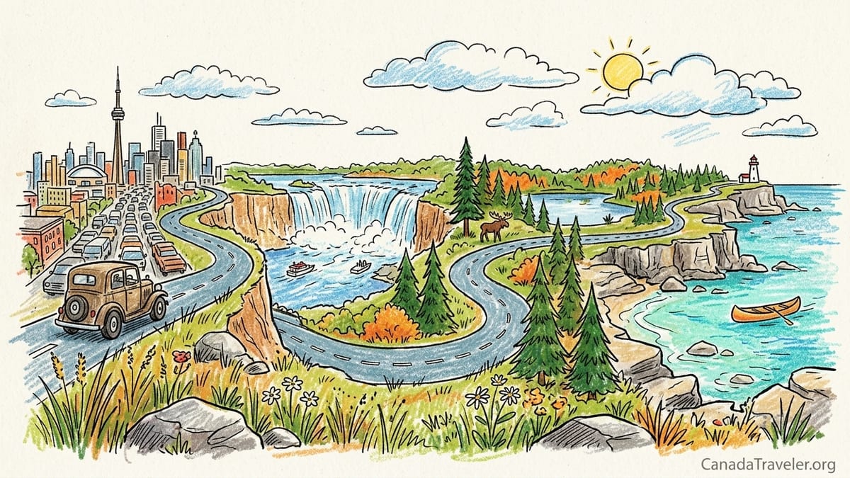
The Itinerary That Looked Reasonable on My Screen
My original plan was a greatest-hits loop: land in Toronto, dip down to Niagara Falls, head up into nature at Algonquin Provincial Park, swing east for Ottawa, then finish with a big lake and lighthouse moment in Bruce Peninsula. The distances were not tiny, but Google Maps made them feel manageable, the way it does when it assumes you are a tireless machine that never needs coffee, gas, or a bathroom break.
At the planning stage, the individual legs didn’t scare me. Downtown Toronto to Niagara Falls showed roughly an hour and a half in light traffic, and the route was basically one highway. Niagara to Huntsville (as a gateway town for Muskoka and a common jumping-off point for Algonquin access) looked like a couple of hours. Ottawa back toward the Toronto area felt like a straight, steady highway run. And a Bruce Peninsula detour looked like “a bit of a drive,” not a trip-defining commitment.
Here is what I thought I was signing up for: leave Toronto after breakfast, reach Niagara in time for the early afternoon, do the Falls, then either return or reposition somewhere for the next day. In my head, “drive time” meant the number on the map. In Ontario, “drive time” is only the first draft.
What Google Maps Predicted vs. What Actually Happened
The first reality check hit immediately: Toronto does not “start driving” the moment you turn the key. It starts with escaping the city, and that can be an entire phase of the day. On the Toronto to Niagara Falls run, the map can show around 90 minutes under ideal conditions. But once you layer in real conditions, it becomes a different trip: downtown hotel parking garage delays, a slow crawl to the Gardiner Expressway, and highway compression as the Greater Toronto Area funnels toward the QEW.
One day, our Toronto to Niagara Falls leg looked like a simple mid-morning departure. Google’s predicted time looked comfortable enough that we planned to stop for a sit-down lunch in Niagara-on-the-Lake and still make it to the Falls with daylight for a boat cruise. Door-to-door, it became closer to two and a half hours by the time we included the hotel checkout lag, downtown traffic, a fuel stop, and the kind of stop-and-go highway flow that feels like it should clear any minute but doesn’t.
The most important lesson was that Ontario’s “extra time” isn’t one single thing. It’s the stack: traffic leaving Toronto, congestion heading into cottage country on peak days, meal stops that aren’t optional if you want to stay sane, and the cumulative friction of parking, park gates, and detours. Each factor can be small; together, they can turn a headline drive time into an exhausting travel day.
The consequence was immediate and concrete. That first day, we sacrificed the Niagara-on-the-Lake lunch plan and grabbed something faster near the Falls, because the day had already slipped away. It wasn’t a tragedy, but it was a warning: in Ontario, you can lose your “fun time” without ever taking a wrong turn.
Toronto, Niagara, And The Southern Ontario Time Tax
Southern Ontario is where optimism goes to get sanded down. The roads are good, services are plentiful, and the distances look tame compared with what comes later. But this is also where time evaporates in predictable ways: city traffic, highway volume, and a long list of destinations that all peak at the same time. Niagara is famous for being a day trip from Toronto, which is true. What’s also true is that it can be a day trip that eats the whole day.
If you are driving, you quickly learn that the “last mile” in tourist Ontario can be the slowest part. Getting close to Niagara Falls can mean heavy local traffic, then the added step of parking, walking, and queueing. The same pattern repeats in Blue Mountain village areas, popular Muskoka lake towns, and weekend-heavy routes where everybody has the same idea at the same hour.
And then there are the optional decisions that become expensive time mistakes. For example: taking Highway 407 ETR to bypass congestion can be tempting, especially when you see a red-and-black traffic snarl on the free routes. But 407 ETR is a toll road with a published 2026 rate chart that varies by time and zone, and if you are in a rental car you can also face extra administrative charges from the rental company on top of the tolls. That is a classic Ontario surprise: paying more to save time, only to realize you still lose time later to meal stops, construction, or the unavoidable slowdown at your destination’s parking bottleneck.
By the end of our first two days, I felt a specific kind of tired: not the satisfied tired of a long hike, but the drained tired of constant micro-decisions behind the wheel. Ontario’s cities and tourist hubs can deliver incredible experiences, but they can also turn short map distances into a mental endurance test if you keep moving every single day.
Cottage Country Congestion, Park Access, And The “Nature Day” That Wasn’t
After Niagara, we aimed for a classic Ontario pivot: trade city and crowds for lakes and trails. The problem is that “escaping to nature” often means joining thousands of other people escaping to nature at the exact same time. Cottage-country corridors toward Muskoka and the Highway 60 area of Algonquin are famous weekend magnets. If your schedule lines up with peak movement days, you might spend the best daylight hours sitting in slow-moving traffic with a trunk full of hiking gear.
Then there is park access itself. Ontario Parks day use is not always a casual pull-in-and-go situation. Many parks require a daily vehicle permit for day use, and Ontario Parks explicitly directs visitors to get a permit through its system, with the ability to purchase daily vehicle permits for many parks shortly before the visit. Algonquin day use has its own details and capacity notes, and when a corridor is busy, the “drive there and figure it out” approach becomes risky.
In real terms, our Algonquin plan was supposed to be a full day of trails and viewpoints. What we got was a late arrival, then a constant sense of time pressure: find parking, orient ourselves, hike something shorter than planned, then leave earlier than we wanted because we still had another drive ahead. The sacrifice wasn’t just a single viewpoint. It was the feeling of being present. Nature in Ontario is at its best when you can slow down, not when you are racing the clock because your accommodation is two regions away.
By that point in the trip, we were making tired-person decisions. We skipped a longer trail we had been excited about and chose something closer to the road, because the thought of finishing a hike and then driving again felt heavier than the hike itself. Ontario didn’t defeat the itinerary with one giant distance. It did it with accumulated friction.
Why The Provincial Map Lies: Toronto + Niagara + Algonquin + Ottawa + Bruce Peninsula
Ontario’s greatest planning trap is how reasonable it looks when you plot it as a loop on a provincial map. The icons are famous. The highways look direct. And because Southern Ontario is more densely populated, your brain assumes the whole experience is compact. But the moment you try to combine Toronto, Niagara, Algonquin, Ottawa, and Bruce Peninsula into one short road trip, you are building a schedule that spends too much of its emotional budget on driving.
Take the logic: Toronto to Niagara is a classic. Niagara up to Algonquin is “just going north.” Algonquin to Ottawa feels like a clean diagonal. Ottawa back toward Bruce Peninsula looks like “crossing the province,” but still within a day. The problem is that each leg carries hidden add-ons: urban exits, cottage-country slowdowns, meal stops, fueling, roadworks, and the slower reality of northern highways once you are out of multi-lane comfort.
Even if each segment is only a few hours on paper, the day becomes a chain of tasks: pack, check out, drive, stop for food, stop for fuel, find parking, do the attraction quickly, check in, repeat. When you stack too many regions, the trip turns into a moving day every day. You don’t just lose time, you lose the point of the place.
This is where Ontario’s official tourism planning advice becomes validating. Destination Ontario publishes a 15-day family road trip that combines Toronto, Niagara Falls, Blue Mountain, Muskoka, and the 1000 Islands, which is telling: even with those regions clustered in the southern half of the province, a comfortable “see a bit of everything” pacing takes over two weeks, not one long weekend.
Northern Ontario Changes The Rules: Longer Distances, Slower Highways, Bigger Fatigue
If Southern Ontario punishes you with congestion, Northern Ontario punishes you with pure scale. Destination Ontario’s Northern Ontario road trip material openly frames travel between Toronto and Thunder Bay as an epic itinerary, not a casual add-on. And once you’ve driven outside the GTA bubble, you understand why: distances stretch, towns thin out, and highways can be two-lane for long stretches where you drive at a steadier but slower rhythm, with more attention required.
Even within Northern Ontario itineraries, the drive-time language is sobering. Destination Ontario’s Lake Superior road trip content presents segments with approximate drive times and distances, underscoring that the coastline experience is inherently road-based and that time between stops is part of the trip’s identity. That is not a warning, it’s an invitation, but only if you have planned for it. If you are trying to bolt Thunder Bay onto a Southern Ontario highlights loop, the drive doesn’t feel like a scenic chapter. It feels like a forced march.
I flirted with the idea of pushing farther north because the map made it look like a logical extension: if you can reach Muskoka and Algonquin, why not keep going? The answer is fatigue. Real fatigue, the kind you feel behind your eyes after hours of scanning for passing lanes, transport trucks, and wildlife risk at dusk. It’s also planning fatigue: in the north, a “quick detour” can carry bigger consequences because services can be spaced farther apart, and arriving late limits what you can realistically do that evening.
Ontario’s north is spectacular, but it demands respect. The right way to do it is not to squeeze it into a southern circuit. The right way is to plan a Northern Ontario trip as its own journey, with fewer bases and longer stays, so the drive becomes part of the experience rather than the thing that steals it.
The Real Cost Of Underestimating Ontario: Fuel, One-Way Rentals, And “Just One More Drive”
Time is the first cost you feel, but money is the second. Ontario road trips are not just about kilometers, they are about fuel burn, toll temptation, and rental math. In October 2026, average gasoline prices in Ontario were reported around the high-one-dollar range per liter, fluctuating over recent months and reaching around the two-dollar mark at peaks earlier in the month. You don’t need to be tracking every cent to feel what that means when you add extra detours and longer-than-planned days.
Our fuel spending climbed because we weren’t just driving the planned legs, we were driving the hidden legs: the extra loops to find a restaurant that was open, the wrong turns to reach the right trailhead parking lot, the backtrack to a grocery store because we arrived too late for a proper dinner. Ontario’s distances turn small inefficiencies into real dollars.
Then there are one-way rentals, which can look like a smart solution on paper: fly into Toronto, drive across regions, drop the car in Ottawa, and fly out. Many travelers do this. But major rental companies explicitly note that one-way rentals in Canada can be subject to a drop charge or mileage charge that varies by pickup and return locations and other factors. In other words: you can plan a clever point-to-point route and still get surprised at checkout.
And finally, the psychological cost: once you’ve already driven a lot, it becomes easier to say yes to “just one more” long day because you’re already tired anyway. That is the trap. Ontario is big enough that “just one more” can be the difference between arriving energized and arriving numb, and numb is when you start skipping the very attractions that justified the drive.
The Takeaway
Ontario taught me a planning rule that I now treat as non-negotiable: pick fewer regions, and give nature the time it deserves. If your trip is short, resist the urge to stitch the province into a single loop, even if the lines look neat on a map. A clean route is not the same thing as a good trip.
In practical terms, that meant changing how I would plan it next time. I would keep Toronto and Niagara in one Southern Ontario trip, add either Blue Mountain or the 1000 Islands, and stop there, especially if I’m traveling in peak summer or on weekends. If I want Algonquin, I would plan for at least two nights so I’m not driving in, rushing a trail, and driving out. And I would not pair Algonquin with a long cross-province hop in the same breath.
Most importantly, I would separate Southern and Northern Ontario into different journeys. Destination Ontario’s own itineraries make it clear that even a concentrated southern circuit can justify 15 days, and that reaching Thunder Bay and the Lake Superior coast belongs in a longer-distance plan. Ontario isn’t a place you “conquer” in one road trip. It’s a place you return to, region by region, until the distances start to feel like part of the story instead of the thing that steals it.
FAQ
Q1. How long should I budget for a Southern Ontario highlights road trip?
For a comfortable pace that includes Toronto, Niagara Falls, Blue Mountain, Muskoka, and the 1000 Islands, Destination Ontario publishes a 15-day family itinerary, which is a useful reality check for planning.
Q2. Why does Toronto to Niagara Falls take longer than the map estimate?
Because the estimate often excludes the real friction: escaping downtown, GTA congestion on the way to the QEW, weekend surges, parking time near the Falls, and the stops you inevitably make for food and fuel.
Q3. Is it realistic to do Toronto, Niagara, Algonquin, Ottawa, and Bruce Peninsula in one short trip?
It can look reasonable on a provincial map, but the day-to-day experience usually becomes too drive-heavy, leaving you rushed at parks and tired at city stops.
Q4. Do I need a permit for day hiking in Ontario Parks like Algonquin?
Often, yes. Ontario Parks uses day-use vehicle permits at many parks, and Algonquin day use has specific rules and purchasing options that are easiest to handle in advance.
Q5. How many nights should I stay at a major nature stop like Algonquin?
At least two nights is a practical minimum if you want a true full day of hiking and lake time without turning arrival and departure into rushed half-days.
Q6. What’s the biggest timing mistake people make in cottage country?
Assuming “north of Toronto” automatically means faster driving. On popular weekends, cottage-country routes can be congested, and a short map drive can swallow prime daylight.
Q7. Should I use Highway 407 ETR to save time around Toronto?
It can save time, but it is a paid toll road with a published 2026 rate chart and additional fees can apply, especially in rental cars. Always weigh the cost against how much time you truly gain.
Q8. How expensive is fuel for an Ontario road trip right now?
Fuel costs can add up quickly. Recent reporting in October 2026 put Ontario’s average gasoline price around the high-one-dollar range per liter, with peaks around the two-dollar mark earlier in the month, so extra detours are not trivial.
Q9. Are one-way car rentals in Ontario a good idea?
They can be convenient, but rental companies note that one-way rentals may include a drop charge or mileage charge that varies by locations. It is worth checking total cost before committing.
Q10. What’s the best way to plan a trip that includes Thunder Bay or Lake Superior?
Treat Northern Ontario as a separate trip. Destination Ontario frames Toronto-to-Thunder Bay itineraries as multi-day adventures, and the long distances and slower highways deserve dedicated time.