


I didn’t set out to “do Ontario” in one neat loop. I set out to drive a route that started where flights and rental cars are easiest, followed the gravitational pull of Toronto and Niagara, then kept going until the province stopped feeling like the same trip. That meant city congestion, casino-bright Niagara, long highway miles, lakefront towns, cottage traffic, and finally the wide-water calm of the Thousand Islands on the St. Lawrence. Along the way I learned two humbling truths: Ontario gets interesting the moment you leave the Toronto–Niagara corridor, and the only way to enjoy that variety is to stop pretending everything is “just outside Toronto.”
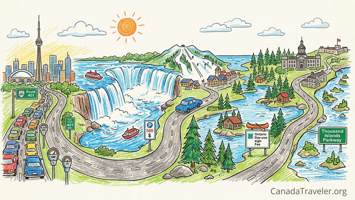
Trip Overview: The Route I Actually Drove (Not a Perfect Loop)
My route was anchored by what Destination Ontario itself bundles into one classic itinerary: Toronto, Niagara Falls, Blue Mountain, Muskoka, and the Thousand Islands. I used that as the backbone, then drove it in a straight-line sequence that made sense for real travel days rather than a brochure-perfect circle. It was a province-scale trip in feel, but still grounded in the southern half of Ontario: dense, fast, and expensive at the start, then increasingly lake-heavy and forested as I moved north and east.
The exact order I drove was Toronto (base) to Niagara Falls (with Niagara-on-the-Lake) to Collingwood and Blue Mountain to Muskoka (Gravenhurst and Bracebridge area) to a long eastbound push to Kingston and the Thousand Islands Parkway, then back toward Toronto by the fastest practical highways. If you’re reading this thinking, “That’s a lot of stops,” you’re already smarter than I was on day one. My biggest planning mistake was stacking too many one-night stays, which turned Ontario’s best scenery into a blur of check-in times and parking receipts.
I drove a midsize rental car and tracked daily kilometres, fuel top-ups, parking, and the “hidden” costs that Ontario road trips love to spring on visitors: urban parking, day-use permits, pricey Niagara attractions, and the toll-road trap that can hit rental drivers if you accidentally route onto Highway 407 ETR. I avoided the 407 on purpose after seeing how steep it can get, but I still built the trip around realistic highway driving: Highway 401 boredom, Highway 400 weekend cottage congestion, and the occasional scenic detour that sounded better than it drove.
Day 1 and Day 2: Toronto Density, Parking Sticker Shock, And Why Driving Here Isn’t Fun
Day 1 was the easiest kilometre day on paper and the most exhausting behind the wheel. I logged about 55 km total, mostly crawling between downtown Toronto, the waterfront, and a couple of neighborhood stops. This is the first contrast lesson of Ontario: your speed is not set by distance, it’s set by traffic friction. In Toronto, a “quick” cross-town run can eat an hour, and the road trip energy you think you’ll have on arrival disappears the first time you circle a block hunting for parking.
Costs in Toronto arrived in small bites. Parking was the biggest daily leak. I paid roughly $25 to $45 per day depending on whether I used a lot/garage near a major attraction or street parking with time limits. Fuel was minor on these first days, but the “mental fuel” was the issue: dense lane changes, streetcar corridors, and constant stop-and-go. If your road trip is about the open road, Toronto is the part you endure so you can earn the rest of Ontario.
Day 2 was similar: about 70 km total in-city, with one longer highway hop out to the suburbs and back. The mistake I made was thinking I could “do Toronto quickly” because I had a car. The car doesn’t speed up a Toronto visit, it complicates it. If I were writing an itinerary for my past self, I’d say: park once, use transit or walk, and treat the rental car as a tool you pick up the morning you leave town.
Day 3: Toronto to Niagara Falls (About 130 km) And The Tourist Machine Reality Check
On Day 3 I drove from Toronto down toward Niagara Falls, logging roughly 130 km depending on whether you detour into Niagara-on-the-Lake or hug the fastest route. The drive itself is straightforward highway work, but the arrival is a shock: Niagara is not a sleepy waterfall town, it’s an entertainment district wrapped around a natural wonder.
This was my first real “tourism costs are real” day. The headline expense is the boat tour. Niagara City Cruises is the official boat tour operator for Niagara Parks, and adult tickets are advertised around $47.95 before tax for popular sailings. That’s a reasonable splurge for what you get, but it set the tone: Niagara is built to separate you from your wallet in $20 to $60 increments, all day long.
Driving and parking were the other reality check. Parking near the main falls area can be expensive and fills quickly. I paid about $30 for a prime lot on a busy afternoon and still walked more than I expected because the “closest” lots are rarely as close as they sound when you’re reading a map. The stretch of Niagara that’s exciting is compact, but the traffic and pedestrian volume make it feel like a theme park access road.
My mistake here was time budgeting. I tried to squeeze Niagara Falls, a winery-side wander in Niagara-on-the-Lake, and a sunset view back at the falls into one day. It’s doable, but it’s not relaxing. Niagara deserves a slower pace or an early start, and if you’re arriving on a weekend, expect everything to feel busier and louder than your photos will suggest.
Day 4: Niagara to Collingwood and Blue Mountain (About 250 km) The Drive That Looked Shorter Than It Felt
Day 4 was Niagara Falls to Collingwood and Blue Mountain, roughly 250 km depending on which highways you take and whether you swing around for food or a lakefront stop. On a map, it doesn’t look punishing. In the car, it felt longer, largely because you spend the first chunk escaping the Toronto-adjacent gravity well of the Golden Horseshoe: lots of traffic, lots of lane discipline, lots of stop-start.
This was one of the stretches where I caught myself thinking, “Why am I not there yet?” It wasn’t scenic enough to be leisurely and it wasn’t fast enough to be efficient. I took a couple of rest stops simply to reset my attention. In Ontario, the most useful rest stops aren’t glamorous: big fuel stations with clean washrooms, decent coffee, and the ability to walk for five minutes without listening to engines.
Blue Mountain itself was a mood shift. You get that Georgian Bay air and the feeling that people are here to move slower. But I also learned another practical lesson: if you arrive late afternoon after a long drive, you won’t enjoy a village-style area the way you imagined. You’ll check in, park, maybe walk one loop, and then you’ll just want dinner and sleep.
If I could redo one thing, it would be staying two nights here instead of one. Blue Mountain works better when you have time for a morning start and a full afternoon outside. Doing it as a one-night “tag” between Niagara and Muskoka turned it into a quick photo stop with a hotel bill attached.
Day 5: Blue Mountain to Muskoka (About 170 km) The Cottage Traffic Mistake I Won’t Make Again
Day 5 was Blue Mountain to Muskoka, roughly 170 km depending on whether you base around Gravenhurst, Bracebridge, or Huntsville. This is where my most embarrassing assumption showed up: I had treated Muskoka as if it were just outside Toronto, like a casual day trip. In reality, Muskoka is a region, not a single stop, and it behaves like cottage country in the most literal way once you hit peak travel windows.
I made the classic timing error: I drove on a weekend travel day. Highway 400 northbound can be a grind when the city empties toward the lakes. The kilometres aren’t the problem, the pulse is. Everyone is impatient, passing lanes fill, and what should be a clean two-hour drive stretches longer. I arrived feeling wrung out, which is exactly the opposite of how you want to arrive in a lakes-and-forest place.
Fuel costs also started to become noticeable now that I was stacking bigger driving days. Ontario gas prices move constantly, so I stuck to a simple rule: don’t chase pennies in the middle of a road trip. I topped up when I hit a half tank and had a convenient station rather than gambling on finding cheaper fuel later. Over the trip, I averaged roughly 8 to 9 litres per 100 km in a midsize car, and I planned my budget as if I’d be paying premium “tourist corridor” pricing in Niagara and “highway convenience” pricing along the 400 and 401.
The day ended with one of my biggest “provincial park isn’t a roadside stop” lessons. I had penciled in a quick park visit as if it were a ten-minute viewpoint. Ontario Parks day use often requires a permit, and day-use vehicle permit fees are published in tiers that commonly land around $12.25 to $21.00 with tax depending on the park category and season. That means a last-minute “quick stop” can become a paid commitment, and if parking areas are full, you may spend your paid time just hunting for a place to leave the car.
Day 6: Muskoka Lake Time, Short Drives, And The Night I Should Have Added
Day 6 was intentionally short: about 60 km total. After too many one-night stays, I finally acted like I was in cottage country and stayed put. This was the day I felt the entire road trip exhale. I drove between Gravenhurst and Bracebridge, paused at small waterfront access points, and did the kind of low-stakes wandering that makes Muskoka feel like Muskoka.
This is where Ontario’s contrast really lands. Toronto and Niagara are loud, scheduled, and price-tagged. Muskoka is quieter, spaced out, and built around lakes, docks, and slow breakfasts. The roads are still busy, but the purpose is different: fewer commuters, more coolers, more canoes strapped to roofs, more “we’re not in a rush” energy. Even if you don’t have a cottage, you can understand why the region pulls people north every weekend.
My biggest regret of the whole trip is not adding a second full day here. Muskoka is where I wished I had stayed an extra night, because it’s the first place on this route where the driving starts to feel like part of the vacation instead of a task. If I had slowed the trip down, I would have added that night in Muskoka before making the long push east.
Practical note: Muskoka is also where I started paying more attention to parking rules in small towns. It’s easy to assume “small town equals free parking,” but popular waterfront areas still fill up, and you can waste time circling. A small paid lot can be worth it if it saves you half an hour and keeps you from rolling the dice on a ticket.
Day 7: Muskoka to Kingston and The Thousand Islands (About 360 km) The Long Highway Day That Got Boring
Day 7 was the biggest driving day: Muskoka down toward the 401, then east to Kingston and onward to the Thousand Islands area, about 360 km in total depending on your exact starting point and where you end the day. This is where Ontario stops being “cute weekend getaway” and becomes “big province with real distances.”
The 401 is efficient and, honestly, mentally draining. This was the most boring stretch of the entire trip, and it wasn’t because the road is bad. It’s because it’s relentlessly similar: straight lines, transport trucks, service centers, and that constant low-grade attention you need to stay safe at highway speeds for hours. I stopped twice just to break the monotony, not because I needed fuel. If you’re doing this day, build in rest stops like you’d schedule meals. Don’t wait for fatigue to surprise you.
I also had to be careful with navigation because this is the zone where Highway 407 ETR can appear as an “easy” route around congestion. The 407 is an all-electronic toll highway, and tolls are charged per kilometre with additional fees depending on whether you have a transponder. The rental-car version of this story is often painful: you don’t just pay the toll, you can get hit with rental company administration charges later. My approach was simple: I set my navigation to avoid toll roads entirely and double-checked any route that looked too clever.
Arriving in Kingston felt like arriving at a real stop again. Kingston is compact, walkable, and historically textured in a way that breaks the highway spell. If you can, arrive with enough daylight to park once and explore on foot. It’s a good reset before you head into the Thousand Islands area, where the driving turns scenic again.
Day 8: Thousand Islands Parkway, A Parks Canada Reality Check, And The Detour I Would Skip
Day 8 was a day of smaller kilometres and bigger scenery: about 95 km total. I drove sections of the Thousand Islands Parkway along the St. Lawrence River and used it the way it’s meant to be used: unhurried, with frequent pull-offs and a willingness to stop for viewpoints even when you’re not “doing” an attraction. After the 401, the parkway felt like someone turned the volume down.
This is also where I ran into a timing detail that matters for 2026. Parks Canada ran a limited-time free admission and discounted camping offer tied to the Canada Strong Pass, but regular fees resumed as of September 8, 2026, and September 7 was the last day of free admission and discounted stays. The point isn’t the promotion itself, it’s the lesson: parks pricing and programs can change within a season, and if you’re building a budget, you can’t assume yesterday’s deal is still running today.
I made a detour I wouldn’t repeat: I tried to treat a “quick island moment” like a roadside attraction. But in the Thousand Islands, the magic is on the water, and many island experiences require a boat, a schedule, and more time than you think. My detour cost me about two hours between parking, walking to a shoreline access point, and realizing I didn’t want to rush a water-based activity late in the day. In hindsight, I would have either booked a proper cruise or skipped the half-committed detour entirely and spent that time in Kingston’s waterfront area.
Where I did spend money happily was parking in convenient lots rather than chasing free curbside spaces. In busy waterfront areas, paying a reasonable daily rate can be the difference between a peaceful afternoon and an hour of low-speed circling. This was also the day I drove the least and felt the most rested, which told me exactly how I should have planned the entire trip.
The Takeaway
This road trip taught me that Ontario is not one trip. It’s at least three distinct moods stitched together by serious highways. Toronto is dense and efficient but stressful to drive. Niagara is spectacular but commercial and surprisingly expensive in the details. And once you head north to Muskoka or east to the St. Lawrence, the province opens up into lakes, forests, and smaller communities where the days feel slower and the driving feels like travel instead of transit.
My biggest mistakes were predictable, and that’s good news for you because they’re avoidable. I assumed Muskoka was basically “just outside Toronto,” then got caught in weekend cottage traffic and arrived tired. I planned too many one-night stays and spent too many evenings checking in, unpacking, and repacking. I treated a provincial park like a quick roadside stop and learned that day-use permits and full lots can turn spontaneity into frustration. And I kept trying to add “one more thing” to days that were already full.
The exact route I would drive again is: Toronto to Niagara Falls (with a half-day in Niagara-on-the-Lake) to Collingwood and Blue Mountain to Muskoka (Gravenhurst or Bracebridge base) to Kingston to the Thousand Islands Parkway and Mallorytown area, then back to Toronto. What I would remove to make it slower is one full relocation. I would either skip Blue Mountain or skip Niagara-on-the-Lake as a separate push, and I would add at least one extra night in Muskoka and one extra night in the Kingston or Thousand Islands area. Ontario rewards travelers who stop trying to conquer it and start letting it unfold one lake, one small town, and one unhurried evening at a time.
FAQ
Q1. How many days do you need for a Toronto, Niagara, Muskoka, and Thousand Islands road trip?
For a relaxed pace, plan 8 to 10 days so you can add rest days in Muskoka and the Kingston or Thousand Islands area.
Q2. What was your total driving distance on this trip?
Over eight days, I logged roughly 1,190 km, with the longest day being about 360 km from Muskoka to Kingston and the Thousand Islands.
Q3. What was the most boring stretch of driving?
The longest, flattest portion of Highway 401 was the most monotonous, especially after leaving Muskoka and heading east.
Q4. What was your biggest planning mistake?
Planning too many one-night stays, which turned evenings into logistics instead of rest.
Q5. Is Muskoka really close to Toronto for a day trip?
It’s not “just outside Toronto” in practice, especially on weekends when cottage traffic can slow Highway 400 significantly.
Q6. Do you need to budget for tolls in Ontario?
You can avoid tolls, but you must watch out for Highway 407 ETR, which is all-electronic and can be costly if you accidentally route onto it in a rental car.
Q7. How much should you budget for Ontario Parks day use?
Ontario Parks day-use vehicle permits commonly fall in a published range of about $12.25 to $21.00 with tax depending on the park fee category and season.
Q8. Is Niagara City Cruises worth it?
If you want one signature Niagara experience, yes. Adult tickets are advertised around $47.95 before tax, and it delivers the classic mist-and-thunder view.
Q9. Where did you wish you had stayed an extra night?
Muskoka, because it’s the first stop where a slower day genuinely improves the trip and makes the driving feel worthwhile.
Q10. What would you cut to make the same route slower and better?
I would cut one relocation night by dropping either Blue Mountain or an extra Niagara-area add-on, then add that night to Muskoka or Kingston.