


Western Canada is built for road trips. Snow capped peaks, turquoise lakes, old growth rainforests and ocean fjords all link together by remarkably well maintained highways. This guide walks you through planning a classic loop from Vancouver to the Canadian Rockies and back, including Banff, Jasper and the Icefields Parkway, plus Vancouver Island and the interior of British Columbia. You will find practical driving advice, approximate prices, rental car tips and realistic routes that work for first time visitors and repeat travelers alike.
How far is it from Vancouver to the Rockies and how much time do you need
The core drive from Vancouver to Banff along the Trans Canada Highway is roughly 850 kilometers, or about 525 miles, and usually takes 9 to 11 hours of pure driving time depending on traffic and construction. Most travelers break this into two days with an overnight in Kamloops or Revelstoke so there is time to stop at places like Hope, the Okanagan Valley or Glacier National Park of Canada instead of just racing along the highway.
If you also want to include Jasper and the Icefields Parkway, expect a minimum loop of 2 000 to 2 400 kilometers once you factor in local drives, side trips and exploring. Many visitors fly into Vancouver, rent a car at Vancouver International Airport and then drive a loop Vancouver – Kamloops – Banff – Jasper – Prince George or Clearwater – back to Vancouver. With this kind of route, 10 to 14 days is a comfortable window for most travelers, allowing multiple nights in Banff or Canmore and two or three nights in Jasper.
Time of year matters. From late May to early October, mountain passes are generally clear of snow, all visitor centers are open and services like campgrounds, roadside cafes and fuel stations along the Icefields Parkway are operating. In shoulder seasons such as late April or late October, you may still encounter snow on passes and some seasonal roads or attractions will be closed. In winter, the route becomes a serious mountain drive that requires proper winter tires, comfort with snow and ice and the willingness to slow down significantly, so many vacationers choose to fly into Calgary instead and limit driving to the Bow Valley corridor.
It is also worth remembering that this is a federal park region with entry fees. A daily Parks Canada pass for Banff and Jasper costs around the price of a modest lunch per adult and is valid across Banff, Jasper, Yoho and Kootenay on the same day. If you are staying several days or visiting multiple parks on this trip and perhaps on another Canadian trip within a year, the annual Discovery Pass often works out cheaper for a couple or family. You can buy passes online in advance or at park gates and major visitor centers.
Choosing the best route: coastal city, BC interior and Alberta Rockies
The fastest and most common route from Vancouver to Banff starts on Highway 1 east from the city, climbs through the Fraser Valley to Hope, then continues via the Coquihalla Highway (Highway 5) to Merritt and Kamloops before rejoining Highway 1 toward Salmon Arm, Revelstoke and Golden. From Golden you cross into Yoho National Park, pass Lake Louise and finally reach Banff. If you drive this route with light stops for fuel and food you can make Banff in a long summer day, but most people break it up to enjoy stops like Craigellachie, where the last spike of the Canadian Pacific Railway was driven, or the viewpoints in Rogers Pass in Glacier National Park of Canada.
A slower but very scenic alternative is to stay on Highway 1 through the Fraser Canyon from Hope up to Cache Creek and then turn toward Kamloops. This route snakes along the Thompson River with old rail bridges and tunnels visible from the highway. Another variation is to cut south on Highway 3, the Crowsnest Highway, through Manning Provincial Park and the wine country around Osoyoos, then turn north through the Okanagan on Highway 97. This works well if you want to combine vineyard visits and warm lakes like Okanagan Lake with mountain scenery in one road trip.
If you are aiming to include Jasper, there is a useful decision point at Kamloops. One option is to continue as above to Banff and Lake Louise, then drive the Icefields Parkway north to Jasper. The other is to go north from Kamloops via Highway 5 toward Clearwater, Wells Gray Provincial Park and then Tete Jaune Cache, entering Jasper from the west. Some visitors choose to drive to Jasper first via this northern route and then travel south along the Icefields Parkway to Lake Louise and Banff. This can make sense if you want to avoid repeating highway sections on a round trip that begins and ends in Vancouver.
On the Alberta side, the Trans Canada Highway between Lake Louise, Banff, Canmore and Calgary is a divided, high standard highway with wildlife fencing and frequent passing lanes. You can base yourself in Canmore, which is just outside the national park boundary, if you prefer a slightly quieter town with competitive hotel and vacation rental prices, then drive 20 to 30 minutes to Banff for hikes, gondola rides or canoe rentals on the Bow River. Many road trippers book two or three nights in Canmore plus one night at Lake Louise to allow for early morning visits before day trippers arrive from Calgary.
Driving the Icefields Parkway: Banff to Jasper
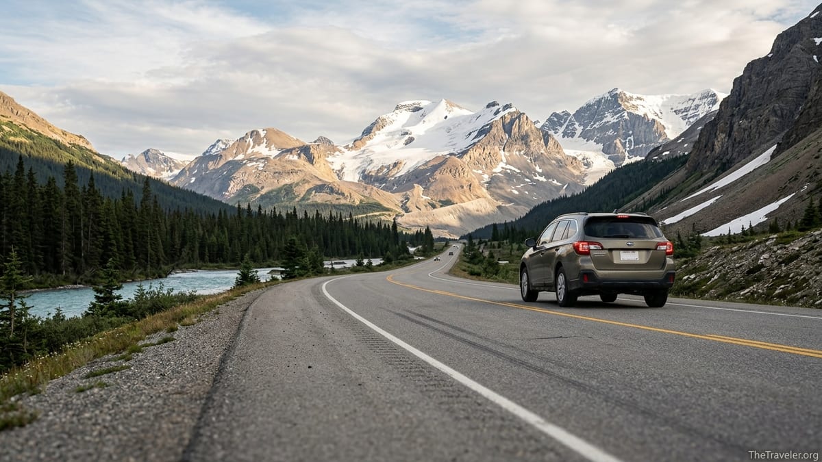
The Icefields Parkway, officially Highway 93 North, connects Lake Louise and Jasper over about 230 kilometers of spectacular alpine scenery. Even though the distance looks short on a map, most travelers allow six to eight hours for this drive because of the many stops at lakes, waterfalls and short viewpoints. Famous highlights include Bow Lake, Peyto Lake, the Columbia Icefield, Athabasca Falls and Sunwapta Falls, each a short walk from large parking areas directly off the highway.
Cell coverage is limited on the Icefields Parkway, with only patchy service near the Columbia Icefield visitor area in peak season. Fuel is available at Saskatchewan River Crossing and at the Columbia Icefield in summer, but prices here are often noticeably higher than in Banff, Jasper or Lake Louise. Many drivers fill their tank in Lake Louise or Jasper before setting out, then top up only if necessary at Saskatchewan River Crossing. Services like restaurants and basic groceries exist at both Saskatchewan River Crossing and the Icefield Centre, but choice is modest and food is often more expensive than in town, so carrying snacks, a picnic lunch and water is sensible.
Driving conditions are generally straightforward in July and August with dry pavement and long daylight, though mid summer brings heavy traffic and parking congestion at the most popular viewpoints from late morning through mid afternoon. Experienced visitors often leave Lake Louise around 7 am, stop first at Bow Lake while the water is calm, then reach Peyto Lake before the main tour buses. They might plan a longer break at the Icefield Centre around midday and arrive in Jasper by late afternoon. In shoulder season, expect a mix of dry pavement, rain and occasional wet snow, especially near Bow Pass and the Columbia Icefield, so stay flexible on timing.
In winter, the Icefields Parkway is a remote high mountain road that can close temporarily for avalanche control or hazardous driving conditions. Snow tires with the mountain snowflake symbol are mandatory during the cold season, and drivers should carry warm clothing, blankets and emergency food even if only traveling between Jasper and Lake Louise. Many rental cars picked up in Calgary or Vancouver come equipped with all season tires by default, which are not ideal for heavy snow. If you are planning a winter Rockies road trip, ask the rental company specifically about winter tire availability in advance and consider postponing the Icefields Parkway section if a storm is forecast.
Vancouver and Vancouver Island: coastal start and finish
Most international visitors begin their road trip in Vancouver, often spending two or three nights in the city before picking up a rental car. Major international brands like Hertz, Avis, Enterprise and Budget all operate from Vancouver International Airport and downtown locations. If you plan to spend a few days car free in the city using the SkyTrain and buses, it often makes sense to wait and pick up your rental on the morning you depart, which saves several days of rental fees and expensive hotel parking. Daily parking in downtown Vancouver hotels can easily add an extra amount comparable to a good dinner per night to your budget.
Vancouver itself rewards at least a full day of exploring on foot or by bike. Travelers commonly rent a bike near Denman Street to ride the Seawall around Stanley Park, visit Granville Island Public Market for local food, and walk or cycle the False Creek waterfront. Those with a car might drive up to the Capilano Suspension Bridge or Lynn Canyon on the North Shore for a taste of temperate rainforest and canyon scenery. Because city traffic around the bridges can be heavy at rush hour, many road trippers leave the city after 9 am or in early afternoon once commuter traffic has eased.
If time allows, adding Vancouver Island to your Western Canada road trip provides a quieter contrast to the Rockies. You can take a vehicle ferry from the mainland to Nanaimo or Victoria and then drive up the island to places like Parksville, Pacific Rim National Park near Tofino or the Cowichan Valley. Ferries operate year round but summer sailings can sell out, so reservations are recommended if you are traveling with a car in July or August. Fuel and grocery prices on Vancouver Island are similar to or slightly higher than in Metro Vancouver, so there is no need for special planning beyond normal road trip habits, though filling up in larger centers like Nanaimo or Courtenay will usually be cheaper than small coastal villages.
Many visitors either start with Vancouver Island, then cross back to the mainland and drive the interior to the Rockies, or save the island for the end as a relaxing finish. A two week loop might look like this in practice: three nights in Vancouver, three on Vancouver Island near Tofino or Ucluelet, one in Kamloops or Salmon Arm, three in the Banff and Lake Louise area, two in Jasper and one final night in Kamloops or Kelowna before returning to Vancouver to fly home.
Rental cars, fuel costs and practical road trip budgeting
Rental cars are widely available in Vancouver and Calgary, with most major brands operating multiple locations. Compact and midsize sedans remain the most economical choice, but many travelers prefer a small SUV for the extra ground clearance and cargo space. During peak summer, a compact car rental might average the cost of a mid range hotel dinner per day, while a midsize SUV can cost noticeably more, especially if booked last minute. Booking several months ahead and being flexible with pick up locations, such as choosing a neighborhood off airport office, often lowers the price.
Fuel in British Columbia and Alberta is sold by the litre and prices vary by region and market conditions. In August 2026, unleaded gasoline in Metro Vancouver has often hovered around the equivalent of several US dollars per gallon, with slightly lower prices in the BC interior and Alberta. Remote locations along the Icefields Parkway or in small mountain communities tend to charge a premium compared with large centers such as Kelowna, Kamloops, Calgary or Edmonton. As a rough budgeting guideline, a typical compact rental car might average 6 to 8 litres per 100 kilometers on the highway, while a small SUV might consume 8 to 10 litres, so a 2 000 kilometer loop could require 160 to 200 litres of fuel plus local driving.
Drivers who want to keep costs under control often choose a fuel efficient compact or hybrid and plan fuel stops at major centers. For instance, you might fill up in Abbotsford rather than Vancouver city, top up again in Kamloops or Salmon Arm, then in Revelstoke or Golden before entering the national parks where prices are higher. In the Rockies, many people plan to fill up in Canmore or Banff before driving to Lake Louise, in Lake Louise before the Icefields Parkway, and again in Jasper before longer day trips such as Maligne Lake.
Beyond fuel and rental fees, remember to budget for park passes, parking and attractions. In the town of Banff and at Lake Louise, paid parking is common during the main season and can run to several dollars per hour or more in central lots. Popular experiences such as the Banff Gondola, Columbia Icefield snowcoach tours or guided hikes to glaciers come with additional charges that can rival a night’s accommodation for a couple or family. To balance the budget, many road trippers mix one or two major paid activities with free or low cost hikes and scenic drives, picnicking at lakes like Two Jack, Johnson Lake, Moraine Lake or Pyramid Lake near Jasper.
Mountain driving, safety and seasonal conditions
The major highways that connect Vancouver with Banff and Jasper are modern, well engineered roads, but they still cross high passes and narrow valleys where weather can change quickly. In summer, the main hazards are wildlife on or near the road, rockfall zones and traffic slowdowns due to construction. It is common to see warning signs for elk, deer, bighorn sheep or even bears near Banff and Jasper. When you see stopped cars ahead or animals near the shoulder, slow down and resist the urge to stop in the traffic lane for photos, which is both dangerous and illegal in many signed wildlife corridors.
Steep grades on sections like the Coquihalla Highway, Rogers Pass and Kicking Horse Pass require attention to braking. When descending long hills, shift your automatic transmission down a gear to let the engine assist with braking rather than riding the brake pedal continuously. Many rental SUVs have this manual gear selection built into the shift lever. A common real world example is the downhill section eastbound from Rogers Pass toward Golden: truckers and experienced drivers will drop into a lower gear well before the long descent and maintain a safe speed rather than trying to slow suddenly part way down.
Weather is highly variable. On a summer road trip you might leave Vancouver in mild drizzle, reach Kamloops in 30 degree Celsius heat, then encounter cool mountain air and even fresh snow near the Columbia Icefield on the same day. Packing layers, including a warm fleece, waterproof shell, hat and gloves, is wise even in July. In shoulder seasons, early morning frost and late afternoon storms can make the pavement slick. Before setting out each day, many travelers check provincial highway conditions through local radio or smartphone apps when coverage is available, and they build in extra time so unexpected delays do not force rushed driving late at night.
From October through April, snow, black ice and reduced daylight make this a very different trip. British Columbia posts specific winter tire or chain requirements on many mountain highways during this period, and rental cars may not automatically meet these standards. If you are not confident driving in winter conditions, consider traveling between Calgary, Banff and Lake Louise only, using shuttles and local transit for some legs, or save the full Vancouver to Rockies road trip for late spring to early autumn when conditions are considerably easier.
Suggested itineraries and realistic pacing
A classic two week Western Canada itinerary that balances driving and exploration might look like this. Days 1 to 3 are spent in Vancouver without a car, walking the seawall, visiting Stanley Park and taking a day trip to the Capilano Suspension Bridge or Grouse Mountain. On Day 4, you pick up a rental car, drive to Kamloops or Salmon Arm and stay overnight, stopping at places like Bridal Veil Falls near Chilliwack and exploring the Shuswap Lake region in the afternoon.
On Days 5 to 7, you continue to the Rockies, arriving in Banff or Canmore and spending several days exploring Bow Falls, Lake Minnewanka, Johnston Canyon and Lake Louise. Many travelers choose an early shuttle or sunrise start to reach Lake Louise before parking fills, then reward themselves with lunch at a lakeside cafe. Day 8 could be reserved for the Icefields Parkway, leaving Lake Louise early, stopping at Bow Lake, Peyto Lake, the Columbia Icefield and Sunwapta Falls, and arriving in Jasper in the early evening.
Days 9 and 10 might focus on Jasper, with time for Maligne Canyon, Medicine Lake, Maligne Lake and a ride on the Jasper SkyTram. Short family friendly hikes like the Valley of the Five Lakes can easily fill a morning. From Jasper, you can return toward Vancouver via Highway 5 through Valemount and Clearwater, perhaps spending a night near Wells Gray Provincial Park to see Helmcken Falls or Spahats Falls. The final days are then spent driving back to Vancouver, dropping off the car and flying out.
For travelers with only 7 to 9 days, it often makes sense to skip Vancouver Island and focus on Vancouver plus the Rockies, or to fly into Calgary and out of Vancouver to avoid backtracking. Example: fly into Calgary, spend three nights in Banff and Lake Louise, drive the Icefields Parkway to Jasper for two nights, then drive west via Highway 5 for one night in Kamloops before finishing in Vancouver for two nights and flying home. This kind of one way itinerary reduces total driving hours while still covering the signature scenery.
The Takeaway
A Western Canada road trip from Vancouver to Banff, Jasper and the Icefields Parkway connects some of the country’s most iconic landscapes in a single, cohesive journey. With solid planning, realistic driving days and an understanding of how park passes, fuel costs and mountain weather work in practice, the trip is well within reach for confident drivers who are new to Canada.
The keys to success are to give yourself enough time, book rental cars and key stays such as Banff, Lake Louise and Jasper well in advance, and stay flexible about daily plans in response to weather and road conditions. Mix headline sights like the Icefields Parkway and Lake Louise with quieter lakes, forest trails and small towns so that the trip feels like a series of discoveries rather than a checklist.
Whether you start with Vancouver’s oceanfront skyline, add the surf beaches and rainforests of Vancouver Island, or go straight for the jagged peaks of the Rockies, this loop rewards unhurried travel. If you treat the road itself as part of the experience, not just a way to get between destinations, you will see why many travelers return to drive these highways again and again.
FAQ
Q1. Do I need a rental car for a Western Canada road trip, or can I rely on buses and tours
For a classic loop that includes Vancouver, the BC interior, Banff, Jasper and the Icefields Parkway, a rental car or your own vehicle gives you far more flexibility than public transit. There are long distance buses and sightseeing tours between Calgary and Banff or along parts of the Icefields Parkway, but there is no single network that covers the entire route on a convenient timetable, especially for side trips to places like Wells Gray Provincial Park or small Okanagan towns.
Q2. Is it better to start the Rockies road trip in Vancouver or Calgary
Both work, but the choice depends on your priorities. Starting in Vancouver lets you enjoy the Pacific Coast and possibly Vancouver Island, then build toward the Rockies. Starting in Calgary shortens the distance to Banff and Jasper, which is useful if you have less than a week. Many travelers choose an open jaw ticket, flying into Calgary and out of Vancouver or vice versa, so they do not need to drive the same highway twice.
Q3. How many days should I spend in Banff and Jasper
For a first visit, three to four nights in the Banff and Lake Louise area and two or three nights in Jasper is a comfortable minimum. This gives you time for at least one full day around Lake Louise and Moraine Lake, a day for Banff town and nearby hikes, and a day or two in Jasper for Maligne Lake, Maligne Canyon and shorter trails. With extra time, you can add rest days or more ambitious hikes without feeling rushed.
Q4. Do I need a 4x4 or SUV for the drive between Vancouver and the Rockies
In summer, a regular two wheel drive car is sufficient for the main highways and most popular attractions, since roads to places like Lake Louise, Maligne Lake and the Icefields Parkway are fully paved. A small SUV can be more comfortable if you have a lot of luggage or plan to use gravel side roads to trailheads, but it is not essential. In winter, an all wheel drive vehicle with proper winter tires is strongly recommended, yet even then road closures and storms can still affect travel plans.
Q5. When is the best time of year to drive the Icefields Parkway
The most popular time is late June through early September, when days are long, most services are open and lakes like Peyto and Bow show their intense turquoise color. May and late September can be quieter and just as beautiful, but you are more likely to encounter mixed weather and some snow on high passes. From late fall through early spring, conditions can be severe and the road may close temporarily, so the Parkway is best reserved for confident winter drivers or visited on a guided tour.
Q6. Can I visit Lake Louise and Moraine Lake with my own car
Access rules change periodically, but in recent years parking at these lakes has been very limited and often sells out early each day. Many visitors book shuttle buses from Lake Louise village or use regional transit options from Banff or Canmore to avoid parking stress and to comply with access regulations. It is wise to check current Parks Canada guidance a few months before your trip and again shortly before you arrive, then build your daily plan around whatever system is in place that season.
Q7. How expensive is fuel on this route compared with the United States or Europe
Fuel prices fluctuate, but in general petrol in British Columbia and Alberta is more expensive than in many parts of the continental United States and somewhat comparable to or slightly lower than prices in many Western European countries. Within Canada, Metro Vancouver and small, remote communities tend to be on the higher end, while larger interior towns and Alberta cities often have somewhat lower prices. To keep costs manageable, many travelers plan to fill up in major centers and only top up in very remote locations if necessary.
Q8. Is it safe to sleep in my car at trailheads or roadside pullouts in the Rockies
Overnight parking and sleeping in vehicles is regulated in both British Columbia and the national parks. In many areas, camping outside designated campgrounds is prohibited, and rangers may ask you to move on or issue a fine. For safety, comfort and wildlife protection, it is better to reserve official campgrounds or stay in hotels, hostels or cabins. Some travelers use commercial campgrounds in places like Revelstoke, Golden, Canmore and Jasper that offer both tent sites and powered RV sites.
Q9. Do I need any special permits besides the national park pass
For most visitors, the main requirement is a valid Parks Canada entry pass. If you plan to fish inside the national parks, you will need a specific national park fishing permit, which is separate from provincial licenses. Backcountry camping in Banff, Jasper, Yoho or Kootenay also requires reservations and permits. Standard day hikes and scenic drives do not require extra permits beyond the park pass.
Q10. Can I do this road trip with children or older travelers
Yes, the Vancouver to Rockies route works very well for families and multi generational groups as long as you plan shorter driving days and build in rest stops. Many viewpoints and lakes along the Trans Canada Highway and Icefields Parkway are only a short, flat walk from parking areas, which suits strollers and less mobile travelers. Booking two night stays where possible, especially in Banff, Lake Louise and Jasper, helps everyone rest between long driving days and makes the trip more enjoyable for all ages.