


Stand on a grassy cliff in Nova Scotia at low tide and the Bay of Fundy can look almost impossibly far away, a gleam of water beyond red mudflats and stranded boats. Return six hours later and the same spot may feel like the edge of an inland sea, waves lapping against wharves and cliffs that were completely dry before. Nowhere is this vertical swing more dramatic than along the Minas Basin and the north shore of the Bay of Fundy, where visitors can watch, measure and even walk across one of the greatest tidal ranges on Earth.
Why the Bay of Fundy’s Tides Become Extreme in Nova Scotia
The Bay of Fundy’s famous tides are not uniform from one end of the bay to the other. What visitors see in Nova Scotia is the result of geography, underwater topography and timing. The bay is shaped like a long funnel, widening at its mouth between New Brunswick and Nova Scotia and narrowing as it pushes inland toward the Minas Basin and Cobequid Bay. As each Atlantic tide flows into this narrowing space, the same volume of water is squeezed into a smaller area, so the tide climbs higher along the shores.
On top of this funnel effect is resonance. The time it takes for a wave to slosh from the mouth of the bay to the inner basins and back again is very close to the natural period of the Atlantic tides, a little over 12 hours. That means each new tidal pulse from the open ocean arrives just as the older pulse is returning, reinforcing it and increasing the range. The closer you travel toward the Minas Basin and its narrow inlets, the stronger this amplification becomes, which is why coastal communities like Burntcoat Head, Five Islands and Parrsboro can see much larger vertical changes than locations nearer the open Gulf of Maine.
It is important not to assume every Fundy location experiences the same extremes. The vertical tidal range at Burntcoat Head may exceed 14 or 15 metres during certain spring tides, while parts of the outer Fundy coast closer to Digby or Yarmouth see much more modest swings. Even within Nova Scotia, the tides at Halifax on the Atlantic side of the province bear little resemblance to the giant rise and fall of the Minas Basin, despite being only a few hours’ drive away.
For travelers, this means that “seeing the Bay of Fundy tides” is not a single experience. Watching boats in Hall’s Harbour settle on the harbour floor at low water, walking on the sea bottom at Burntcoat Head, and exploring the fossil cliffs at Joggins all involve the same bay-wide tidal system, but what you actually see on the ground varies dramatically by location and by how carefully you plan around the tide tables.
Reading Real Tide Data: Burntcoat Head as a Case Study
Burntcoat Head Park on Nova Scotia’s south shore of the Minas Basin has become one of the clearest windows into Fundy’s extremes. The community of Burntcoat is widely cited as the location of the world’s greatest recorded tidal range, and on big spring tides the waterline can shift vertically by more than a four-storey building between low and high tide. Visitors come here specifically to walk on the exposed red seabed at low water, then return a few hours later to watch waves push almost to their feet.
Understanding what you will see requires reading real tide predictions rather than relying on slogans. For example, on October 28, 2026, the official Canadian tide predictions for Burntcoat Head show a low water of approximately 0.769 metres at 09:05 and a high water of about 14.779 metres at 15:04. In plain terms, the ocean surface at that spot was forecast to climb roughly 14 metres in about six hours. That is an extraordinary change, but it is not a permanent daily value. On smaller neap tides the range is several metres less, and exact heights shift from day to day, month to month and year to year.
For a visitor standing on the shore, those numbers translate into specific experiences. Arriving at Burntcoat Head Park around 08:30 on October 28, 2026, you would have seen the Minas Basin drawn far back from the cliffs, with the red sandstone and mudstone floor fully exposed, shallow rivulets crossing the flats and the flowerpot sea stacks completely isolated on dry ground. If you had stayed through early afternoon, the same spot would have transformed as the incoming tide pushed across the seabed, swallowed tide pools and finally reached the base of the staircase that leads to the beach. By 15:04, areas that were solid walking surface at breakfast time would have been more than head-deep underwater.
When planning a visit, this case study shows why you should pull real-time or seasonal predictions from a trusted tide source naming “Burntcoat Head” or very close reference points, and then build your day around the low-tide window if you want to walk the sea floor. Using historical examples like October 28, 2026 as a template can help you understand the scale, but every actual trip should be based on the dates you will be there.
Burntcoat Head Park: Walking Safely on the Sea Floor
Burntcoat Head Park itself is a compact but carefully managed site that makes the Bay of Fundy’s extremes easy to grasp. The park sits on a low headland surrounded by cliffs of red sandstone and siltstone. A lighthouse replica houses a small interpretive centre explaining why the tides are so high, and a network of trails leads to viewing platforms where visitors can watch the rapid rise and fall from safe ground if they prefer not to go down to the beach.
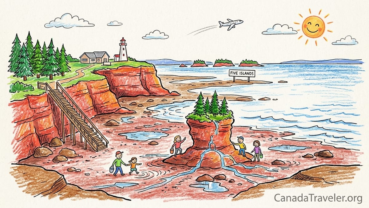
The signature experience, though, is walking on the seabed. At low tide, a long stairway leads from the bluff down onto the exposed intertidal zone. The red “beach” underfoot is not a conventional sandy shore but the actual top of the basin’s sedimentary rocks, covered in patches of soft mud and cobbles. During big lows, you can circle the base of flowerpot sea stacks, examine ripple marks in the rock and look up at cliffs that will be lapped by waves in only a few hours. The reason this walk is possible is simple: the vertical difference between the predicted high and low waters can exceed 10 metres, which is enough for the waterline to retreat hundreds of metres horizontally across a shallow shelf.
Because that water returns quickly, safety is built around timing. Burntcoat Head Park staff publish suggested beach-access windows based on daily tide tables, and during the core season they offer guided ocean floor tours that depart close to low water and last about 60 to 90 minutes. On a high-range day like October 28, 2026, a typical safe window for general visitors might be from about two hours before low tide until roughly two hours afterward. Outside that period, the stairway can be closed as the rising tide cuts off parts of the seabed and channels fill deep enough to be hazardous.
Visitors should come prepared as if they were walking on a streambed rather than a dry trail. Waterproof hiking boots with good grip, or rubber boots, handle the mix of slick mud and small rocks far better than open sandals. On days when the park has experienced heavy rain, expect deeper mud patches and small pools. One simple practical tip is to take a photo looking back at the stairs or cliffs every 20 minutes. Comparing these images makes it obvious how quickly the waterline creeps inland, especially in the final two hours before high tide, and encourages you to retreat to higher ground in plenty of time.
Why Halifax Tide Times Cannot Stand In for Burntcoat Head
Many first-time visitors to Nova Scotia fly into Halifax and are tempted to use “Halifax tide times” as a rough guide for day trips around the province. This works reasonably for nearby beaches on the Atlantic shore, but it breaks down completely when you cross to the Bay of Fundy side. The Bay of Fundy’s inner basins are part of a different system with much greater amplification, and even the timing of high and low water lags noticeably behind what is predicted for the Halifax waterfront.
To see why, it helps to remember the bay’s funnel shape. The Atlantic tide first reaches the wider mouth of Fundy, then surges inward through Chignecto Bay and the Minas Channel, and finally sloshes into the Minas Basin and Cobequid Bay. Each of these steps introduces delays. High tide at Burntcoat Head can occur several hours later than in Halifax on the same day, and the vertical range is many times larger. Relying on Halifax tables might easily place you on the sea floor at Burntcoat or Joggins while the tide is already racing back in.
For example, on a day when Halifax might list low tide mid-morning, Burntcoat Head could experience low tide closer to late morning or even midday. The discrepancy is not a fixed offset, so visitors cannot simply add a set number of hours. Transport Canada’s official tide tables list separate stations for Halifax, Burntcoat Head and points along the Fundy shore for exactly this reason. When planning a trip that involves walking on the seabed, it is critical to select the table that matches your destination, whether that is Burntcoat Head, Parrsboro, Advocate Harbour, Five Islands or Joggins.
In practice this means that a visitor driving from Halifax to Burntcoat Head for a low-tide walk needs two pieces of information before leaving: the Burntcoat Head low-tide time on the specific date of travel, and an honest estimate of driving time. Online mapping tools generally show about 1 hour 15 minutes to 1 hour 30 minutes from central Halifax in good conditions. Building in an extra 30 minutes for traffic and a quick stop in Truro or nearby Shubenacadie can mean the difference between arriving to a wide, walkable sea floor or finding that the stairway is already closed as the rising tide approaches.
Comparing Key Viewpoints: What You Actually See
Although the same tidal pulse drives all of the locations described here, each site frames the tide differently. Travelers trying to choose between Burntcoat Head, Five Islands, Cape Chignecto, Hall’s Harbour, Parrsboro and Joggins should think less in terms of which place has “the highest tide” and more about what they want to observe with their own eyes and cameras.
At Burntcoat Head, the emphasis is on personal scale. You stand on the sea floor next to flowerpot rock pillars and watch the rising wall of water erase your footprints. The cliffs are modest in height compared with some parts of the Fundy coast, but the intimate feel makes the vertical change easy to grasp. Interpretive panels explain the numbers, and guides can point out where the high-water line normally reaches on the cliffs so you can imagine the full 10 to 15 metres of lift.
Five Islands Provincial Park, east of Parrsboro, offers sweeping long-distance views. Here the intertidal zone is extremely broad, and at low tide the sea retreats so far that the five offshore islands of basalt and sedimentary rock seem marooned in a vast mudflat. From the headland campground and day-use area, you can look out over this plain and watch channels wriggle and shift as the tide drains out, then see the same depressions refill on the flood. The cliffs expose layers of Triassic and Jurassic rocks related to the breakup of the supercontinent Pangaea, and the Cliffs of Fundy UNESCO Global Geopark uses the site as one of its outdoor classrooms for explaining rifting and lava flows.
Cape Chignecto, farther west near Advocate Harbour, is where Fundy’s wild energy meets big topography. Here a protected provincial park encloses more than 180 metres of cliffs that rise almost sheer from the bay, so you never walk as far across a horizontal seabed as at Burntcoat Head or Five Islands. Instead, you hike high coastal trails and watch the tide surge and retreat far below, sometimes revealing sea caves and rock arches that are completely washed at high water. Backpacking loops and sea-kayaking tours both rely heavily on tide timing, using low-slack periods to round headlands and cross coves safely.
Hall’s Harbour, on the opposite side of the province along the north shore of the Annapolis Valley, offers a human-scaled demonstration using fishing boats. This sheltered harbour has a tidal gate opening to the Bay of Fundy. At high tide, boats float nearly level with the wharf decks and diners at the waterfront restaurant can look across at masts. At low tide, however, the water drains almost completely and the same vessels sit upright on the harbour floor, leaning into their mooring lines against timber pilings that now tower above them. It is an effective way to visualize a 10-metre vertical swing using familiar objects.
Parrsboro and the surrounding “Parrsboro Shore” sit in the middle of these experiences. From the small town’s waterfront you can see a working harbour at high tide and expansive mudflats and exposed channel banks at low tide. Drive a short distance east or west and you reach sites like Partridge Island and Wasson Bluff, where cliffs reveal dinosaur-age rocks, fault lines and mineral veins. The Cliffs of Fundy UNESCO Global Geopark includes several stops here, so geology-focused travelers can watch the Fundy tide do its work in sculpting the shore and then walk up to observe fossils and minerals in the exposed faces.
Joggins, on the inner shore of the Cumberland Basin near the Nova Scotia–New Brunswick border, combines a dramatic tidal range with globally significant fossils. At the Joggins Fossil Cliffs, recognized as a UNESCO World Heritage Site, the receding tide opens up a long, gently sloping beach at the base of coal-bearing cliffs. As the water pulls back, new layers of shale and sandstone crumble and fall, revealing 300-million-year-old plant fossils, tree stumps and occasional footprints of early land animals. The contrast between the fast-moving modern tide and these ancient forest remains on the beach is one of the reasons UNESCO singled out Joggins for protection.
Cliffs of Fundy Geopark vs Joggins World Heritage Site
Travel planning along this stretch of coast is occasionally complicated by similar-sounding designations. Joggins Fossil Cliffs hold a UNESCO World Heritage Site listing focused on the global geological importance of the Carboniferous-age fossils and rock exposures there. This status recognizes Joggins as a site of “outstanding universal value” because of the record it preserves of life in coal-forming swamp forests roughly 310 to 315 million years ago. The visitor centre, guided walks and research use at Joggins all revolve around this deep-time story.
The Cliffs of Fundy UNESCO Global Geopark, by contrast, is a much larger landscape designation that extends along the north shore of the Minas Basin and parts of the upper Bay of Fundy in Nova Scotia. It includes sites from Debert and Truro through Five Islands and Parrsboro to Cape Chignecto and Advocate Harbour. The geopark’s mission is to interpret the region’s geological history, from the opening of the Atlantic Ocean to more recent glacial and tidal processes, and to connect that story with local communities, Mi’kmaq cultural heritage and sustainable tourism. It is not a World Heritage Site, although it is part of UNESCO’s separate Global Geoparks network.
For visitors, the practical difference is that Joggins is a single, compact destination anchored by a dedicated interpretive centre and a defined section of coastline, whereas the Cliffs of Fundy Geopark is a string of viewpoints, trails and communities spread over more than 100 kilometres. You might spend an afternoon at Joggins timing your beach walk between the centre’s posted safe tide windows, then devote several days to driving and hiking between geopark stops like Five Islands Provincial Park, Cape Chignecto and Wasson Bluff.
It is possible, and rewarding, to visit both. For example, a geology-focused traveler might schedule a morning low tide at Joggins to explore the Carboniferous fossil beach, drive south via Amherst and Parrsboro, and then spend the next day walking lava flows and fault exposures at Five Islands and Cape Chignecto. Throughout, the same Fundy tide will be rising and falling around you, but in very different settings and rock types.
Guided Walks, Safe Windows and Rising-Tide Risks
Because the Bay of Fundy’s tides change the coastline so quickly, guided experiences and clearly posted tide windows are more than just conveniences. They are core safety tools. At Burntcoat Head Park, staff use official tide tables to calculate when the beach stairs will be open and when they must be closed to prevent visitors from being cut off. Guided ocean-floor walks depart near low water and usually return to the base of the stairs at least an hour before the tide reaches potentially hazardous levels.
Joggins Fossil Cliffs operates in a similar way. The visitor centre maintains a yearly tide schedule and marks “green” or recommended beach access periods when both the water level and daylight align for safe guided or self-guided exploration. Outside these windows, parts of the beach narrow significantly and the risk of being trapped against the cliff by a rising tide increases. Staff often remind guests that the safest fossils to examine are on loose blocks on the beach surface and that removing or hammering into the bedrock is prohibited.
Along the Cliffs of Fundy Geopark, commercial guides and park rangers at sites like Five Islands and Cape Chignecto also plan hikes and paddling trips around the tide. Sea-kayak outfitters based in Advocate Harbour, for instance, typically schedule departures to take advantage of high slack water when cliffs can be approached safely and then use the ebb to help carry paddlers back. On certain routes, a misjudged tide can mean confronting strong currents around headlands or discovering that a landing beach has vanished under water.
For independent travelers, a few practical rules go a long way. Always check tide predictions for the exact location and date using a current table or a reliable tide app. Treat posted closure times and staff advice as firm. If you are walking on the seabed, identify clear exit points as you go and be prepared to turn around earlier than planned if the water seems to advance quickly. It is helpful to imagine the incoming tide not as a gentle rise in place but as a river flowing inland, filling channels from the outer bay toward you.
Footwear, Clothing and Dealing With Tidal Cut-Offs
The same properties that make Fundy’s sea floor fascinating also make it messy. The red mud and clay-rich sediments that line much of the Minas Basin cling stubbornly to shoes and can be extremely slippery. In places like Burntcoat Head and Five Islands, the safest footwear for most visitors is a pair of waterproof hiking boots or sturdy rubber boots that support the ankle and provide grip on wet rock and mud. Many families travelling by car from Halifax or Moncton keep a pair of inexpensive rubber boots in the trunk specifically for Fundy beach days.
On the rockier shores near Cape Chignecto and parts of Parrsboro, closed-toe sandals with aggressive tread or light hiking shoes work well, but they will still be exposed to salt water and mud. It is worth packing a plastic bag and an old towel so that muddy footwear can be contained before getting back into a rental car. Clothing layers are essential in all seasons. Even in July and August, wind off the bay can feel cool, especially when you are standing on wet rock in the shadow of cliffs.
Tidal cut-offs are one of the most serious hazards. On some beaches, shallow depressions that are dry at low tide become deep channels as the water races in, turning an easy strolling route into a moat that blocks the way back to your access stairs or trail. This is a particular risk around headlands and sea stacks. At Burntcoat Head, guides often point out low-lying gullies that fill early on the flood, effectively turning isolated patches of rock into islands. The safest strategy is to explore outward along the shore on the ebbing or low tide, then begin working back toward your exit as soon as you notice the waterline starting to rise.
If you do find yourself unexpectedly cut off, the priority is always to move to the highest available ground and signal for help rather than trying to wade or swim across a newly flooded channel. The water in the Bay of Fundy is cold even in summer, and tidal currents can be deceptively strong. In popular locations such as Burntcoat Head Park and Joggins, staff monitor beach access during core hours, another reason to time your visit when facilities are open rather than during a solitary early-morning low tide.
Building a One-Day or Overnight Route Around the Tides
Because Fundy’s tides are predictable, you can reverse the usual approach to trip planning. Instead of picking attractions first and checking the tides later, start by looking up the low and high tides for Burntcoat Head, Five Islands or Joggins on the date you expect to travel, then design a day that treats each tide change as a highlight. Below is an example of how a family, a photographer and a geology-focused traveler might structure a shared route around real tidal windows, assuming a day with a late-morning low and an early-evening high.
Imagine it is a summer Saturday and the tide table for Burntcoat Head lists low water around 10:30 and high water around 16:40. A family based in Halifax could leave the city around 08:00, reach Burntcoat Head Park by 09:30, and head straight down to the sea floor during the falling tide. With rubber boots and a picnic packed, they could spend 90 minutes walking around the flowerpot rocks, making sure to be back at the stairs by about 11:30 as staff begin to restrict access. Lunch on the bluff would give the children a chance to see how much of the area they just explored is already underwater.
From mid-afternoon, the same family might drive north via Truro to Parrsboro, checking into a small inn or seaside motel for the night. As the tide approaches late-afternoon high, they could stroll the town’s waterfront, watching boats ride high in the harbour and comparing the scene to photographs taken earlier at Burntcoat. Dinner at a local restaurant would complete the day, and if they stay overnight they could plan a morning stop at Five Islands Provincial Park the next day, catching the start of the ebb as the broad mudflats begin to emerge.
A photographer following the same tide pattern might tweak the schedule. They could still reach Burntcoat Head for the late-morning low, but they would likely stay through early afternoon to capture the drama of the flood, shooting time-lapse sequences of the water racing across the seabed or using a telephoto lens to frame the rising tide against the lighthouse and cliffs. Later in the day, they might position themselves at Hall’s Harbour for the evening high to catch boats afloat in soft golden light, then return at dawn the next morning for low tide images of the same vessels resting on the harbour floor. Comparing these paired shots would tell a clear visual story of the bay’s vertical range.
Geology-focused travelers could design an overnight route that strings multiple tide-sensitive sites together. On the same hypothetical weekend, they might start even earlier from Halifax, drive directly to Joggins to catch an early-morning low tide, and join a guided fossil walk from the visitor centre. After two or three hours on the beach, they would drive south through Amherst and Parrsboro, reaching Five Islands in mid-afternoon as the next low tide approaches there. Standing on the basalt headlands, they would watch channels carve through the mudflat and compare this modern erosion with interpretive signs explaining how much older lava flows and sedimentary layers were laid down.
That evening, they could continue around the shore to Advocate Harbour and check into a small lodge that caters to hikers and paddlers. The next morning, they would rise early to walk a section of the Cape Chignecto coastal trail, timing their route so that low tide reveals sea caves and coves beneath the towering cliffs. In just 36 hours, this circuit would let them experience the same Fundy tide shaping very different rock types and landscapes, all while following tide tables as closely as weather forecasts.
The Takeaway
Watching the Bay of Fundy’s tides in Nova Scotia is not just about standing on a cliff and hearing a big number quoted over a loudspeaker. It is about matching those numbers to what your eyes and feet experience as harbours empty, mudflats widen and cliffs alternately tower over dry rock and breaking surf. The vertical range is greatest toward the inner Minas Basin, but each viewpoint from Burntcoat Head to Joggins presents the tide in a unique frame.
The keys are specificity and timing. Use tide predictions for the exact places you plan to visit, such as Burntcoat Head, Five Islands, Hall’s Harbour, Parrsboro, Cape Chignecto and Joggins, instead of generic “Fundy” or Halifax tables. Decide whether you want to walk on the sea floor, watch boats settle on harbour bottoms, or explore cliffs and fossils, then plan your day around low or high water accordingly. Combine that precision with practical gear like rubber boots and layers, and a cautious respect for how quickly the tide races back in.
Done well, a Fundy-focused itinerary turns each change of tide into the day’s main event, whether you are photographing flowerpot rocks disappearing under water or watching children race the rising edge of the flood back to the stairs at Burntcoat Head Park. In a province full of forests, beaches and historic towns, the Bay of Fundy’s tides remain Nova Scotia’s most vivid, time-sensitive show, a performance that repeats without fail yet looks different every single day.
FAQ
Q1. Do I really need to check separate tide tables for Burntcoat Head instead of using Halifax?
Yes. Burntcoat Head is in the Minas Basin, where tides are delayed and amplified compared with Halifax on the Atlantic coast. Using Halifax times can put you on the sea floor while the tide is already racing in at Burntcoat.
Q2. How much does the tide actually change at Burntcoat Head?
The vertical range varies. On October 28, 2026, the forecast low water was about 0.769 metres at 09:05 and high water about 14.779 metres at 15:04, roughly 14 metres of change. On other days, especially around neap tides, the range is smaller.
Q3. When is it safe to walk on the sea floor at Burntcoat Head Park?
Safety depends on the day’s tides and park guidance, but a common rule is to walk within roughly two hours before and after low tide and to be back at the stairs well before mid-tide. Always follow park staff instructions and posted closure times.
Q4. Can I see dramatic tides at Five Islands without going down to the mudflats?
Yes. From the campground and day-use lookoffs in Five Islands Provincial Park you can watch the sea retreat far from shore at low tide and then refill broad channels and coves, even if you choose to stay on dry ground.
Q5. What makes Joggins different from other Fundy sites?
Joggins Fossil Cliffs is a UNESCO World Heritage Site recognized for its Carboniferous fossils. The receding tide exposes a beach at the base of coal-bearing cliffs where you can see ancient tree stumps and plant fossils that are not present at most other Fundy viewpoints.
Q6. Is the Cliffs of Fundy UNESCO Global Geopark the same as a World Heritage Site?
No. The Cliffs of Fundy is a UNESCO Global Geopark, a broader landscape designation focused on geology, culture and sustainable tourism along the Fundy coast. Joggins Fossil Cliffs separately holds World Heritage status for its exceptional fossil record.
Q7. What kind of footwear should I bring for walking on Fundy sea floors?
Waterproof hiking boots or rubber boots with good traction are ideal for muddy and rocky intertidal zones at places like Burntcoat Head and Five Islands. On rockier shores such as parts of Cape Chignecto, sturdy closed-toe sandals or light hikers also work if you do not mind them getting wet and dirty.
Q8. How risky are tidal cut-offs for casual visitors?
Tidal cut-offs are a real hazard wherever shallow channels fill quickly, especially near headlands and sea stacks. At busier sites like Burntcoat Head and Joggins, staff reduce the risk by limiting access windows, but you should still watch the waterline, know your exit routes and retreat early if in doubt.
Q9. Can I see the big Fundy tides on a quick day trip from Halifax?
Yes. Burntcoat Head Park and Hall’s Harbour are both within roughly 90 minutes’ drive of Halifax in good conditions. With careful use of tide tables you can time a day trip to walk the sea floor at low tide and see a full harbour at high tide before returning to the city.
Q10. How far in advance should I plan around the tides?
Official tide tables are published months or even years in advance, so you can check likely low and high tides when booking accommodation. For final planning, recheck a few days before your visit and adjust driving times, meals and activities so you are in place for the tide windows you care about most.